
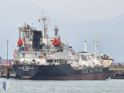
THANG LONG GAS
Lpg Tanker
Current Trip
| Time Travelled | 23 days |
|---|---|
| Remaining Time | --- |
| Distance Travelled | 2773.21 nm |
| Remaining Distance | --- |
| AVG Speed | 9.2 Knopen |
| MAX Speed | 12.7 Knopen |
| AVG Wind | 7.6 knots |
| MAX Wind | 21.9 knots |
| MIN Temp | 20.8°C / 69.44°F |
| MAX Temp | 34.6°C / 94.28°F |
| Diepgang | 4.5 M |
| Positie ontvangen | 4 d geleden |
Current Position
| Lengtegraad | 106.88302° |
|---|---|
| Breedtegraat | 20.65841° |
| Status | Under way using engine |
| Snelheid | 7.7 Knopen |
| Koers | 269.1° |
| Gebied | South China Sea |
| Station | T-AIS |
| Positie ontvangen | 4 d geleden |
Info
Information
The current position of THANG LONG GAS is in South China Sea with coordinates 20.65841° / 106.88302° as reported on 2024-04-14 23:45 by AIS to our vessel tracker app. The vessel's current speed is 7.7 Knopen and is heading at the port of GUISHAN. The estimated time of arrival as calculated by MyShipTracking vessel tracking app is 2024-04-16 22:00 LT
The vessel THANG LONG GAS (IMO: 9343704, MMSI: 574004060) is a Lpg Tanker that was built in 2006 ( 18 Jaar oud ). It's sailing under the flag of [VN] Vietnam.
In this page you can find informations about the vessels current position, last detected port calls, and current voyage information. If the vessels is not in coverage by AIS you will find the latest position.
The current position of THANG LONG GAS is detected by our AIS receivers and we are not responsible for the reliability of the data. The last position was recorded while the vessel was in Coverage by the Ais receivers of our vessel tracking app.
The current draught of THANG LONG GAS as reported by AIS is 4.5 meters
Weather
| Temperature | 26.9°C / 80.42°F |
|---|---|
| Wind Speed | 11 knots |
| Direction | 197° SSW |
| Pressure | 1006.7 hPa |
| Humidity | 84.6 % |
| Cloud Coverage | 100 % |
Featured Company
Most Visited Ports (Last year)
| Port | Arrivals | |
|---|---|---|
| 15 | ||
| 7 | ||
| 2 | ||
| 1 | ||
| 1 |
Last Trips
Events
| Tijd | Evenement | Details | Positie / Bestemming | Info |
|---|---|---|---|---|
| 2024-04-18 01:29 | Start beweging | 2.16 nm, South of XINSHA |
22.94757 / 113.55130
GUISHAN PS
|
Snelheid: 5.2 kn Koers: 186° |
| 2024-04-17 09:44 | Stop beweging | 1.94 nm, South of XINSHA |
22.95144 / 113.55155
GUISHAN PS
|
Snelheid: 0.3 kn Koers: 152° |
| 2024-04-17 04:20 | Start beweging | 1.92 nm, South West of GUISHAN |
22.12421 / 113.78842
GUISHAN PS
|
Snelheid: 5.3 kn Koers: 96° |
| 2024-04-16 16:59 | Stop beweging | 2.09 nm, South West of GUISHAN |
22.12467 / 113.78443
GUISHAN PS
|
Snelheid: 0.1 kn Koers: 330° |
| 2024-04-14 23:50 | Status Changed | Default Under way using engine |
20.65473 / 106.87618
GUISHAN PS
|
Snelheid: 7.7 kn Koers: 269.1° |
| 2024-04-14 23:45 | Buitenbereik |
20.65841 / 106.88302
South China Sea
GUISHAN PS
|
Snelheid: 7.7 kn Koers: 269.1° |
|
| 2024-04-14 23:19 | Status Changed | Under way using engine Default |
20.68719 / 106.94980
GUISHAN PS
|
Snelheid: 9.9 kn Koers: 248° |
| 2024-04-14 23:10 | Status Changed | Default Under way using engine |
20.69558 / 106.97313
GUISHAN PS
|
Snelheid: 9.2 kn Koers: 216.5° |
| 2024-04-14 23:07 | Status Changed | Under way using engine Default |
20.69955 / 106.98196
GUISHAN PS
|
Snelheid: 11.4 kn Koers: 144° |
| 2024-04-14 22:33 | Status Changed | Default Under way using engine |
20.78672 / 106.91931
GUISHAN PS
|
Snelheid: 11.2 kn Koers: 150.1° |