
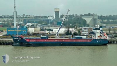
TERSCHELLING
General Cargo
Current Trip
| Time Travelled | 13 h, 59 mins |
|---|---|
| Remaining Time | 16 h, 22 mins |
| Distance Travelled | 139.33 nm |
| Remaining Distance | 186.66 nm |
| AVG Speed | 10.2 Knopen |
| MAX Speed | 11.4 Knopen |
| AVG Wind | 8.2 knots |
| MAX Wind | 15.4 knots |
| MIN Temp | 3.5°C / 38.3°F |
| MAX Temp | 7.9°C / 46.22°F |
| Diepgang | 5.9 M |
| Positie ontvangen | 5 d geleden |
Current Position
| Lengtegraad | 4.08248° |
|---|---|
| Breedtegraat | 58.40747° |
| Status | Under way using engine |
| Snelheid | 7.9 Knopen |
| Koers | 299.5° |
| Gebied | North Sea |
| Station | T-AIS |
| Positie ontvangen | 5 d geleden |
Info
Information
The current position of TERSCHELLING is in North Sea with coordinates 58.40747° / 4.08248° as reported on 2024-04-19 18:25 by AIS to our vessel tracker app. The vessel's current speed is 7.9 Knopen and is heading at the port of HERJOLFUR. The estimated time of arrival as calculated by MyShipTracking vessel tracking app is 2024-04-26 04:50 LT
The vessel TERSCHELLING (IMO: 9313826, MMSI: 246507000) is a General Cargo that was built in 2005 ( 19 Jaar oud ). It's sailing under the flag of [NL] Netherlands.
In this page you can find informations about the vessels current position, last detected port calls, and current voyage information. If the vessels is not in coverage by AIS you will find the latest position.
The current position of TERSCHELLING is detected by our AIS receivers and we are not responsible for the reliability of the data. The last position was recorded while the vessel was in Coverage by the Ais receivers of our vessel tracking app.
The current draught of TERSCHELLING as reported by AIS is 5.9 meters
Weather
| Temperature | 3.4°C / 38.12°F |
|---|---|
| Wind Speed | 10 knots |
| Direction | 1° N |
| Pressure | 1023.2 hPa |
| Humidity | 85.3 % |
| Cloud Coverage | 17 % |
Featured Company
Last Port Calls
| Port | Arrival | Departure | Time In Port |
|---|---|---|---|
| 2024-04-24 15:18 | 2024-04-24 22:29 | 7 h | |
| 2024-04-23 07:16 | 2024-04-24 06:35 | 23 h | |
| 2024-04-09 13:14 | 2024-04-16 09:05 | 6 d | |
| 2024-04-06 15:49 | 2024-04-08 18:08 | 2 d | |
| 2024-03-25 14:05 | 2024-03-27 22:42 | 2 d | |
| 2024-03-20 11:32 | 2024-03-25 13:26 | 5 d | |
| 2024-03-20 01:15 | 2024-03-20 02:42 | 1 h | |
| 2024-03-16 17:59 | 2024-03-19 23:31 | 3 d | |
| 2024-03-16 16:46 | 2024-03-16 17:03 | 17 m | |
| 2024-03-09 07:57 | 2024-03-15 16:32 | 6 d |
Last Trips
| Origin | Departure | Destination | Arrival | Distance | |
|---|---|---|---|---|---|
| 2024-04-24 06:35 | 2024-04-24 15:18 | 92.07 nm | |||
| 2024-04-16 12:05 | 2024-04-23 07:16 | 1755.78 nm | |||
| 2024-04-08 21:08 | 2024-04-09 16:14 | 234.34 nm | |||
| 2024-03-27 23:42 | 2024-04-06 18:49 | 1259.53 nm | |||
| 2024-03-25 14:26 | 2024-03-25 15:05 | 7.53 nm | |||
| 2024-03-20 03:42 | 2024-03-20 12:32 | 78.11 nm | |||
| 2024-03-20 00:31 | 2024-03-20 02:15 | 9.18 nm | |||
| 2024-03-16 18:03 | 2024-03-16 18:59 | 8.16 nm | |||
| 2024-03-15 17:32 | 2024-03-16 17:46 | 179.69 nm | |||
| 2024-03-07 12:58 | 2024-03-09 08:57 | 416.27 nm |
Events
| Tijd | Evenement | Details | Positie / Bestemming | Info |
|---|---|---|---|---|
| 2024-04-24 22:29 | Start beweging | 0.43 nm, South of AKRANES |
64.30711 / -22.07307
THORLAKSHOFN
|
Snelheid: 8.3 kn Koers: 218° |
| 2024-04-24 22:29 | Vertrekhaven |
|
64.30711 / -22.07307
THORLAKSHOFN
|
Snelheid: 0.4 kn Koers: 57° |
| 2024-04-24 15:35 | Stop beweging |
64.31405 / -22.07921
[IS] AKRANES
|
Snelheid: Koers: 346° |
|
| 2024-04-24 15:18 | Aankomsthaven |
|
64.31406 / -22.07926
[IS] AKRANES
|
Snelheid: 3.8 kn Koers: 25° |
| 2024-04-24 06:35 | Start beweging | 0.31 nm, North East of HERJOLFUR |
63.86211 / -21.35829
THORLAKSHOFN
|
Snelheid: 6 kn Koers: 76° |
| 2024-04-24 06:35 | Vertrekhaven |
|
63.86211 / -21.35829
THORLAKSHOFN
|
Snelheid: 2.2 kn Koers: 50° |
| 2024-04-23 07:27 | Stop beweging |
63.85977 / -21.37161
[IS] HERJOLFUR
|
Snelheid: 0.3 kn Koers: 283° |
|
| 2024-04-23 07:16 | Aankomsthaven |
|
63.85944 / -21.36605
[IS] HERJOLFUR
|
Snelheid: 6.9 kn Koers: 321° |
| 2024-04-19 19:19 | Status Changed | Default Under way using engine |
58.44788 / 3.89405
THORLAKSHOFN
|
Snelheid: 7.9 kn Koers: 299.5° |
| 2024-04-19 18:25 | Buitenbereik |
58.40747 / 4.08248
North Sea
THORLAKSHOFN
|
Snelheid: 7.9 kn Koers: 299.5° |