
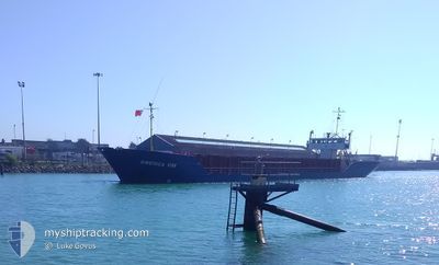
SWEDICA HAV
General Cargo
Current Trip
| Time Travelled | 2 days |
|---|---|
| Remaining Time | --- |
| Distance Travelled | 260.37 nm |
| Remaining Distance | --- |
| AVG Speed | 4.6 Knopen |
| MAX Speed | 9.2 Knopen |
| AVG Wind | 20.9 knots |
| MAX Wind | 26.9 knots |
| MIN Temp | 13.5°C / 56.3°F |
| MAX Temp | 15.7°C / 60.26°F |
| Diepgang | 4.5 M |
| Positie ontvangen | 12 h, 23 m geleden |
Current Position
| Lengtegraad | -9.71312° |
|---|---|
| Breedtegraat | 41.60644° |
| Status | Under way using engine |
| Snelheid | 3.3 Knopen |
| Koers | 359° |
| Gebied | North Atlantic Ocean |
| Station | T-AIS |
| Positie ontvangen | 12 h, 23 m geleden |
Info
Information
The current position of SWEDICA HAV is in North Atlantic Ocean with coordinates 41.60644° / -9.71312° as reported on 2024-04-17 20:05 by AIS to our vessel tracker app. The vessel's current speed is 3.3 Knopen and is heading at the port of SUTTON BRIDGE. The estimated time of arrival as calculated by MyShipTracking vessel tracking app is 2024-04-23 11:00 LT
The vessel SWEDICA HAV (IMO: 8605478, MMSI: 309584000) is a General Cargo that was built in 1986 ( 38 Jaar oud ). It's sailing under the flag of [BS] Bahamas.
In this page you can find informations about the vessels current position, last detected port calls, and current voyage information. If the vessels is not in coverage by AIS you will find the latest position.
The current position of SWEDICA HAV is detected by our AIS receivers and we are not responsible for the reliability of the data. The last position was recorded while the vessel was in Coverage by the Ais receivers of our vessel tracking app.
The current draught of SWEDICA HAV as reported by AIS is 4.5 meters
Weather
| Temperature | 13.3°C / 55.94°F |
|---|---|
| Wind Speed | 27 knots |
| Direction | 35° NE |
| Pressure | 1017.2 hPa |
| Humidity | 73.1 % |
| Cloud Coverage | 12 % |
Featured Company
Last Port Calls
| Port | Arrival | Departure | Time In Port |
|---|---|---|---|
| 2024-04-13 11:17 | 2024-04-15 20:50 | 2 d | |
| 2024-04-12 05:42 | 2024-04-12 16:55 | 11 h | |
| 2024-03-31 05:55 | 2024-04-02 16:18 | 2 d | |
| 2024-03-26 19:30 | 2024-03-27 22:44 | 1 d | |
| 2024-03-23 08:32 | 2024-03-24 14:20 | 1 d | |
| 2024-03-20 08:50 | 2024-03-21 20:35 | 1 d | |
| 2024-03-13 20:20 | |||
| 2024-03-08 00:40 | 2024-03-08 14:09 | 13 h | |
| 2024-03-03 09:47 | 2024-03-05 22:10 | 2 d | |
| 2024-02-29 07:26 | 2024-03-03 04:42 | 2 d |
Most Visited Ports (Last year)
| Port | Arrivals | |
|---|---|---|
| 4 | ||
| 4 | ||
| 4 | ||
| 4 | ||
| 3 | ||
| 3 |
Last Trips
| Origin | Departure | Destination | Arrival | Distance | |
|---|---|---|---|---|---|
| 2024-04-12 17:55 | 2024-04-13 12:17 | 162.71 nm | |||
| 2024-04-02 18:18 | 2024-04-12 06:42 | 1273.09 nm | |||
| 2024-03-27 22:44 | 2024-03-31 07:55 | 532.99 nm | |||
| 2024-03-24 14:20 | 2024-03-26 19:30 | 401.72 nm | |||
| 2024-03-21 20:35 | 2024-03-23 08:32 | 245.99 nm | |||
| 2024-03-08 14:09 | 2024-03-13 20:20 | 88.74 nm | |||
| 2024-03-05 23:10 | 2024-03-08 00:40 | 359.10 nm | |||
| 2024-03-03 05:42 | 2024-03-03 10:47 | 30.05 nm | |||
| 2024-02-27 23:21 | 2024-02-29 08:26 | 235.54 nm | |||
| 2024-02-25 17:33 | 2024-02-27 13:40 | 278.67 nm |
Events
| Tijd | Evenement | Details | Positie / Bestemming | Info |
|---|---|---|---|---|
| 2024-04-17 20:10 | Status Changed | Default Under way using engine |
41.61167 / -9.71333
GB PSB
|
Snelheid: 3.3 kn Koers: 359° |
| 2024-04-17 20:05 | Status Changed | Under way using engine Default |
41.60644 / -9.71312
GB PSB
|
Snelheid: 3 kn Koers: -1° |
| 2024-04-17 20:05 | Buitenbereik |
41.60644 / -9.71312
North Atlantic Ocean
GB PSB
|
Snelheid: 3.3 kn Koers: 358° |
|
| 2024-04-17 19:56 | Status Changed | Default Under way using engine |
41.59895 / -9.71237
GB PSB
|
Snelheid: 3.7 kn Koers: 0° |
| 2024-04-17 19:33 | Status Changed | Under way using engine Default |
41.57311 / -9.71006
GB PSB
|
Snelheid: 3 kn Koers: -1° |
| 2024-04-17 19:33 | Binnenbereik |
41.57311 / -9.71006
North Atlantic Ocean
GB PSB
|
Snelheid: 3.4 kn Koers: 357.9° |
|
| 2024-04-17 17:15 | Status Changed | Default Under way using engine |
41.43500 / -9.70500
GB PSB
|
Snelheid: 4.1 kn Koers: 0° |
| 2024-04-17 17:07 | Status Changed | Under way using engine Default |
41.42305 / -9.70651
GB PSB
|
Snelheid: 3.9 kn Koers: 1° |
| 2024-04-17 17:07 | Buitenbereik |
41.42305 / -9.70651
North Atlantic Ocean
GB PSB
|
Snelheid: 4.1 kn Koers: 3.6° |
|
| 2024-04-17 16:55 | Status Changed | Default Under way using engine |
41.41193 / -9.70732
GB PSB
|
Snelheid: 4.3 kn Koers: 0° |