
STRATEGIC VENTURE
Cargo
Current Trip
US PFN
| Time Travelled | 21 h, 24 mins |
|---|---|
| Remaining Time | --- |
| Distance Travelled | 224.82 nm |
| Remaining Distance | --- |
| AVG Speed | 11.5 Knopen |
| MAX Speed | 14 Knopen |
| AVG Wind | 4.8 knots |
| MAX Wind | 8 knots |
| MIN Temp | 16.6°C / 61.88°F |
| MAX Temp | 22.8°C / 73.04°F |
| Diepgang | 6.4 M |
| Positie ontvangen | 5 d geleden |
Current Position
| Lengtegraad | -89.31023° |
|---|---|
| Breedtegraat | 28.65510° |
| Status | Under way using engine |
| Snelheid | 11.1 Knopen |
| Koers | 144.6° |
| Gebied | Gulf of Mexico |
| Station | T-AIS |
| Positie ontvangen | 5 d geleden |
Info
Information
The current position of STRATEGIC VENTURE is in Gulf of Mexico with coordinates 28.65510° / -89.31023° as reported on 2024-04-19 16:52 by AIS to our vessel tracker app. The vessel's current speed is 11.1 Knopen
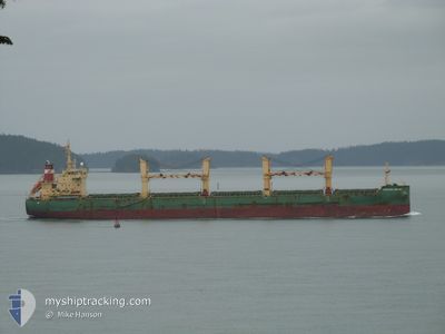
The vessel STRATEGIC VENTURE (IMO: 9648104, MMSI: 564881000) is a Cargo It's sailing under the flag of [SG] Singapore.
In this page you can find informations about the vessels current position, last detected port calls, and current voyage information. If the vessels is not in coverage by AIS you will find the latest position.
The current position of STRATEGIC VENTURE is detected by our AIS receivers and we are not responsible for the reliability of the data. The last position was recorded while the vessel was in Coverage by the Ais receivers of our vessel tracking app.
The current draught of STRATEGIC VENTURE as reported by AIS is 6.4 meters
Weather
| Temperature | 23.1°C / 73.58°F |
|---|---|
| Wind Speed | 7 knots |
| Direction | 47° NE |
| Pressure | 1018.8 hPa |
| Humidity | 62.5 % |
| Cloud Coverage | --- |
Featured Company
Last Port Calls
| Port | Arrival | Departure | Time In Port |
|---|---|---|---|
| 2024-04-21 04:10 | 2024-04-24 01:58 | 2 d | |
| 2024-04-16 13:29 | 2024-04-16 19:05 | 5 h | |
| 2024-04-06 01:31 | 2024-04-11 00:58 | 4 d | |
| 2024-02-27 11:09 | 2024-03-11 19:33 | 13 d | |
| 2024-02-14 15:36 | 2024-02-22 15:19 | 7 d |
Most Visited Ports (Last year)
| Port | Arrivals | |
|---|---|---|
| 2 | ||
| 2 | ||
| 2 | ||
| 1 | ||
| 1 | ||
| 1 |
Last Trips
| Origin | Departure | Destination | Arrival | Distance | |
|---|---|---|---|---|---|
| 2024-04-16 14:05 | 2024-04-20 23:10 | 502.13 nm | |||
| 2024-04-10 20:58 | 2024-04-16 08:29 | 1410.38 nm | |||
| 2024-03-11 22:33 | 2024-04-05 21:31 | 6041.08 nm | |||
| 2024-02-22 18:19 | 2024-02-27 14:09 | 893.14 nm | |||
| 2024-01-22 13:21 | 2024-02-14 18:36 | 4991.55 nm |
Events
| Tijd | Evenement | Details | Positie / Bestemming | Info |
|---|---|---|---|---|
| 2024-04-24 10:10 | Start beweging |
29.44500 / -86.14500
US PFN
|
Snelheid: 8 kn Koers: 155° |
|
| 2024-04-24 08:04 | Stop beweging |
29.45667 / -86.14667
US PFN
|
Snelheid: Koers: -1° |
|
| 2024-04-24 02:16 | Start beweging | 0.9 nm, South East of PANAMA CITY |
30.16833 / -85.71667
US PFN
|
Snelheid: 6 kn Koers: 129° |
| 2024-04-24 01:58 | Vertrekhaven |
|
30.17333 / -85.72833
US PFN
|
Snelheid: Koers: -1° |
| 2024-04-21 04:10 | Aankomsthaven |
|
30.17597 / -85.72881
[US] PANAMA CITY
|
Snelheid: Koers: -1° |
| 2024-04-20 22:37 | Stop beweging | 0.19 nm, East of PANAMA CITY |
30.17500 / -85.72833
US PFN
|
Snelheid: Koers: -1° |
| 2024-04-20 20:38 | Start beweging | 9.47 nm, South of PANAMA CITY |
30.01892 / -85.75874
US PFN
|
Snelheid: 9.7 kn Koers: 342° |
| 2024-04-20 17:10 | Stop beweging | 11.03 nm, South of PANAMA CITY |
29.99667 / -85.78333
US PFN
|
Snelheid: Koers: -1° |
| 2024-04-19 17:03 | Status Changed | Default Under way using engine |
28.63475 / -89.28096
US PFN
|
Snelheid: 11.1 kn Koers: 144.6° |
| 2024-04-19 16:52 | Buitenbereik |
28.65510 / -89.31023
Gulf of Mexico
US PFN
|
Snelheid: 11.1 kn Koers: 144.6° |