
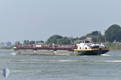
STOLT MAAS
Tanker
Current Trip
| Time Travelled | 3 days |
|---|---|
| Remaining Time | 12 h, 10 mins |
| Distance Travelled | 323.37 nm |
| Remaining Distance | 156.29 nm |
| AVG Speed | 6.7 Knopen |
| MAX Speed | 14.2 Knopen |
| AVG Wind | 7.6 knots |
| MAX Wind | 14.9 knots |
| MIN Temp | --- |
| MAX Temp | 10.1°C / 50.18°F |
| Diepgang | 1.4 M |
| Positie ontvangen | Nu |
Current Position
| Lengtegraad | 6.84747° |
|---|---|
| Breedtegraat | 51.13968° |
| Status | Under way using engine |
| Snelheid | 13.3 Knopen |
| Koers | 1.9° |
| Gebied | North Sea |
| Station | T-AIS |
| Positie ontvangen | Nu |
Info
Information
The current position of STOLT MAAS is in North Sea with coordinates 51.13968° / 6.84747° as reported on 2024-04-23 21:18 by AIS to our vessel tracker app. The vessel's current speed is 13.3 Knopen and is heading at the port of BOTLEK - ROTTERDAM. The estimated time of arrival as calculated by MyShipTracking vessel tracking app is 2024-04-24 09:29 LT
The vessel STOLT MAAS (MMSI: 244660644) is a Tanker It's sailing under the flag of [NL] Netherlands.
In this page you can find informations about the vessels current position, last detected port calls, and current voyage information. If the vessels is not in coverage by AIS you will find the latest position.
The current position of STOLT MAAS is detected by our AIS receivers and we are not responsible for the reliability of the data. The last position was recorded while the vessel was in Coverage by the Ais receivers of our vessel tracking app.
The current draught of STOLT MAAS as reported by AIS is 1.4 meters
Weather
| Temperature | 6.6°C / 43.88°F |
|---|---|
| Wind Speed | 9 knots |
| Direction | 283° WNW |
| Pressure | 1014.6 hPa |
| Humidity | 63.4 % |
| Cloud Coverage | 99 % |
Featured Company
Last Port Calls
| Port | Arrival | Departure | Time In Port |
|---|---|---|---|
| 2024-04-20 13:21 | 2024-04-20 14:01 | 40 m | |
| 2024-04-19 22:28 | 2024-04-19 22:50 | 21 m | |
| 2024-04-18 10:12 | 2024-04-19 18:34 | 1 d | |
| 2024-04-18 05:46 | 2024-04-18 06:39 | 52 m | |
| 2024-04-16 16:41 | 2024-04-17 19:47 | 1 d | |
| 2024-04-15 10:52 | 2024-04-16 08:21 | 21 h | |
| 2024-04-14 10:05 | 2024-04-15 03:39 | 17 h | |
| 2024-04-14 04:21 | 2024-04-14 04:29 | 8 m | |
| 2024-04-12 21:13 | 2024-04-14 02:31 | 1 d | |
| 2024-04-07 11:15 | 2024-04-12 13:52 | 5 d |
Most Visited Ports (Last year)
| Port | Arrivals | |
|---|---|---|
| 44 | ||
| 32 | ||
| 19 | ||
| 19 | ||
| 19 | ||
| 18 |
Last Trips
| Origin | Departure | Destination | Arrival | Distance | |
|---|---|---|---|---|---|
| 2024-04-20 00:50 | 2024-04-20 15:21 | 73.21 nm | |||
| 2024-04-19 20:34 | 2024-04-20 00:28 | 30.98 nm | |||
| 2024-04-18 08:39 | 2024-04-18 12:12 | 22.76 nm | |||
| 2024-04-17 21:47 | 2024-04-18 07:46 | 65.85 nm | |||
| 2024-04-16 10:21 | 2024-04-16 18:41 | 50.31 nm | |||
| 2024-04-15 05:39 | 2024-04-15 12:52 | 52.06 nm | |||
| 2024-04-14 06:29 | 2024-04-14 12:05 | 37.87 nm | |||
| 2024-04-14 04:31 | 2024-04-14 06:21 | 13.56 nm | |||
| 2024-04-12 15:52 | 2024-04-12 23:13 | 51.78 nm | |||
| 2024-04-07 10:45 | 2024-04-07 13:15 | 29.67 nm |
Events
| Tijd | Evenement | Details | Positie / Bestemming | Info |
|---|---|---|---|---|
| 2024-04-23 17:09 | Binnenbereik |
50.48541 / 7.33257
North Sea
ROTTERDAM CHEMIEHAVE
|
Snelheid: 12.5 kn Koers: 324.9° |
|
| 2024-04-23 13:13 | Buitenbereik |
49.97234 / 7.90502
North Sea
ROTTERDAM CHEMIEHAVE
|
Snelheid: 11.2 kn Koers: 266.7° |
|
| 2024-04-23 08:29 | Draught Changed | 1.4 2.7 |
49.50876 / 8.44160
ROTTERDAM CHEMIEHAVE
|
Snelheid: 7.9 kn Koers: 317° |
| 2024-04-23 08:29 | Destination Changed | ROTTERDAM CHEMIEHAVE STRAENBRUCKE ILVESHE |
49.50876 / 8.44160
ROTTERDAM CHEMIEHAVE
|
Snelheid: 7.9 kn Koers: 317° |
| 2024-04-23 08:29 | ETA Changed | 2024/04/25 20:08 2024/04/22 01:54 |
49.50876 / 8.44160
ROTTERDAM CHEMIEHAVE
|
Snelheid: 7.9 kn Koers: 317° |
| 2024-04-23 08:29 | Binnenbereik |
49.51530 / 8.43517
North Sea
ROTTERDAM CHEMIEHAVE
|
Snelheid: 10.8 kn Koers: 340° |
|
| 2024-04-22 05:35 | Buitenbereik |
49.48864 / 8.49274
North Sea
STRAENBRUCKE ILVESHE
|
Snelheid: 5 kn Koers: 90.2° |
|
| 2024-04-21 17:20 | Binnenbereik |
50.05531 / 7.77687
North Sea
STRAENBRUCKE ILVESHE
|
Snelheid: 4.8 kn Koers: 140.4° |
|
| 2024-04-21 08:31 | Buitenbereik |
50.46497 / 7.35480
North Sea
STRAENBRUCKE ILVESHE
|
Snelheid: 3.9 kn Koers: 138.5° |
|
| 2024-04-20 14:01 | Vertrekhaven |
|
51.40380 / 6.74487
STRAENBRUCKE ILVESHE
|
Snelheid: 4.8 kn Koers: 178.7° |