
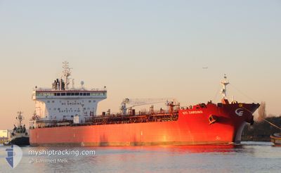
STI JARDINS
Tanker
Current Trip
| Time Travelled | 2 days |
|---|---|
| Remaining Time | --- |
| Distance Travelled | 713.19 nm |
| Remaining Distance | --- |
| AVG Speed | 11.4 Knopen |
| MAX Speed | 14 Knopen |
| AVG Wind | 13.4 knots |
| MAX Wind | 22.2 knots |
| MIN Temp | 2.2°C / 35.96°F |
| MAX Temp | 7.2°C / 44.96°F |
| Diepgang | 8 M |
| Positie ontvangen | 2 d geleden |
Current Position
| Lengtegraad | -70.91495° |
|---|---|
| Breedtegraat | 42.37056° |
| Status | Under way using engine |
| Snelheid | 10.3 Knopen |
| Koers | 51.9° |
| Gebied | North Atlantic Ocean |
| Station | T-AIS |
| Positie ontvangen | 2 d geleden |
Info
Information
The current position of STI JARDINS is in North Atlantic Ocean with coordinates 42.37056° / -70.91495° as reported on 2024-04-23 07:56 by AIS to our vessel tracker app. The vessel's current speed is 10.3 Knopen and is heading at the port of FALMOUTH. The estimated time of arrival as calculated by MyShipTracking vessel tracking app is 2024-05-02 12:00 LT
The vessel STI JARDINS (IMO: 9794446, MMSI: 538007044) is a Tanker It's sailing under the flag of [MH] Marshall Is.
In this page you can find informations about the vessels current position, last detected port calls, and current voyage information. If the vessels is not in coverage by AIS you will find the latest position.
The current position of STI JARDINS is detected by our AIS receivers and we are not responsible for the reliability of the data. The last position was recorded while the vessel was in Coverage by the Ais receivers of our vessel tracking app.
The current draught of STI JARDINS as reported by AIS is 8 meters
Weather
| Temperature | 2.3°C / 36.14°F |
|---|---|
| Wind Speed | 16 knots |
| Direction | 275° W |
| Pressure | 1022 hPa |
| Humidity | 79.6 % |
| Cloud Coverage | 100 % |
Featured Company
Last Port Calls
| Port | Arrival | Departure | Time In Port |
|---|---|---|---|
| 2024-04-22 00:38 | 2024-04-23 07:28 | 1 d | |
| 2024-04-11 14:40 | 2024-04-13 19:09 | 2 d | |
| 2024-03-24 19:51 | 2024-03-26 12:35 | 1 d | |
| 2024-03-21 20:16 | 2024-03-23 19:10 | 1 d | |
| 2024-03-21 19:59 | 2024-03-21 20:02 | 2 m | |
| 2024-03-16 19:10 | 2024-03-17 20:36 | 1 d | |
| 2024-03-03 05:36 | 2024-03-06 03:29 | 2 d | |
| 2024-02-29 06:16 | 2024-03-02 09:52 | 2 d | |
| 2024-02-19 19:05 | 2024-02-21 15:32 | 1 d | |
| 2024-02-18 16:30 | 2024-02-19 05:38 | 13 h |
Most Visited Ports (Last year)
| Port | Arrivals | |
|---|---|---|
| 3 | ||
| 2 | ||
| 2 | ||
| 2 | ||
| 2 | ||
| 1 |
Last Trips
| Origin | Departure | Destination | Arrival | Distance | |
|---|---|---|---|---|---|
| 2024-04-13 15:09 | 2024-04-21 20:38 | 1503.84 nm | |||
| 2024-03-26 13:35 | 2024-04-11 10:40 | 4087.69 nm | |||
| 2024-03-23 20:10 | 2024-03-24 20:51 | 276.31 nm | |||
| 2024-03-21 21:02 | 2024-03-21 21:16 | 0.85 nm | |||
| 2024-03-17 21:36 | 2024-03-21 20:59 | 366.04 nm | |||
| 2024-03-05 22:29 | 2024-03-16 20:10 | 3162.76 nm | |||
| 2024-03-02 04:52 | 2024-03-03 00:36 | 220.83 nm | |||
| 2024-02-21 10:32 | 2024-02-29 01:16 | 1530.20 nm | |||
| 2024-02-19 00:38 | 2024-02-19 14:05 | 125.77 nm | |||
| 2024-02-08 01:32 | 2024-02-18 11:30 | 3124.43 nm |
Events
| Tijd | Evenement | Details | Positie / Bestemming | Info |
|---|---|---|---|---|
| 2024-04-23 08:02 | Status Changed | Default Under way using engine |
42.37833 / -70.89450
GBFAL
|
Snelheid: 10.3 kn Koers: 51.9° |
| 2024-04-23 07:56 | Buitenbereik |
42.37056 / -70.91495
North Atlantic Ocean
GBFAL
|
Snelheid: 10.3 kn Koers: 51.9° |
|
| 2024-04-23 07:28 | Vertrekhaven |
|
42.33911 / -71.00631
GBFAL
|
Snelheid: 11.7 kn Koers: 129° |
| 2024-04-23 07:05 | Start beweging |
42.38184 / -71.04511
[US] BOSTON
|
Snelheid: 3.1 kn Koers: 186° |
|
| 2024-04-23 06:36 | Draught Changed | 8 9.2 |
42.38404 / -71.02857
[US] BOSTON
|
Snelheid: 2.4 kn Koers: 85° |
| 2024-04-23 06:36 | Destination Changed | GBFAL USBOS |
42.38404 / -71.02857
[US] BOSTON
|
Snelheid: 2.4 kn Koers: 85° |
| 2024-04-23 06:36 | ETA Changed | 2024/05/02 12:00 2024/04/18 16:00 |
42.38404 / -71.02857
[US] BOSTON
|
Snelheid: 2.4 kn Koers: 85° |
| 2024-04-23 06:30 | Status Changed | Under way using engine Default |
42.38451 / -71.02534
[US] BOSTON
|
Snelheid: Koers: 54° |
| 2024-04-23 06:14 | Status Changed | Default Moored |
42.38445 / -71.02525
[US] BOSTON
|
Snelheid: Koers: 54° |
| 2024-04-23 05:50 | Status Changed | Moored Default |
42.38447 / -71.02530
[US] BOSTON
|
Snelheid: Koers: -1° |