
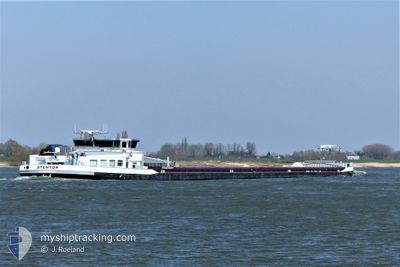
STENTOR
Cargo
Current Trip
RHEINBROHL
| Time Travelled | 1 day |
|---|---|
| Remaining Time | --- |
| Distance Travelled | 90.80 nm |
| Remaining Distance | --- |
| AVG Speed | 5.6 Knopen |
| MAX Speed | 8.1 Knopen |
| AVG Wind | 10.8 knots |
| MAX Wind | 13.9 knots |
| MIN Temp | 3.3°C / 37.94°F |
| MAX Temp | 10.6°C / 51.08°F |
| Diepgang | 1 M |
| Positie ontvangen | 1 h, 15 m geleden |
Current Position
| Lengtegraad | 6.59538° |
|---|---|
| Breedtegraat | 51.58044° |
| Status | Moored |
| Snelheid | |
| Koers | --- |
| Gebied | North Sea |
| Station | T-AIS |
| Positie ontvangen | 1 h, 15 m geleden |
Info
Information
The current position of STENTOR is in North Sea with coordinates 51.58044° / 6.59538° as reported on 2024-04-25 11:00 by AIS to our vessel tracker app. The vessel's current speed is 0 Knopen
The vessel STENTOR (MMSI: 244730022) is a Cargo It's sailing under the flag of [NL] Netherlands.
In this page you can find informations about the vessels current position, last detected port calls, and current voyage information. If the vessels is not in coverage by AIS you will find the latest position.
The current position of STENTOR is detected by our AIS receivers and we are not responsible for the reliability of the data. The last position was recorded while the vessel was in Coverage by the Ais receivers of our vessel tracking app.
The current draught of STENTOR as reported by AIS is 1 meters
Weather
| Temperature | 9.2°C / 48.56°F |
|---|---|
| Wind Speed | 10 knots |
| Direction | 242° WSW |
| Pressure | 1005.6 hPa |
| Humidity | 60.9 % |
| Cloud Coverage | 100 % |
Featured Company
Last Port Calls
| Port | Arrival | Departure | Time In Port |
|---|---|---|---|
| 2024-04-23 00:39 | 2024-04-23 12:21 | 11 h | |
| 2024-04-22 20:07 | 2024-04-22 20:21 | 13 m | |
| 2024-04-19 18:58 | 2024-04-20 02:55 | 7 h | |
| 2024-04-12 10:46 | 2024-04-16 05:57 | 3 d | |
| 2024-04-12 03:15 | 2024-04-12 08:46 | 5 h | |
| 2024-04-11 11:13 | 2024-04-12 01:15 | 14 h | |
| 2024-04-10 18:39 | 2024-04-11 09:38 | 14 h | |
| 2024-04-10 13:25 | 2024-04-10 14:25 | 1 h | |
| 2024-04-10 08:18 | 2024-04-10 10:29 | 2 h | |
| 2024-04-09 08:40 | 2024-04-10 07:39 | 22 h |
Last Trips
| Origin | Departure | Destination | Arrival | Distance | |
|---|---|---|---|---|---|
| 2024-04-22 22:21 | 2024-04-23 02:39 | 34.83 nm | |||
| 2024-04-20 04:55 | 2024-04-22 22:07 | 118.20 nm | |||
| 2024-04-16 07:57 | 2024-04-19 20:58 | 228.62 nm | |||
| 2024-04-12 10:46 | 2024-04-12 12:46 | 13.20 nm | |||
| 2024-04-12 03:15 | 2024-04-12 05:15 | 15.11 nm | |||
| 2024-04-11 11:38 | 2024-04-11 13:13 | 15.23 nm | |||
| 2024-04-10 16:25 | 2024-04-10 20:39 | 29.74 nm | |||
| 2024-04-10 12:29 | 2024-04-10 15:25 | 23.41 nm | |||
| 2024-04-10 09:39 | 2024-04-10 10:18 | 4.49 nm | |||
| 2024-04-08 20:16 | 2024-04-09 10:40 | 36.99 nm |
Events
| Tijd | Evenement | Details | Positie / Bestemming | Info |
|---|---|---|---|---|
| 2024-04-25 11:00 | Buitenbereik |
51.58044 / 6.59538
North Sea
|
Snelheid: Koers: 511° |
|
| 2024-04-25 11:00 | Binnenbereik |
51.58044 / 6.59538
North Sea
|
Snelheid: Koers: 511° |
|
| 2024-04-24 10:46 | Buitenbereik |
51.82789 / 6.20664
North Sea
|
Snelheid: 4.9 kn Koers: 97° |
|
| 2024-04-24 10:11 | Start beweging | 1.38 nm, North West of SPYCK |
51.84651 / 6.14067
RHEINBROHL
|
Snelheid: 4.9 kn Koers: 103° |
| 2024-04-24 10:09 | Stop beweging | 1.27 nm, East of TOLKAMER |
51.84690 / 6.13781
RHEINBROHL
|
Snelheid: Koers: 0° |
| 2024-04-24 09:50 | Start beweging | 0.39 nm, West of TOLKAMER |
51.84996 / 6.09327
RHEINBROHL
|
Snelheid: 5 kn Koers: 119° |
| 2024-04-24 09:49 | Stop beweging | 0.39 nm, South West of LOBITH |
51.85092 / 6.09067
RHEINBROHL
|
Snelheid: Koers: 0° |
| 2024-04-24 04:47 | Start beweging | 0.88 nm, North East of TIEL |
51.89908 / 5.45609
RHEINBROHL
|
Snelheid: 3.5 kn Koers: 158° |
| 2024-04-24 04:31 | Stop beweging | 0.94 nm, North East of TIEL |
51.90077 / 5.45508
RHEINBROHL
|
Snelheid: 0.1 kn Koers: 511° |
| 2024-04-24 04:21 | Start beweging | 1.15 nm, North of TIEL |
51.90519 / 5.45221
RHEINBROHL
|
Snelheid: 3.1 kn Koers: 155° |