
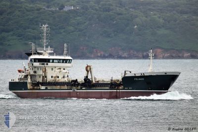
STELLAMARIS
Aggregates Carrier
Current Trip
| Time Travelled | 19 h, 16 mins |
|---|---|
| Remaining Time | 19 h, 58 mins |
| Distance Travelled | 163.28 nm |
| Remaining Distance | 55.59 nm |
| AVG Speed | 11.1 Knopen |
| MAX Speed | 16.1 Knopen |
| AVG Wind | 8.9 knots |
| MAX Wind | 15 knots |
| MIN Temp | 4.3°C / 39.74°F |
| MAX Temp | 14.5°C / 58.1°F |
| Diepgang | 6.1 M |
| Positie ontvangen | Nu |
Current Position
| Lengtegraad | -2.59693° |
|---|---|
| Breedtegraat | 46.99010° |
| Status | Restricted manoeuverability |
| Snelheid | 2.4 Knopen |
| Koers | 54° |
| Gebied | Bay of Biscay |
| Station | T-AIS |
| Positie ontvangen | Nu |
Info
Information
The current position of STELLAMARIS is in Bay of Biscay with coordinates 46.99010° / -2.59693° as reported on 2024-04-19 19:32 by AIS to our vessel tracker app. The vessel's current speed is 2.4 Knopen and is heading at the port of LORIENT. The estimated time of arrival as calculated by MyShipTracking vessel tracking app is 2024-04-20 15:31 LT
The vessel STELLAMARIS (IMO: 9614751, MMSI: 228032800) is a Aggregates Carrier that was built in 2012 ( 12 Jaar oud ). It's sailing under the flag of [FR] France.
In this page you can find informations about the vessels current position, last detected port calls, and current voyage information. If the vessels is not in coverage by AIS you will find the latest position.
The current position of STELLAMARIS is detected by our AIS receivers and we are not responsible for the reliability of the data. The last position was recorded while the vessel was in Coverage by the Ais receivers of our vessel tracking app.
The current draught of STELLAMARIS as reported by AIS is 6.1 meters
Weather
| Temperature | 12.6°C / 54.68°F |
|---|---|
| Wind Speed | 15 knots |
| Direction | 308° NW |
| Pressure | 1021.7 hPa |
| Humidity | 82.2 % |
| Cloud Coverage | 69 % |
Featured Company
Last Port Calls
| Port | Arrival | Departure | Time In Port |
|---|---|---|---|
| 2024-04-19 00:14 | 2024-04-19 00:17 | 3 m | |
| 2024-04-17 15:09 | 2024-04-17 17:22 | 2 h | |
| 2024-04-16 14:51 | 2024-04-16 17:37 | 2 h | |
| 2024-04-16 05:27 | 2024-04-16 09:45 | 4 h | |
| 2024-04-15 06:13 | 2024-04-15 09:00 | 2 h | |
| 2024-04-14 08:31 | 2024-04-14 09:12 | 40 m | |
| 2024-04-14 06:00 | 2024-04-14 06:03 | 2 m | |
| 2024-04-12 06:42 | 2024-04-12 06:45 | 3 m | |
| 2024-04-11 04:46 | 2024-04-11 07:12 | 2 h | |
| 2024-04-10 07:16 | 2024-04-10 07:19 | 3 m |
Most Visited Ports (Last year)
| Port | Arrivals | |
|---|---|---|
| 111 | ||
| 68 | ||
| 39 | ||
| 12 | ||
| 6 | ||
| 4 |
Last Trips
| Origin | Departure | Destination | Arrival | Distance | |
|---|---|---|---|---|---|
| 2024-04-17 19:22 | 2024-04-19 02:14 | 304.74 nm | |||
| 2024-04-16 19:37 | 2024-04-17 17:09 | 229.09 nm | |||
| 2024-04-16 11:45 | 2024-04-16 16:51 | 36.93 nm | |||
| 2024-04-15 11:00 | 2024-04-16 07:27 | 223.95 nm | |||
| 2024-04-14 11:12 | 2024-04-15 08:13 | 216.59 nm | |||
| 2024-04-14 08:03 | 2024-04-14 10:31 | 3.57 nm | |||
| 2024-04-12 08:45 | 2024-04-14 08:00 | 324.14 nm | |||
| 2024-04-11 09:12 | 2024-04-12 08:42 | 202.20 nm | |||
| 2024-04-10 09:19 | 2024-04-11 06:46 | 214.73 nm | |||
| 2024-04-09 13:23 | 2024-04-10 09:16 | 148.31 nm |
Events
| Tijd | Evenement | Details | Positie / Bestemming | Info |
|---|---|---|---|---|
| 2024-04-19 18:26 | Draught Changed | 6.1 7.2 |
47.02540 / -2.51716
LORIENT
|
Snelheid: 14.6 kn Koers: 235.4° |
| 2024-04-19 18:19 | ETA Changed | 2024/04/20 01:00 2024/04/19 20:00 |
47.04210 / -2.48626
LORIENT
|
Snelheid: 14.8 kn Koers: 226° |
| 2024-04-19 18:18 | Destination Changed | LORIENT CAIRNSTRATH |
47.04722 / -2.47843
LORIENT
|
Snelheid: 14.8 kn Koers: 225.6° |
| 2024-04-19 18:17 | Status Changed | Restricted manoeuverability Under way using engine |
47.04722 / -2.47843
CAIRNSTRATH
|
Snelheid: 14.9 kn Koers: 225.1° |
| 2024-04-19 17:58 | Destination Changed | CAIRNSTRATH NANTES |
47.10600 / -2.39484
CAIRNSTRATH
|
Snelheid: 15.1 kn Koers: 223.4° |
| 2024-04-19 17:58 | ETA Changed | 2024/04/19 20:00 2024/04/19 13:00 |
47.10600 / -2.39484
CAIRNSTRATH
|
Snelheid: 15.1 kn Koers: 223.4° |
| 2024-04-19 16:07 | Status Changed | Under way using engine Default |
47.27985 / -1.91295
NANTES
|
Snelheid: 14.2 kn Koers: 283° |
| 2024-04-19 16:07 | Status Changed | Default Under way using engine |
47.27945 / -1.91010
NANTES
|
Snelheid: 11.5 kn Koers: 295.4° |
| 2024-04-19 14:59 | Start beweging | 3.78 nm, West of NANTES |
47.19201 / -1.63586
NANTES
|
Snelheid: 5.7 kn Koers: 264.8° |
| 2024-04-19 13:01 | Stop beweging | 3.66 nm, West of NANTES |
47.19187 / -1.63297
NANTES
|
Snelheid: 0.2 kn Koers: 262° |