
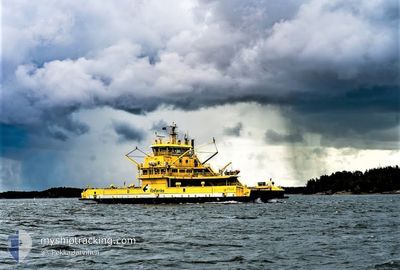
STELLA
Ro-Ro/Passenger Ship
Current Trip
| Time Travelled | --- |
|---|---|
| Remaining Time | --- |
| Distance Travelled | --- |
| Remaining Distance | --- |
| AVG Speed | --- |
| MAX Speed | --- |
| AVG Wind | --- |
| MAX Wind | --- |
| MIN Temp | --- |
| MAX Temp | --- |
| Diepgang | 4.2 M |
| Positie ontvangen | 5 h, 39 m geleden |
Current Position
| Lengtegraad | 21.45393° |
|---|---|
| Breedtegraat | 60.18073° |
| Status | Under way using engine |
| Snelheid | 11.8 Knopen |
| Koers | 292.2° |
| Gebied | Gulf of Bothnia |
| Station | T-AIS |
| Positie ontvangen | 5 h, 39 m geleden |
Info
Information
The current position of STELLA is in Gulf of Bothnia with coordinates 60.18073° / 21.45393° as reported on 2024-04-24 19:59 by AIS to our vessel tracker app. The vessel's current speed is 11.8 Knopen
The vessel STELLA (IMO: 9624691, MMSI: 230634000) is a Ro-Ro/Passenger Ship that was built in 2012 ( 12 Jaar oud ). It's sailing under the flag of [FI] Finland.
In this page you can find informations about the vessels current position, last detected port calls, and current voyage information. If the vessels is not in coverage by AIS you will find the latest position.
The current position of STELLA is detected by our AIS receivers and we are not responsible for the reliability of the data. The last position was recorded while the vessel was in Coverage by the Ais receivers of our vessel tracking app.
The current draught of STELLA as reported by AIS is 4.2 meters
Weather
| Temperature | 2.5°C / 36.5°F |
|---|---|
| Wind Speed | 9 knots |
| Direction | 135° SE |
| Pressure | 1012.1 hPa |
| Humidity | 87.1 % |
| Cloud Coverage | 25 % |
Featured Company
Last Port Calls
Most Visited Ports (Last year)
| Port | Arrivals |
|---|
Last Trips
| Origin | Departure | Destination | Arrival | Distance |
|---|
Events
| Tijd | Evenement | Details | Positie / Bestemming | Info |
|---|---|---|---|---|
| 2024-04-24 19:59 | Buitenbereik |
60.18073 / 21.45393
Gulf of Bothnia
|
Snelheid: 11.8 kn Koers: 292.2° |
|
| 2024-04-24 19:22 | Start beweging | 21.15 nm, South West of NAANTALI |
60.19333 / 21.57729
GALTBY-KITTUIS
|
Snelheid: 11.3 kn Koers: 337.7° |
| 2024-04-24 19:11 | Stop beweging | 21.35 nm, South West of NAANTALI |
60.18560 / 21.58493
GALTBY-KITTUIS
|
Snelheid: 0.1 kn Koers: 134° |
| 2024-04-24 15:51 | Binnenbereik |
60.19470 / 21.53548
Gulf of Bothnia
|
Snelheid: 11 kn Koers: 250.2° |
|
| 2024-04-24 14:18 | Buitenbereik |
60.18373 / 21.47842
Gulf of Bothnia
|
Snelheid: 11.3 kn Koers: 57.9° |
|
| 2024-04-24 13:55 | Binnenbereik |
60.18415 / 21.47838
Gulf of Bothnia
|
Snelheid: 10.8 kn Koers: 235.5° |
|
| 2024-04-24 12:52 | Buitenbereik |
60.18124 / 21.46911
Gulf of Bothnia
|
Snelheid: 11.2 kn Koers: 73.1° |
|
| 2024-04-24 10:18 | Binnenbereik |
60.18357 / 21.47804
Gulf of Bothnia
|
Snelheid: 11.5 kn Koers: 56.1° |
|
| 2024-04-24 08:47 | Buitenbereik |
60.18230 / 21.47305
Gulf of Bothnia
|
Snelheid: 10.5 kn Koers: 241.5° |
|
| 2024-04-24 08:47 | Binnenbereik |
60.18230 / 21.47305
Gulf of Bothnia
|
Snelheid: 10.5 kn Koers: 241.5° |