
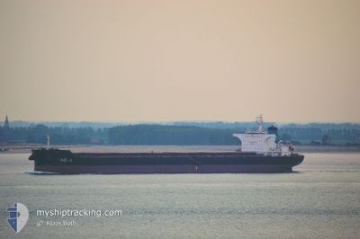
STAR PAOLA
Bulk Carrier
Current Trip
AE KLF
| Time Travelled | 9 days |
|---|---|
| Remaining Time | --- |
| Distance Travelled | 23.50 nm |
| Remaining Distance | --- |
| AVG Speed | 7.6 Knopen |
| MAX Speed | 11.2 Knopen |
| AVG Wind | 10.6 knots |
| MAX Wind | 27.4 knots |
| MIN Temp | 21.4°C / 70.52°F |
| MAX Temp | 30.8°C / 87.44°F |
| Diepgang | 7.5 M |
| Positie ontvangen | 1 m geleden |
Current Position
| Lengtegraad | 56.49535° |
|---|---|
| Breedtegraat | 25.40994° |
| Status | At anchor |
| Snelheid | |
| Koers | 175° |
| Gebied | Gulf of Oman |
| Station | T-AIS |
| Positie ontvangen | 1 m geleden |
Info
Information
The current position of STAR PAOLA is in Gulf of Oman with coordinates 25.40994° / 56.49535° as reported on 2024-04-23 12:29 by AIS to our vessel tracker app. The vessel's current speed is 0 Knopen
The vessel STAR PAOLA (IMO: 9497579, MMSI: 636020465) is a Bulk Carrier that was built in 2011 ( 13 Jaar oud ). It's sailing under the flag of [LR] Liberia.
In this page you can find informations about the vessels current position, last detected port calls, and current voyage information. If the vessels is not in coverage by AIS you will find the latest position.
The current position of STAR PAOLA is detected by our AIS receivers and we are not responsible for the reliability of the data. The last position was recorded while the vessel was in Coverage by the Ais receivers of our vessel tracking app.
The current draught of STAR PAOLA as reported by AIS is 7.5 meters
Weather
| Temperature | 27°C / 80.6°F |
|---|---|
| Wind Speed | 7 knots |
| Direction | 168° SSE |
| Pressure | 1005.3 hPa |
| Humidity | 61.6 % |
| Cloud Coverage | 26 % |
Featured Company
Last Port Calls
| Port | Arrival | Departure | Time In Port |
|---|---|---|---|
| 2024-04-12 06:22 | 2024-04-14 08:16 | 2 d | |
| 2024-04-01 13:51 | 2024-04-07 04:32 | 5 d | |
| 2024-03-09 12:22 | 2024-03-11 08:51 | 1 d |
Most Visited Ports (Last year)
| Port | Arrivals | |
|---|---|---|
| 3 | ||
| 1 | ||
| 1 | ||
| 1 | ||
| 1 | ||
| 1 |
Last Trips
| Origin | Departure | Destination | Arrival | Distance | |
|---|---|---|---|---|---|
| 2024-04-07 10:02 | 2024-04-12 10:22 | 991.95 nm | |||
| 2024-03-11 10:51 | 2024-04-01 19:21 | 3946.83 nm | |||
| 2023-12-31 02:35 | 2024-03-09 14:22 | 4896.29 nm |
Events
| Tijd | Evenement | Details | Positie / Bestemming | Info |
|---|---|---|---|---|
| 2024-04-22 22:05 | Status Changed | At anchor Default |
25.40974 / 56.49595
AE KLF
|
Snelheid: Koers: 188° |
| 2024-04-22 22:02 | Status Changed | Default At anchor |
25.40976 / 56.49594
AE KLF
|
Snelheid: Koers: 187° |
| 2024-04-20 12:41 | Status Changed | At anchor Default |
25.40920 / 56.49410
AE KLF
|
Snelheid: Koers: -1° |
| 2024-04-20 12:37 | Status Changed | Default At anchor |
25.40833 / 56.49333
AE KLF
|
Snelheid: Koers: 141° |
| 2024-04-16 15:23 | Status Changed | At anchor Default |
25.40656 / 56.49224
AE KLF
|
Snelheid: Koers: -1° |
| 2024-04-16 15:19 | Status Changed | Default At anchor |
25.40667 / 56.49166
AE KLF
|
Snelheid: 0.2 kn Koers: 107° |
| 2024-04-15 22:25 | Status Changed | At anchor Default |
25.40910 / 56.49546
AE KLF
|
Snelheid: Koers: -1° |
| 2024-04-15 22:22 | Status Changed | Default At anchor |
25.40833 / 56.49500
AE KLF
|
Snelheid: 0.1 kn Koers: 139° |
| 2024-04-14 09:55 | Stop beweging | 8.05 nm, East of KHORFAKKAN |
25.40631 / 56.50016
AE KLF
|
Snelheid: 0.1 kn Koers: 278° |
| 2024-04-14 09:37 | Status Changed | At anchor Under way using engine |
25.40876 / 56.49825
AE KLF
|
Snelheid: 1.2 kn Koers: 192° |