
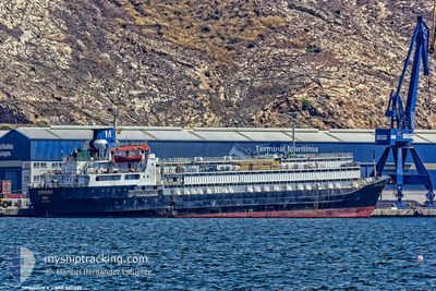
SPIRIDON II
General Cargo
Current Trip
| Time Travelled | 21 days |
|---|---|
| Remaining Time | --- |
| Distance Travelled | 5171.62 nm |
| Remaining Distance | --- |
| AVG Speed | 9.5 Knopen |
| MAX Speed | 13.9 Knopen |
| AVG Wind | 16 knots |
| MAX Wind | 32 knots |
| MIN Temp | 15°C / 59°F |
| MAX Temp | 28.4°C / 83.12°F |
| Diepgang | 7.2 M |
| Positie ontvangen | 2 h, 21 m geleden |
Current Position
| Lengtegraad | 29.06512° |
|---|---|
| Breedtegraat | 35.34945° |
| Status | Under way using engine |
| Snelheid | 9.6 Knopen |
| Koers | 70° |
| Gebied | Mediterranean Sea - Eastern Basin |
| Station | T-AIS |
| Positie ontvangen | 2 h, 21 m geleden |
Info
Information
The current position of SPIRIDON II is in Mediterranean Sea - Eastern Basin with coordinates 35.34945° / 29.06512° as reported on 2024-04-19 23:57 by AIS to our vessel tracker app. The vessel's current speed is 9.6 Knopen and is heading at the port of TASUCU. The estimated time of arrival as calculated by MyShipTracking vessel tracking app is 2024-04-20 22:00 LT
The vessel SPIRIDON II (IMO: 7311329, MMSI: 671114100) is a General Cargo that was built in 1973 ( 51 Jaar oud ). It's sailing under the flag of [TG] Togo.
In this page you can find informations about the vessels current position, last detected port calls, and current voyage information. If the vessels is not in coverage by AIS you will find the latest position.
The current position of SPIRIDON II is detected by our AIS receivers and we are not responsible for the reliability of the data. The last position was recorded while the vessel was in Coverage by the Ais receivers of our vessel tracking app.
The current draught of SPIRIDON II as reported by AIS is 7.2 meters
Weather
| Temperature | 18.4°C / 65.12°F |
|---|---|
| Wind Speed | 21 knots |
| Direction | 134° SE |
| Pressure | 1007 hPa |
| Humidity | 80.1 % |
| Cloud Coverage | 100 % |
Featured Company
Last Port Calls
| Port | Arrival | Departure | Time In Port |
|---|---|---|---|
| 2024-03-26 14:35 | 2024-03-29 13:38 | 2 d | |
| 2024-02-17 08:13 | 2024-02-22 16:20 | 5 d | |
| 2024-02-16 19:24 | |||
| 2024-02-13 17:25 |
Most Visited Ports (Last year)
| Port | Arrivals | |
|---|---|---|
| 5 | ||
| 4 | ||
| 2 | ||
| 2 | ||
| 2 | ||
| 2 |
Last Trips
| Origin | Departure | Destination | Arrival | Distance | |
|---|---|---|---|---|---|
| 2024-02-22 18:20 | 2024-03-26 11:35 | 5703.28 nm | |||
| 2024-02-16 21:24 | 2024-02-17 10:13 | 109.92 nm |
Events
| Tijd | Evenement | Details | Positie / Bestemming | Info |
|---|---|---|---|---|
| 2024-04-20 00:06 | Status Changed | Default Under way using engine |
35.35684 / 29.09242
TRTAS
|
Snelheid: 9.6 kn Koers: 70° |
| 2024-04-19 23:57 | Buitenbereik |
35.34945 / 29.06512
Mediterranean Sea - Eastern Basin
TRTAS
|
Snelheid: 9.6 kn Koers: 70° |
|
| 2024-04-19 22:59 | Wijzig zee gebeid | Greek part of the Mediterranean Sea - Eastern Basin Turkish part of the Mediterranean Sea - Eastern Basin |
35.31075 / 28.88755
Mediterranean Sea - Eastern Basin
TRTAS
|
Snelheid: 9.1 kn Koers: 78.6° |
| 2024-04-19 22:56 | Wijzig zee gebeid | Turkish part of the Mediterranean Sea - Eastern Basin Greek part of the Mediterranean Sea - Eastern Basin |
35.30940 / 28.87837
Mediterranean Sea - Eastern Basin
TRTAS
|
Snelheid: 9 kn Koers: 80.7° |
| 2024-04-19 22:40 | Status Changed | Under way using engine Default |
35.30081 / 28.83077
TRTAS
|
Snelheid: 9.1 kn Koers: 93° |
| 2024-04-19 22:29 | Status Changed | Default Under way using engine |
35.30190 / 28.79714
TRTAS
|
Snelheid: 9.6 kn Koers: 90.4° |
| 2024-04-19 18:44 | Status Changed | Under way using engine Default |
35.19652 / 28.02529
TRTAS
|
Snelheid: 10.4 kn Koers: 79° |
| 2024-04-19 18:25 | Binnenbereik |
35.19652 / 28.02529
Mediterranean Sea - Eastern Basin
TRTAS
|
Snelheid: 10.5 kn Koers: 81.2° |
|
| 2024-04-19 16:53 | Status Changed | Default Under way using engine |
35.13274 / 27.62764
TRTAS
|
Snelheid: 10.8 kn Koers: 77° |
| 2024-04-19 16:50 | Buitenbereik |
35.12992 / 27.61651
Mediterranean Sea - Eastern Basin
TRTAS
|
Snelheid: 10.8 kn Koers: 77° |