
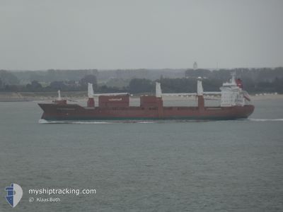
SLUISGRACHT
General Cargo
Current Trip
| Trip Time | 8 h, 44 mins |
|---|---|
| Trip Distance | 127.47 nm |
| AVG Speed | 14.6 Knopen |
| MAX Speed | 17.5 Knopen |
| Diepgang | 7.2 M |
| AVG Wind | 15.2 knots |
| MAX Wind | 24 knots |
| MIN Temp | -2.4°C / 27.68°F |
| MAX Temp | -0.6°C / 30.92°F |
| Positie ontvangen | 3 d geleden |
Current Position
| Lengtegraad | 19.09776° |
|---|---|
| Breedtegraat | 60.52342° |
| Status | Under way using engine |
| Snelheid | 14.7 Knopen |
| Koers | 43.1° |
| Gebied | Gulf of Bothnia |
| Station | T-AIS |
| Positie ontvangen | 3 d geleden |
Info
Information
The current position of SLUISGRACHT is in Gulf of Bothnia with coordinates 60.52342° / 19.09776° as reported on 2024-04-21 19:38 by AIS to our vessel tracker app. The vessel's current speed is 14.7 Knopen and is currently inside the port of HUSUM.
The vessel SLUISGRACHT (IMO: 9202522, MMSI: 244903000) is a General Cargo that was built in 2001 ( 23 Jaar oud ). It's sailing under the flag of [NL] Netherlands.
In this page you can find informations about the vessels current position, last detected port calls, and current voyage information. If the vessels is not in coverage by AIS you will find the latest position.
The current position of SLUISGRACHT is detected by our AIS receivers and we are not responsible for the reliability of the data. The last position was recorded while the vessel was in Coverage by the Ais receivers of our vessel tracking app.
The current draught of SLUISGRACHT as reported by AIS is 7.2 meters
Weather
| Temperature | 0.5°C / 32.9°F |
|---|---|
| Wind Speed | 4 knots |
| Direction | 153° SSE |
| Pressure | 1011.6 hPa |
| Humidity | 85.1 % |
| Cloud Coverage | 31 % |
Featured Company
Last Port Calls
| Port | Arrival | Departure | Time In Port |
|---|---|---|---|
| 2024-04-23 16:24 | |||
| 2024-04-22 03:40 | 2024-04-23 07:40 | 1 d | |
| 2024-04-15 05:36 | 2024-04-16 19:29 | 1 d | |
| 2024-04-03 21:27 | 2024-04-05 18:15 | 1 d | |
| 2024-03-19 21:24 | 2024-03-22 15:33 | 2 d | |
| 2024-03-04 02:17 | 2024-03-06 01:40 | 1 d | |
| 2024-02-27 20:39 | 2024-03-02 00:38 | 3 d | |
| 2024-02-15 16:28 | 2024-02-16 11:55 | 19 h | |
| 2024-02-11 22:47 | 2024-02-13 13:21 | 1 d | |
| 2024-02-06 22:02 | 2024-02-08 17:22 | 1 d |
Last Trips
| Origin | Departure | Destination | Arrival | Distance | |
|---|---|---|---|---|---|
| 2024-04-23 10:40 | 2024-04-23 18:24 | 127.47 nm | |||
| 2024-04-16 21:29 | 2024-04-22 06:40 | 2026.15 nm | |||
| 2024-04-05 20:15 | 2024-04-15 07:36 | 2024.61 nm | |||
| 2024-03-22 11:33 | 2024-04-03 23:27 | 3351.64 nm | |||
| 2024-03-05 20:40 | 2024-03-19 17:24 | 2993.89 nm | |||
| 2024-03-01 19:38 | 2024-03-03 21:17 | 712.96 nm | |||
| 2024-02-16 11:55 | 2024-02-27 15:39 | 3753.69 nm | |||
| 2024-02-13 14:21 | 2024-02-15 16:28 | 863.83 nm | |||
| 2024-02-08 18:22 | 2024-02-11 23:47 | 1275.72 nm | |||
| 2024-02-06 11:07 | 2024-02-06 23:02 | 153.72 nm |
Events
| Tijd | Evenement | Details | Positie / Bestemming | Info |
|---|---|---|---|---|
| 2024-04-23 16:44 | Stop beweging |
63.31874 / 19.15500
[SE] HUSUM
|
Snelheid: Koers: 355° |
|
| 2024-04-23 16:24 | Aankomsthaven |
|
63.31664 / 19.15319
[SE] HUSUM
|
Snelheid: 6.5 kn Koers: 274° |
| 2024-04-23 07:40 | Start beweging | 0.97 nm, West of MANTYLUOTO |
61.59626 / 21.45369
PORI
|
Snelheid: 8.6 kn Koers: 215° |
| 2024-04-23 07:40 | Vertrekhaven |
|
61.59626 / 21.45369
PORI
|
Snelheid: 3.7 kn Koers: 258° |
| 2024-04-22 03:40 | Stop beweging |
61.60012 / 21.46782
[FI] MANTYLUOTO
|
Snelheid: 0.1 kn Koers: 64° |
|
| 2024-04-22 03:40 | Aankomsthaven |
|
61.60012 / 21.46782
[FI] MANTYLUOTO
|
Snelheid: 0.9 kn Koers: 73° |
| 2024-04-21 19:44 | Status Changed | Default Under way using engine |
60.54008 / 19.13435
PORI
|
Snelheid: 14.7 kn Koers: 43.1° |
| 2024-04-21 19:38 | Status Changed | Under way using engine Default |
60.52342 / 19.09776
PORI
|
Snelheid: 14.7 kn Koers: 41° |
| 2024-04-21 19:38 | Buitenbereik |
60.52342 / 19.09776
Gulf of Bothnia
PORI
|
Snelheid: 14.7 kn Koers: 43.1° |
|
| 2024-04-21 19:36 | Status Changed | Default Under way using engine |
60.51694 / 19.08631
PORI
|
Snelheid: 14.3 kn Koers: 22.5° |