
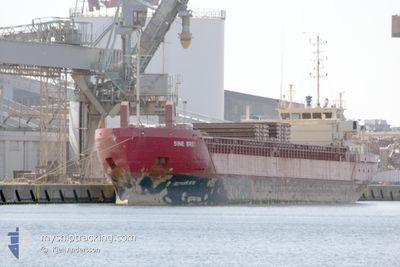
SINE BRES
General Cargo
Current Trip
| Time Travelled | 2 days |
|---|---|
| Remaining Time | 14 h, 23 mins |
| Distance Travelled | 506.84 nm |
| Remaining Distance | 132.46 nm |
| AVG Speed | 9 Knopen |
| MAX Speed | 10.2 Knopen |
| AVG Wind | 8.9 knots |
| MAX Wind | 22.4 knots |
| MIN Temp | 15.8°C / 60.44°F |
| MAX Temp | 23.1°C / 73.58°F |
| Diepgang | 3.6 M |
| Positie ontvangen | Nu |
Current Position
| Lengtegraad | -9.84719° |
|---|---|
| Breedtegraat | 38.70258° |
| Status | Under way using engine |
| Snelheid | 9.4 Knopen |
| Koers | 0.4° |
| Gebied | North Atlantic Ocean |
| Station | T-AIS |
| Positie ontvangen | Nu |
Info
Information
The current position of SINE BRES is in North Atlantic Ocean with coordinates 38.70258° / -9.84719° as reported on 2024-04-19 21:25 by AIS to our vessel tracker app. The vessel's current speed is 9.4 Knopen and is heading at the port of AVEIRO. The estimated time of arrival as calculated by MyShipTracking vessel tracking app is 2024-04-20 11:48 LT
The vessel SINE BRES (IMO: 9364150, MMSI: 304225000) is a General Cargo that was built in 2006 ( 18 Jaar oud ). It's sailing under the flag of [AG] Antigua Barbuda.
In this page you can find informations about the vessels current position, last detected port calls, and current voyage information. If the vessels is not in coverage by AIS you will find the latest position.
The current position of SINE BRES is detected by our AIS receivers and we are not responsible for the reliability of the data. The last position was recorded while the vessel was in Coverage by the Ais receivers of our vessel tracking app.
The current draught of SINE BRES as reported by AIS is 3.6 meters
Weather
| Temperature | 15.8°C / 60.44°F |
|---|---|
| Wind Speed | 5 knots |
| Direction | 334° NNW |
| Pressure | 1016.3 hPa |
| Humidity | 84.5 % |
| Cloud Coverage | 100 % |
Featured Company
Last Port Calls
| Port | Arrival | Departure | Time In Port |
|---|---|---|---|
| 2024-04-16 20:01 | 2024-04-17 13:59 | 17 h | |
| 2024-04-15 06:03 | 2024-04-15 17:31 | 11 h | |
| 2024-04-01 12:05 | 2024-04-03 23:37 | 2 d | |
| 2024-03-27 18:51 | 2024-03-29 20:20 | 2 d | |
| 2024-03-21 01:41 | 2024-03-22 17:18 | 1 d | |
| 2024-03-19 12:22 | 2024-03-20 02:11 | 13 h | |
| 2024-03-15 23:46 | 2024-03-16 19:48 | 20 h | |
| 2024-03-14 15:36 | |||
| 2024-02-28 02:37 | 2024-03-01 00:37 | 1 d | |
| 2024-02-22 02:58 | 2024-02-26 19:11 | 4 d |
Last Trips
| Origin | Departure | Destination | Arrival | Distance | |
|---|---|---|---|---|---|
| 2024-04-15 18:31 | 2024-04-16 21:01 | 272.50 nm | |||
| 2024-04-04 01:37 | 2024-04-15 07:03 | 2059.61 nm | |||
| 2024-03-29 20:20 | 2024-04-01 14:05 | 656.64 nm | |||
| 2024-03-22 17:18 | 2024-03-27 18:51 | 1041.53 nm | |||
| 2024-03-20 02:11 | 2024-03-21 01:41 | 213.07 nm | |||
| 2024-03-16 20:48 | 2024-03-19 12:22 | 673.41 nm | |||
| 2024-03-14 15:36 | 2024-03-16 00:46 | 305.33 nm | |||
| 2024-02-26 20:11 | 2024-02-28 03:37 | 257.80 nm | |||
| 2024-02-16 01:07 | 2024-02-22 03:58 | 1452.21 nm | |||
| 2024-02-14 06:12 | 2024-02-15 06:33 | 215.19 nm |
Events
| Tijd | Evenement | Details | Positie / Bestemming | Info |
|---|---|---|---|---|
| 2024-04-19 15:44 | Status Changed | Under way using engine Default |
37.81276 / -9.85491
AVEIRO PORTUGAL
|
Snelheid: 10 kn Koers: 359° |
| 2024-04-19 15:44 | Binnenbereik |
37.81276 / -9.85491
North Atlantic Ocean
AVEIRO PORTUGAL
|
Snelheid: 9.7 kn Koers: 4.9° |
|
| 2024-04-19 13:56 | Status Changed | Default Under way using engine |
37.51498 / -9.86170
AVEIRO PORTUGAL
|
Snelheid: 9.6 kn Koers: 1.6° |
| 2024-04-19 13:54 | Buitenbereik |
37.50744 / -9.86206
North Atlantic Ocean
AVEIRO PORTUGAL
|
Snelheid: 9.6 kn Koers: 1.6° |
|
| 2024-04-19 13:46 | Binnenbereik |
37.48792 / -9.86301
North Atlantic Ocean
AVEIRO PORTUGAL
|
Snelheid: 9.7 kn Koers: 1.7° |
|
| 2024-04-19 11:33 | Status Changed | Default Under way using engine |
37.12611 / -9.87571
AVEIRO PORTUGAL
|
Snelheid: 9 kn Koers: 2.2° |
| 2024-04-19 11:12 | Buitenbereik |
37.07074 / -9.87726
North Atlantic Ocean
AVEIRO PORTUGAL
|
Snelheid: 9 kn Koers: 2.2° |
|
| 2024-04-19 10:37 | Status Changed | Under way using engine Default |
36.98102 / -9.87637
AVEIRO PORTUGAL
|
Snelheid: 9.1 kn Koers: 356° |
| 2024-04-19 10:37 | Binnenbereik |
36.98102 / -9.87637
North Atlantic Ocean
AVEIRO PORTUGAL
|
Snelheid: 9.4 kn Koers: 358.7° |
|
| 2024-04-19 08:59 | Buitenbereik |
36.70494 / -9.85692
North Atlantic Ocean
AVEIRO PORTUGAL
|
Snelheid: 9.5 kn Koers: 355.5° |