
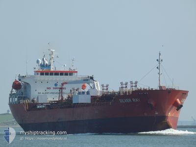
SILVER RAY
Oil/Chemical Tanker
Current Trip
| Time Travelled | 3 days |
|---|---|
| Remaining Time | --- |
| Distance Travelled | 675.15 nm |
| Remaining Distance | --- |
| AVG Speed | 9.5 Knopen |
| MAX Speed | 13.5 Knopen |
| AVG Wind | 17 knots |
| MAX Wind | 31 knots |
| MIN Temp | 11.8°C / 53.24°F |
| MAX Temp | 17.4°C / 63.32°F |
| Diepgang | 5.4 M |
| Positie ontvangen | 4 h, 42 m geleden |
Current Position
| Lengtegraad | 14.73616° |
|---|---|
| Breedtegraat | 35.81098° |
| Status | Under way using engine |
| Snelheid | 12.9 Knopen |
| Koers | 105.5° |
| Gebied | Mediterranean Sea - Eastern Basin |
| Station | T-AIS |
| Positie ontvangen | 4 h, 42 m geleden |
Info
Information
The current position of SILVER RAY is in Mediterranean Sea - Eastern Basin with coordinates 35.81098° / 14.73616° as reported on 2024-04-25 00:50 by AIS to our vessel tracker app. The vessel's current speed is 12.9 Knopen and is heading at the port of TERNEUZEN. The estimated time of arrival as calculated by MyShipTracking vessel tracking app is 2024-04-26 16:00 LT
The vessel SILVER RAY (IMO: 9493133, MMSI: 636015953) is a Oil/Chemical Tanker that was built in 2013 ( 11 Jaar oud ). It's sailing under the flag of [LR] Liberia.
In this page you can find informations about the vessels current position, last detected port calls, and current voyage information. If the vessels is not in coverage by AIS you will find the latest position.
The current position of SILVER RAY is detected by our AIS receivers and we are not responsible for the reliability of the data. The last position was recorded while the vessel was in Coverage by the Ais receivers of our vessel tracking app.
The current draught of SILVER RAY as reported by AIS is 5.4 meters
Weather
| Temperature | 14.7°C / 58.46°F |
|---|---|
| Wind Speed | 20 knots |
| Direction | 309° NW |
| Pressure | 1012.9 hPa |
| Humidity | 58.1 % |
| Cloud Coverage | 21 % |
Featured Company
Last Port Calls
| Port | Arrival | Departure | Time In Port |
|---|---|---|---|
| 2024-04-20 04:57 | 2024-04-21 15:17 | 1 d | |
| 2024-04-06 14:00 | 2024-04-06 14:25 | 24 m | |
| 2024-04-01 07:29 | 2024-04-04 04:29 | 2 d | |
| 2024-03-26 15:22 | 2024-03-28 12:13 | 1 d | |
| 2024-03-22 17:28 | 2024-03-24 11:10 | 1 d | |
| 2024-02-25 20:11 | 2024-02-27 05:02 | 1 d | |
| 2024-02-15 21:22 | 2024-02-16 23:50 | 1 d | |
| 2024-02-08 08:18 | 2024-02-10 13:11 | 2 d | |
| 2024-02-07 03:06 | 2024-02-07 19:55 | 16 h | |
| 2024-02-04 06:33 |
Most Visited Ports (Last year)
| Port | Arrivals | |
|---|---|---|
| 3 | ||
| 3 | ||
| 3 | ||
| 2 | ||
| 2 | ||
| 2 |
Last Trips
| Origin | Departure | Destination | Arrival | Distance | |
|---|---|---|---|---|---|
| 2024-04-06 16:25 | 2024-04-20 06:57 | 1432.67 nm | |||
| 2024-04-04 04:29 | 2024-04-06 16:00 | 485.74 nm | |||
| 2024-03-28 13:13 | 2024-04-01 07:29 | 415.52 nm | |||
| 2024-03-24 11:10 | 2024-03-26 16:22 | 336.01 nm | |||
| 2024-02-27 07:02 | 2024-03-22 17:28 | 2769.61 nm | |||
| 2024-02-17 00:50 | 2024-02-25 22:11 | 2251.45 nm | |||
| 2024-02-10 14:11 | 2024-02-15 22:22 | 1374.04 nm | |||
| 2024-02-07 20:55 | 2024-02-08 09:18 | 94.93 nm | |||
| 2024-02-04 07:33 | 2024-02-07 04:06 | 386.27 nm |
Events
| Tijd | Evenement | Details | Positie / Bestemming | Info |
|---|---|---|---|---|
| 2024-04-25 00:55 | Status Changed | Default Under way using engine |
35.80432 / 14.75395
FOR ORDER
|
Snelheid: 12.9 kn Koers: 105.5° |
| 2024-04-25 00:50 | Buitenbereik |
35.81098 / 14.73616
Mediterranean Sea - Eastern Basin
FOR ORDER
|
Snelheid: 12.9 kn Koers: 105.5° |
|
| 2024-04-25 00:38 | Status Changed | Under way using engine Default |
35.82219 / 14.68412
FOR ORDER
|
Snelheid: 12.6 kn Koers: 104° |
| 2024-04-25 00:35 | Status Changed | Default Under way using engine |
35.82476 / 14.67159
FOR ORDER
|
Snelheid: 12.5 kn Koers: 99.8° |
| 2024-04-25 00:28 | Destination Changed | FOR ORDER MALTA |
35.83046 / 14.63942
FOR ORDER
|
Snelheid: 12.3 kn Koers: 100.3° |
| 2024-04-25 00:28 | ETA Changed | 2024/04/26 16:00 2024/04/24 16:00 |
35.83046 / 14.63942
FOR ORDER
|
Snelheid: 12.3 kn Koers: 100.3° |
| 2024-04-25 00:19 | Start beweging | 3.21 nm, East of MARSAXLOKK |
35.83677 / 14.61079
MALTA
|
Snelheid: 7.6 kn Koers: 111.3° |
| 2024-04-25 00:13 | Status Changed | Under way using engine Default |
35.84037 / 14.60068
MALTA
|
Snelheid: 0.7 kn Koers: 343° |
| 2024-04-25 00:06 | Binnenbereik |
35.84037 / 14.60068
Mediterranean Sea - Eastern Basin
|
Snelheid: 2.8 kn Koers: 82.5° |
|
| 2024-04-24 21:45 | Buitenbereik |
35.83724 / 14.60034
Mediterranean Sea - Eastern Basin
|
Snelheid: 0.1 kn Koers: 311.2° |