
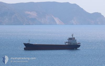
SIFTERI
General Cargo
Current Trip
| Time Travelled | 6 days |
|---|---|
| Remaining Time | --- |
| Distance Travelled | 1222.83 nm |
| Remaining Distance | --- |
| AVG Speed | 9.9 Knopen |
| MAX Speed | 13.5 Knopen |
| AVG Wind | 11.3 knots |
| MAX Wind | 34 knots |
| MIN Temp | 10.5°C / 50.9°F |
| MAX Temp | 23.5°C / 74.3°F |
| Diepgang | 7.9 M |
| Positie ontvangen | 1 d geleden |
Current Position
| Lengtegraad | 14.16538° |
|---|---|
| Breedtegraat | 36.32417° |
| Status | Under way using engine |
| Snelheid | 11.2 Knopen |
| Koers | 293.5° |
| Gebied | Mediterranean Sea - Eastern Basin |
| Station | T-AIS |
| Positie ontvangen | 1 d geleden |
Info
Information
The current position of SIFTERI is in Mediterranean Sea - Eastern Basin with coordinates 36.32417° / 14.16538° as reported on 2024-04-22 09:14 by AIS to our vessel tracker app. The vessel's current speed is 11.2 Knopen and is heading at the port of GIJON. The estimated time of arrival as calculated by MyShipTracking vessel tracking app is 2024-04-29 12:00 LT
The vessel SIFTERI (IMO: 9452323, MMSI: 636020513) is a General Cargo that was built in 2008 ( 16 Jaar oud ). It's sailing under the flag of [LR] Liberia.
In this page you can find informations about the vessels current position, last detected port calls, and current voyage information. If the vessels is not in coverage by AIS you will find the latest position.
The current position of SIFTERI is detected by our AIS receivers and we are not responsible for the reliability of the data. The last position was recorded while the vessel was in Coverage by the Ais receivers of our vessel tracking app.
The current draught of SIFTERI as reported by AIS is 7.9 meters
Weather
| Temperature | 10.9°C / 51.62°F |
|---|---|
| Wind Speed | 7 knots |
| Direction | 346° NNW |
| Pressure | 1015.5 hPa |
| Humidity | 64.1 % |
| Cloud Coverage | 100 % |
Featured Company
Last Port Calls
| Port | Arrival | Departure | Time In Port |
|---|---|---|---|
| 2024-04-11 08:11 | 2024-04-17 03:24 | 5 d | |
| 2024-03-31 23:05 | 2024-04-04 22:41 | 3 d | |
| 2024-03-20 05:40 | 2024-03-30 00:58 | 9 d | |
| 2024-03-02 07:23 | 2024-03-12 09:46 | 10 d | |
| 2024-02-14 17:01 | 2024-02-20 13:32 | 5 d | |
| 2024-02-05 08:31 | 2024-02-10 13:52 | 5 d | |
| 2024-02-01 16:53 |
Last Trips
| Origin | Departure | Destination | Arrival | Distance | |
|---|---|---|---|---|---|
| 2024-04-04 23:41 | 2024-04-11 11:11 | 1096.29 nm | |||
| 2024-03-30 01:58 | 2024-04-01 00:05 | 211.71 nm | |||
| 2024-03-12 10:46 | 2024-03-20 06:40 | 300.87 nm | |||
| 2024-02-20 14:32 | 2024-03-02 08:23 | 982.75 nm | |||
| 2024-02-10 15:52 | 2024-02-14 18:01 | 865.54 nm | |||
| 2024-02-01 17:53 | 2024-02-05 10:31 | 743.56 nm |
Events
| Tijd | Evenement | Details | Positie / Bestemming | Info |
|---|---|---|---|---|
| 2024-04-22 09:14 | Status Changed | Default Under way using engine |
36.32476 / 14.16367
ES GIJ
|
Snelheid: 11.2 kn Koers: 293.5° |
| 2024-04-22 09:14 | Buitenbereik |
36.32417 / 14.16538
Mediterranean Sea - Eastern Basin
ES GIJ
|
Snelheid: 11.2 kn Koers: 293.5° |
|
| 2024-04-22 06:42 | Gevonden in zee | Maltese part of the Mediterranean Sea - Eastern Basin |
36.25062 / 14.71051
Mediterranean Sea - Eastern Basin
ES GIJ
|
Snelheid: 9.9 kn Koers: 271.4° |
| 2024-04-22 06:41 | Status Changed | Under way using engine Default |
36.25064 / 14.71509
ES GIJ
|
Snelheid: 9.9 kn Koers: 270° |
| 2024-04-22 06:41 | Binnenbereik |
36.25062 / 14.71051
Mediterranean Sea - Eastern Basin
ES GIJ
|
Snelheid: 9.9 kn Koers: 271.4° |
|
| 2024-04-20 13:21 | Status Changed | Default Under way using engine |
36.62937 / 23.26026
ES GIJ
|
Snelheid: 10.7 kn Koers: 186.1° |
| 2024-04-20 13:18 | Status Changed | Under way using engine Default |
36.63974 / 23.26226
ES GIJ
|
Snelheid: 10.7 kn Koers: 188° |
| 2024-04-20 13:18 | Buitenbereik |
36.63974 / 23.26226
Aegean Sea
ES GIJ
|
Snelheid: 10.7 kn Koers: 186.1° |
|
| 2024-04-20 13:04 | Binnenbereik |
36.63974 / 23.26226
Aegean Sea
ES GIJ
|
Snelheid: 10.7 kn Koers: 186.1° |
|
| 2024-04-20 12:17 | Buitenbereik |
36.81775 / 23.27991
Aegean Sea
ES GIJ
|
Snelheid: 10.7 kn Koers: 182.1° |