
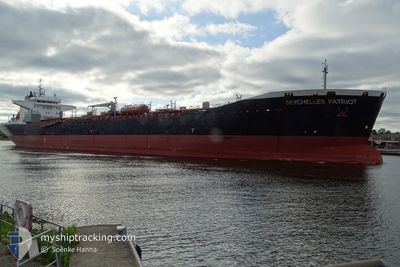
SEYCHELLES PATRIOT
Oil/Chemical Tanker
Current Trip
| Time Travelled | 10 h, 50 mins |
|---|---|
| Remaining Time | --- |
| Distance Travelled | 1.18 nm |
| Remaining Distance | --- |
| AVG Speed | --- |
| MAX Speed | --- |
| AVG Wind | 10.1 knots |
| MAX Wind | 11 knots |
| MIN Temp | 29.4°C / 84.92°F |
| MAX Temp | 30.9°C / 87.62°F |
| Diepgang | 7.3 M |
| Positie ontvangen | 5 d geleden |
Current Position
| Lengtegraad | 37.52683° |
|---|---|
| Breedtegraat | 22.53441° |
| Status | Under way using engine |
| Snelheid | 12.3 Knopen |
| Koers | 358° |
| Gebied | Red Sea |
| Station | T-AIS |
| Positie ontvangen | 5 d geleden |
Info
Information
The current position of SEYCHELLES PATRIOT is in Red Sea with coordinates 22.53441° / 37.52683° as reported on 2024-04-18 03:14 by AIS to our vessel tracker app. The vessel's current speed is 12.3 Knopen
The vessel SEYCHELLES PATRIOT (IMO: 9365635, MMSI: 664445000) is a Oil/Chemical Tanker that was built in 2008 ( 16 Jaar oud ). It's sailing under the flag of [SC] Seychelles.
In this page you can find informations about the vessels current position, last detected port calls, and current voyage information. If the vessels is not in coverage by AIS you will find the latest position.
The current position of SEYCHELLES PATRIOT is detected by our AIS receivers and we are not responsible for the reliability of the data. The last position was recorded while the vessel was in Coverage by the Ais receivers of our vessel tracking app.
The current draught of SEYCHELLES PATRIOT as reported by AIS is 7.3 meters
Weather
| Temperature | 36.5°C / 97.7°F |
|---|---|
| Wind Speed | 12 knots |
| Direction | 62° ENE |
| Pressure | 1010.8 hPa |
| Humidity | 16.8 % |
| Cloud Coverage | 2 % |
Featured Company
Events
| Tijd | Evenement | Details | Positie / Bestemming | Info |
|---|---|---|---|---|
| 2024-04-22 22:11 | Vertrekhaven |
|
23.94186 / 38.21182
SA YNB
|
Snelheid: 2.9 kn Koers: 240° |
| 2024-04-21 16:50 | Stop beweging |
23.94449 / 38.22633
[SA] YANBU
|
Snelheid: 0.3 kn Koers: 303° |
|
| 2024-04-21 16:50 | Aankomsthaven |
|
23.94449 / 38.22633
[SA] YANBU
|
Snelheid: 1.3 kn Koers: 309° |
| 2024-04-21 09:58 | Start beweging |
23.74750 / 37.52930
SA YNB
|
Snelheid: 4.3 kn Koers: 303° |
|
| 2024-04-20 14:34 | Stop beweging |
24.00462 / 37.38282
SA YNB
|
Snelheid: 0.3 kn Koers: 270° |
|
| 2024-04-18 03:18 | Status Changed | Default Under way using engine |
22.54702 / 37.52628
SA YNB
|
Snelheid: 12.3 kn Koers: 358° |
| 2024-04-18 03:14 | Buitenbereik |
22.53441 / 37.52683
Red Sea
SA YNB
|
Snelheid: 12.3 kn Koers: 358° |
|
| 2024-04-18 02:17 | Status Changed | Under way using engine Default |
22.33650 / 37.53963
SA YNB
|
Snelheid: 12.3 kn Koers: 356° |
| 2024-04-18 01:58 | Binnenbereik |
22.33766 / 37.53953
Red Sea
SA YNB
|
Snelheid: 12.4 kn Koers: 356.1° |
|
| 2024-04-18 00:33 | Buitenbereik |
21.97709 / 37.56608
Red Sea
SA YNB
|
Snelheid: 12.7 kn Koers: 357.8° |