
SEAVENTURE
Passengers Ship
Current Trip
| Time Travelled | 40 days |
|---|---|
| Remaining Time | 18 h, 21 mins |
| Distance Travelled | 9258.92 nm |
| Remaining Distance | 215.34 nm |
| AVG Speed | 11.8 Knopen |
| MAX Speed | 15.3 Knopen |
| AVG Wind | 13 knots |
| MAX Wind | 34.7 knots |
| MIN Temp | -7.3°C / 18.86°F |
| MAX Temp | 29.2°C / 84.56°F |
| Diepgang | 5 M |
| Positie ontvangen | Nu |
Current Position
| Lengtegraad | -0.40802° |
|---|---|
| Breedtegraat | 50.24328° |
| Status | Under way using engine |
| Snelheid | 9 Knopen |
| Koers | 76.9° |
| Gebied | English Channel |
| Station | T-AIS |
| Positie ontvangen | Nu |
Info
Information
The current position of SEAVENTURE is in English Channel with coordinates 50.24328° / -0.40802° as reported on 2024-04-25 08:59 by AIS to our vessel tracker app. The vessel's current speed is 9 Knopen and is heading at the port of ROTTERDAM. The estimated time of arrival as calculated by MyShipTracking vessel tracking app is 2024-04-26 03:21 LT
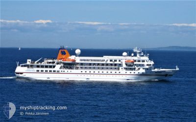
The vessel SEAVENTURE (IMO: 8907424, MMSI: 210081000) is a Passengers Ship that was built in 1990 ( 34 Jaar oud ). It's sailing under the flag of [CY] Cyprus.
In this page you can find informations about the vessels current position, last detected port calls, and current voyage information. If the vessels is not in coverage by AIS you will find the latest position.
The current position of SEAVENTURE is detected by our AIS receivers and we are not responsible for the reliability of the data. The last position was recorded while the vessel was in Coverage by the Ais receivers of our vessel tracking app.
The current draught of SEAVENTURE as reported by AIS is 5 meters
Weather
| Temperature | 9.5°C / 49.1°F |
|---|---|
| Wind Speed | 13 knots |
| Direction | 232° SW |
| Pressure | 1007.4 hPa |
| Humidity | 69.5 % |
| Cloud Coverage | 100 % |
Featured Company
Most Visited Ports (Last year)
| Port | Arrivals | |
|---|---|---|
| 12 | ||
| 11 | ||
| 8 | ||
| 8 | ||
| 7 | ||
| 7 |
Last Trips
Events
| Tijd | Evenement | Details | Positie / Bestemming | Info |
|---|---|---|---|---|
| 2024-04-25 08:08 | Status Changed | Under way using engine Default |
50.20040 / -.64816
NL RTM
|
Snelheid: 11.7 kn Koers: 74° |
| 2024-04-25 07:27 | Status Changed | Default Under way using engine |
50.16279 / -.84751
NL RTM
|
Snelheid: 11.1 kn Koers: 74.6° |
| 2024-04-25 07:17 | Status Changed | Under way using engine Default |
50.15464 / -.89304
NL RTM
|
Snelheid: 11 kn Koers: 74° |
| 2024-04-25 07:14 | Status Changed | Default Under way using engine |
50.15271 / -.90377
NL RTM
|
Snelheid: 11.1 kn Koers: 74.3° |
| 2024-04-25 07:08 | Gevonden in zee | United Kingdom part of the English Channel |
50.14752 / -.93272
English Channel
NL RTM
|
Snelheid: 11.1 kn Koers: 74.3° |
| 2024-04-25 07:05 | Status Changed | Under way using engine Default |
50.14467 / -.94829
NL RTM
|
Snelheid: 11.7 kn Koers: 75° |
| 2024-04-25 06:58 | Binnenbereik |
50.14752 / -.93272
English Channel
NL RTM
|
Snelheid: 11.1 kn Koers: 74.3° |
|
| 2024-04-25 02:10 | Status Changed | Default Under way using engine |
49.90776 / -2.31717
NL RTM
|
Snelheid: 9.3 kn Koers: 75.4° |
| 2024-04-25 02:04 | Buitenbereik |
49.90370 / -2.34131
English Channel
NL RTM
|
Snelheid: 9.3 kn Koers: 75.4° |
|
| 2024-04-25 02:00 | Status Changed | Under way using engine Default |
49.90108 / -2.35682
NL RTM
|
Snelheid: 9.4 kn Koers: 75° |