
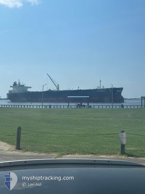
SEAGUARDIAN
Tanker
Current Trip
| Time Travelled | 1 day |
|---|---|
| Remaining Time | --- |
| Distance Travelled | 443.67 nm |
| Remaining Distance | 21.97 nm |
| AVG Speed | 10.6 Knopen |
| MAX Speed | 13.9 Knopen |
| AVG Wind | 21.1 knots |
| MAX Wind | 31.8 knots |
| MIN Temp | 9.2°C / 48.56°F |
| MAX Temp | 13.3°C / 55.94°F |
| Diepgang | 13.8 M |
| Positie ontvangen | 1 m geleden |
Current Position
| Lengtegraad | --- |
|---|---|
| Breedtegraat | --- |
| Status | Under way using engine |
| Snelheid | 4.5 Knopen |
| Koers | 183° |
| Gebied | English Channel |
| Station | T-AIS |
| Positie ontvangen | 1 m geleden |
Info
Information
The current position of SEAGUARDIAN is in English Channel with coordinates 49.70371° / -0.17700° as reported on 2025-12-09 05:45 by AIS to our vessel tracker app. The vessel's current speed is 4.5 Knopen and is heading at the port of LE HAVRE. The estimated time of arrival as calculated by MyShipTracking vessel tracking app is 2025-12-09 08:30 LT
The vessel SEAGUARDIAN (IMO: 9891919, MMSI: 538009055) is a Tanker It's sailing under the flag of [MH] Marshall Is.
In this page you can find informations about the vessels current position, last detected port calls, and current voyage information. If the vessels is not in coverage by AIS you will find the latest position.
The current position of SEAGUARDIAN is detected by our AIS receivers and we are not responsible for the reliability of the data. The last position was recorded while the vessel was in Coverage by the Ais receivers of our vessel tracking app.
The current draught of SEAGUARDIAN as reported by AIS is 13.8 meters
Weather
| Temperature | 12.3°C / 54.14°F |
|---|---|
| Wind Speed | 19 knots |
| Direction | 175° S |
| Pressure | 1008.3 hPa |
| Humidity | 85.5 % |
| Cloud Coverage | 100 % |
Featured Company
Last Port Calls
| Port | Arrival | Departure | Time In Port |
|---|---|---|---|
| 2025-12-06 09:07 | 2025-12-07 14:48 | 1 d | |
| 2025-11-02 20:47 | 2025-11-04 14:59 | 1 d | |
| 2025-10-24 09:55 | 2025-10-25 23:59 | 1 d | |
| 2025-10-13 22:28 | 2025-10-15 02:02 | 1 d | |
| 2025-10-08 07:39 | 2025-10-09 15:45 | 1 d |
Most Visited Ports (Last year)
| Port | Arrivals | |
|---|---|---|
| 4 | ||
| 2 | ||
| 2 | ||
| 1 | ||
| 1 | ||
| 1 |
Last Trips
| Origin | Departure | Destination | Arrival | Distance | |
|---|---|---|---|---|---|
| 2025-11-04 14:59 | 2025-12-06 09:07 | 7056.27 nm | |||
| 2025-10-25 23:59 | 2025-11-02 20:47 | 2083.18 nm | |||
| 2025-10-15 02:02 | 2025-10-24 09:55 | 368.51 nm | |||
| 2025-10-09 15:45 | 2025-10-13 22:28 | 378.94 nm | |||
| 2025-09-17 17:34 | 2025-10-08 07:39 | 5491.75 nm |
Events
| Tijd | Evenement | Details | Positie / Bestemming | Info |
|---|---|---|---|---|
| 2025-12-09 04:29 | ETA Changed | 2025/12/09 07:30 2025/12/09 06:00 |
49.90709 / -.16090
GBTEE>FRLEH
|
Snelheid: 11.4 kn Koers: 181.8° |
| 2025-12-09 02:47 | Wijzig zee gebeid | French part of the English Channel United Kingdom part of the English Channel |
50.22498 / -.16793
English Channel
GBTEE>FRLEH
|
Snelheid: 11 kn Koers: 169.9° |
| 2025-12-09 00:33 | Status Changed | Under way using engine Default |
50.52051 / .11993
GBTEE>FRLEH
|
Snelheid: 10.1 kn Koers: 262° |
| 2025-12-09 00:17 | Status Changed | Default Under way using engine |
50.52821 / .19070
GBTEE>FRLEH
|
Snelheid: 9.9 kn Koers: 246.1° |
| 2025-12-09 00:09 | Status Changed | Under way using engine Default |
50.53642 / .21959
GBTEE>FRLEH
|
Snelheid: 9.8 kn Koers: 247° |
| 2025-12-09 00:05 | Status Changed | Default Under way using engine |
50.54118 / .23681
GBTEE>FRLEH
|
Snelheid: 9.8 kn Koers: 246.3° |
| 2025-12-08 23:56 | Status Changed | Under way using engine Default |
50.55138 / .27344
GBTEE>FRLEH
|
Snelheid: 9.7 kn Koers: 246° |
| 2025-12-08 23:29 | Status Changed | Default Under way using engine |
50.57930 / .37627
GBTEE>FRLEH
|
Snelheid: 9.6 kn Koers: 258.9° |
| 2025-12-08 23:22 | Status Changed | Under way using engine Default |
50.58491 / .40243
GBTEE>FRLEH
|
Snelheid: 9.6 kn Koers: 259° |
| 2025-12-08 23:17 | Binnenbereik |
50.58491 / .40243
English Channel
GBTEE>FRLEH
|
Snelheid: 9.6 kn Koers: 258.9° |