
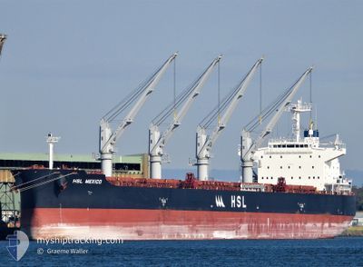
HSL MEXICO
Cargo
Current Trip
| Time Travelled | 22 days |
|---|---|
| Remaining Time | --- |
| Distance Travelled | 5451.08 nm |
| Remaining Distance | 73.79 nm |
| AVG Speed | 11.7 Knopen |
| MAX Speed | 16.9 Knopen |
| AVG Wind | 14.5 knots |
| MAX Wind | 31 knots |
| MIN Temp | 1.5°C / 34.7°F |
| MAX Temp | 16°C / 60.8°F |
| Diepgang | 7 M |
| Positie ontvangen | 2 m geleden |
Current Position
| Lengtegraad | -123.80102° |
|---|---|
| Breedtegraat | 46.20868° |
| Status | At anchor |
| Snelheid | |
| Koers | 66° |
| Gebied | North Pacific Ocean |
| Station | T-AIS |
| Positie ontvangen | 2 m geleden |
Info
Information
The current position of HSL MEXICO is in North Pacific Ocean with coordinates 46.20868° / -123.80102° as reported on 2024-04-23 23:21 by AIS to our vessel tracker app. The vessel's current speed is 0 Knopen and is heading at the port of PORTLAND. The estimated time of arrival as calculated by MyShipTracking vessel tracking app is 2024-04-21 05:00 LT
The vessel HSL MEXICO (IMO: 9897561, MMSI: 353470000) is a Cargo It's sailing under the flag of [PA] Panama.
In this page you can find informations about the vessels current position, last detected port calls, and current voyage information. If the vessels is not in coverage by AIS you will find the latest position.
The current position of HSL MEXICO is detected by our AIS receivers and we are not responsible for the reliability of the data. The last position was recorded while the vessel was in Coverage by the Ais receivers of our vessel tracking app.
The current draught of HSL MEXICO as reported by AIS is 7 meters
Weather
| Temperature | 14.1°C / 57.38°F |
|---|---|
| Wind Speed | 9 knots |
| Direction | 284° WNW |
| Pressure | 1014.4 hPa |
| Humidity | 66.4 % |
| Cloud Coverage | 69 % |
Featured Company
Events
| Tijd | Evenement | Details | Positie / Bestemming | Info |
|---|---|---|---|---|
| 2024-04-23 12:00 | Status Changed | At anchor Default |
46.20858 / -123.80128
US PDX
|
Snelheid: 0.1 kn Koers: 61° |
| 2024-04-23 11:57 | Status Changed | Default At anchor |
46.20849 / -123.80122
US PDX
|
Snelheid: Koers: 65° |
| 2024-04-22 02:36 | Status Changed | At anchor Default |
46.20876 / -123.80051
US PDX
|
Snelheid: Koers: 46° |
| 2024-04-22 02:33 | Status Changed | Default At anchor |
46.20875 / -123.80054
US PDX
|
Snelheid: Koers: 47° |
| 2024-04-21 07:33 | Status Changed | At anchor Under way using engine |
46.21049 / -123.79475
US PDX
|
Snelheid: 1.2 kn Koers: 257° |
| 2024-04-21 07:30 | Stop beweging | 2.98 nm, North East of ASTORIA |
46.21036 / -123.79577
US PDX
|
Snelheid: 0.3 kn Koers: 255° |
| 2024-04-21 01:15 | Wijzig zee gebeid | United States part of the North Pacific Ocean Japanese part of the North Pacific Ocean |
46.19899 / -125.11407
North Pacific Ocean
US PDX
|
Snelheid: 12.2 kn Koers: 87° |
| 2024-04-21 01:15 | Status Changed | Under way using engine Default |
46.19899 / -125.11407
US PDX
|
Snelheid: 12.4 kn Koers: 89° |
| 2024-04-21 01:10 | Binnenbereik |
46.19899 / -125.11407
North Pacific Ocean
US PDX
|
Snelheid: 12.2 kn Koers: 87° |
|
| 2024-04-21 01:03 | Destination Changed | US PDX VANCOUVER |
46.19780 / -125.19692
US PDX
|
Snelheid: 12.3 kn Koers: 90° |