
SCII
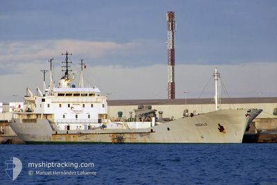
Cement Carrier
Current Trip
| Time Travelled | 11 days |
|---|---|
| Remaining Time | 14 h, 21 mins |
| Distance Travelled | 514.00 nm |
| Remaining Distance | 211.76 nm |
| AVG Speed | 8.6 Knopen |
| MAX Speed | 8.6 Knopen |
| AVG Wind | 11.6 knots |
| MAX Wind | 16.8 knots |
| MIN Temp | 14.4°C / 57.92°F |
| MAX Temp | 20.2°C / 68.36°F |
| Diepgang | 7 M |
| Positie ontvangen | 1 h, 24 m geleden |
Current Position
| Lengtegraad | 31.80309° |
|---|---|
| Breedtegraat | 31.57146° |
| Status | At anchor |
| Snelheid | 0.3 Knopen |
| Koers | 4° |
| Gebied | Mediterranean Sea - Eastern Basin |
| Station | T-AIS |
| Positie ontvangen | 1 h, 24 m geleden |
Info
Information
The current position of SCII is in Mediterranean Sea - Eastern Basin with coordinates 31.57146° / 31.80309° as reported on 2024-04-20 00:32 by AIS to our vessel tracker app. The vessel's current speed is 0.3 Knopen and is heading at the port of HAIFA. The estimated time of arrival as calculated by MyShipTracking vessel tracking app is 2024-04-20 16:17 LT
The vessel SCII (IMO: 7813561, MMSI: 374959000) is a Cement Carrier that was built in 1980 ( 44 Jaar oud ). It's sailing under the flag of [PA] Panama.
In this page you can find informations about the vessels current position, last detected port calls, and current voyage information. If the vessels is not in coverage by AIS you will find the latest position.
The current position of SCII is detected by our AIS receivers and we are not responsible for the reliability of the data. The last position was recorded while the vessel was in Coverage by the Ais receivers of our vessel tracking app.
The current draught of SCII as reported by AIS is 7 meters
Weather
| Temperature | 18.5°C / 65.3°F |
|---|---|
| Wind Speed | 4 knots |
| Direction | 117° ESE |
| Pressure | 1010.8 hPa |
| Humidity | 75.2 % |
| Cloud Coverage | 100 % |
Featured Company
Events
| Tijd | Evenement | Details | Positie / Bestemming | Info |
|---|---|---|---|---|
| 2024-04-20 00:35 | Status Changed | Default At anchor |
31.57143 / 31.80301
HAIFA
|
Snelheid: 0.3 kn Koers: 4° |
| 2024-04-20 00:32 | Gevonden in zee | Egyptian part of the Mediterranean Sea - Eastern Basin |
31.57146 / 31.80309
Mediterranean Sea - Eastern Basin
|
Snelheid: 0.3 kn Koers: 165.3° |
| 2024-04-20 00:32 | Status Changed | At anchor Default |
31.57146 / 31.80309
HAIFA
|
Snelheid: 0.2 kn Koers: 338° |
| 2024-04-20 00:32 | Binnenbereik |
31.57146 / 31.80309
Mediterranean Sea - Eastern Basin
|
Snelheid: 0.3 kn Koers: 165.3° |
|
| 2024-04-20 00:32 | Buitenbereik |
31.57146 / 31.80309
Mediterranean Sea - Eastern Basin
|
Snelheid: 0.3 kn Koers: 165.3° |
|
| 2024-04-19 18:14 | Stop beweging | 6.65 nm, North of DAMIETTA |
31.57153 / 31.80352
HAIFA
|
Snelheid: 0.3 kn Koers: 313° |
| 2024-04-18 18:30 | Buitenbereik |
33.81827 / 35.49081
Mediterranean Sea - Eastern Basin
|
Snelheid: 0.1 kn Koers: 217.9° |
|
| 2024-04-18 16:49 | Stop beweging | 6.14 nm, South of BEIRUT |
33.81826 / 35.49079
HAIFA
|
Snelheid: Koers: 305° |
| 2024-04-18 16:01 | Start beweging | 6.04 nm, South of BEIRUT |
33.81975 / 35.49201
HAIFA
|
Snelheid: 4 kn Koers: 350° |
| 2024-04-18 14:55 | Status Changed | Under way using engine Moored |
33.81825 / 35.49080
HAIFA
|
Snelheid: 10.8 kn Koers: 49.3° |