
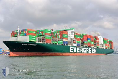
EVER FOREVER
Cargo D
Current Trip
| Time Travelled | 13 days |
|---|---|
| Remaining Time | 8 h, 49 mins |
| Distance Travelled | 5471.88 nm |
| Remaining Distance | 185.06 nm |
| AVG Speed | 17.3 Knopen |
| MAX Speed | 21 Knopen |
| AVG Wind | 13.4 knots |
| MAX Wind | 34 knots |
| MIN Temp | -1.5°C / 29.3°F |
| MAX Temp | 24.9°C / 76.82°F |
| Diepgang | 14.6 M |
| Positie ontvangen | 1 h, 16 m geleden |
Current Position
| Lengtegraad | 121.06614° |
|---|---|
| Breedtegraat | 25.29222° |
| Status | Under way using engine |
| Snelheid | 17.5 Knopen |
| Koers | 222.8° |
| Gebied | South China Sea |
| Station | T-AIS |
| Positie ontvangen | 1 h, 16 m geleden |
Info
Information
The current position of EVER FOREVER is in South China Sea with coordinates 25.29222° / 121.06614° as reported on 2024-04-19 13:23 by AIS to our vessel tracker app. The vessel's current speed is 17.5 Knopen and is heading at the port of KAOHSIUNG. The estimated time of arrival as calculated by MyShipTracking vessel tracking app is 2024-04-19 23:28 LT
The vessel EVER FOREVER (IMO: 9850575, MMSI: 351571000) is a Cargo D It's sailing under the flag of [PA] Panama.
In this page you can find informations about the vessels current position, last detected port calls, and current voyage information. If the vessels is not in coverage by AIS you will find the latest position.
The current position of EVER FOREVER is detected by our AIS receivers and we are not responsible for the reliability of the data. The last position was recorded while the vessel was in Coverage by the Ais receivers of our vessel tracking app.
The current draught of EVER FOREVER as reported by AIS is 14.6 meters
Weather
| Temperature | 23.6°C / 74.48°F |
|---|---|
| Wind Speed | 10 knots |
| Direction | 223° SW |
| Pressure | 1010.6 hPa |
| Humidity | 85.7 % |
| Cloud Coverage | 100 % |
Featured Company
Last Port Calls
| Port | Arrival | Departure | Time In Port |
|---|---|---|---|
| 2024-04-04 11:32 | 2024-04-06 14:01 | 2 d | |
| 2024-03-30 12:16 | 2024-04-02 00:31 | 2 d | |
| 2024-03-25 21:07 | 2024-03-28 23:48 | 3 d | |
| 2024-03-10 04:51 | 2024-03-11 11:22 | 1 d | |
| 2024-03-08 00:48 | 2024-03-09 02:50 | 1 d | |
| 2024-03-06 10:04 | 2024-03-07 07:06 | 21 h | |
| 2024-02-27 23:30 | 2024-02-29 08:12 | 1 d | |
| 2024-02-20 13:51 | 2024-02-22 21:03 | 2 d | |
| 2024-02-01 12:11 | 2024-02-03 14:21 | 2 d |
Most Visited Ports (Last year)
| Port | Arrivals | |
|---|---|---|
| 11 | ||
| 6 | ||
| 6 | ||
| 6 | ||
| 6 | ||
| 4 |
Last Trips
| Origin | Departure | Destination | Arrival | Distance | |
|---|---|---|---|---|---|
| 2024-04-01 17:31 | 2024-04-04 04:32 | 863.16 nm | |||
| 2024-03-28 16:48 | 2024-03-30 05:16 | 405.89 nm | |||
| 2024-03-11 19:22 | 2024-03-25 14:07 | 6423.97 nm | |||
| 2024-03-09 10:50 | 2024-03-10 12:51 | 347.65 nm | |||
| 2024-03-07 15:06 | 2024-03-08 08:48 | 215.74 nm | |||
| 2024-02-29 16:12 | 2024-03-06 18:04 | 2106.04 nm | |||
| 2024-02-23 05:03 | 2024-02-28 07:30 | 1812.66 nm | |||
| 2024-02-03 06:21 | 2024-02-20 21:51 | 5615.23 nm | |||
| 2024-01-29 18:02 | 2024-02-01 04:11 | 863.00 nm |
Events
| Tijd | Evenement | Details | Positie / Bestemming | Info |
|---|---|---|---|---|
| 2024-04-19 13:23 | Buitenbereik |
25.29222 / 121.06614
South China Sea
US TCM >TW KSG
|
Snelheid: 17.5 kn Koers: 222.8° |
|
| 2024-04-19 13:20 | Wijzig zee gebeid | Taiwanese part of the South China Sea Taiwanese part of the Eastern China Sea |
25.30220 / 121.07621
South China Sea
US TCM >TW KSG
|
Snelheid: 17.5 kn Koers: 222.7° |
| 2024-04-19 10:49 | Gevonden in zee | Taiwanese part of the Eastern China Sea |
25.90337 / 121.57858
Eastern China Sea
US TCM >TW KSG
|
Snelheid: 18.3 kn Koers: 219.2° |
| 2024-04-19 10:49 | Binnenbereik |
25.90337 / 121.57858
Eastern China Sea
US TCM >TW KSG
|
Snelheid: 18.3 kn Koers: 219.2° |
|
| 2024-04-17 22:33 | Status Changed | Default Under way using engine |
34.44370 / 129.92723
US TCM >TW KSG
|
Snelheid: 18.8 kn Koers: 231.3° |
| 2024-04-17 22:28 | Buitenbereik |
34.45929 / 129.95118
Japan Sea
US TCM >TW KSG
|
Snelheid: 18.8 kn Koers: 231.3° |
|
| 2024-04-17 22:27 | Status Changed | Under way using engine Default |
34.46189 / 129.95512
US TCM >TW KSG
|
Snelheid: 18.9 kn Koers: 235° |
| 2024-04-17 22:17 | Status Changed | Default Under way using engine |
34.49318 / 130.00754
US TCM >TW KSG
|
Snelheid: 19 kn Koers: 232.7° |
| 2024-04-17 22:14 | Status Changed | Under way using engine Default |
34.50416 / 130.02618
US TCM >TW KSG
|
Snelheid: 19 kn Koers: 231° |
| 2024-04-17 22:09 | Status Changed | Default Under way using engine |
34.51906 / 130.04925
US TCM >TW KSG
|
Snelheid: 19 kn Koers: 227.3° |