
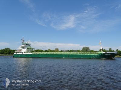
GOOTEBORG
General Cargo
Current Trip
| Time Travelled | 17 h, 19 mins |
|---|---|
| Remaining Time | --- |
| Distance Travelled | 167.46 nm |
| Remaining Distance | --- |
| AVG Speed | 10 Knopen |
| MAX Speed | 12.4 Knopen |
| AVG Wind | 11.7 knots |
| MAX Wind | 22.8 knots |
| MIN Temp | 6.1°C / 42.98°F |
| MAX Temp | 7.5°C / 45.5°F |
| Diepgang | 6.1 M |
| Positie ontvangen | 2 m geleden |
Current Position
| Lengtegraad | 4.27121° |
|---|---|
| Breedtegraat | 52.89928° |
| Status | Under way using engine |
| Snelheid | 10.9 Knopen |
| Koers | 19.1° |
| Gebied | North Sea |
| Station | T-AIS |
| Positie ontvangen | 2 m geleden |
Info
Information
The current position of GOOTEBORG is in North Sea with coordinates 52.89928° / 4.27121° as reported on 2024-04-25 15:09 by AIS to our vessel tracker app. The vessel's current speed is 10.9 Knopen and is heading at the port of ODDA. The estimated time of arrival as calculated by MyShipTracking vessel tracking app is 2024-04-27 08:00 LT
The vessel GOOTEBORG (IMO: 9518256, MMSI: 246798000) is a General Cargo that was built in 2011 ( 13 Jaar oud ). It's sailing under the flag of [NL] Netherlands.
In this page you can find informations about the vessels current position, last detected port calls, and current voyage information. If the vessels is not in coverage by AIS you will find the latest position.
The current position of GOOTEBORG is detected by our AIS receivers and we are not responsible for the reliability of the data. The last position was recorded while the vessel was in Coverage by the Ais receivers of our vessel tracking app.
The current draught of GOOTEBORG as reported by AIS is 6.1 meters
Weather
| Temperature | 7.3°C / 45.14°F |
|---|---|
| Wind Speed | 17 knots |
| Direction | 261° W |
| Pressure | 1000.6 hPa |
| Humidity | 79.6 % |
| Cloud Coverage | 100 % |
Featured Company
Last Port Calls
| Port | Arrival | Departure | Time In Port |
|---|---|---|---|
| 2024-04-23 06:04 | 2024-04-24 21:52 | 1 d | |
| 2024-04-21 23:19 | 2024-04-23 05:52 | 1 d | |
| 2024-04-17 09:52 | 2024-04-21 04:41 | 3 d | |
| 2024-04-14 14:28 | 2024-04-15 10:57 | 20 h | |
| 2024-03-22 14:17 | 2024-04-11 11:08 | 19 d | |
| 2024-03-02 06:42 | 2024-03-07 12:08 | 5 d | |
| 2024-02-29 10:28 | 2024-03-01 15:15 | 1 d | |
| 2024-02-21 07:27 | 2024-02-21 07:30 | 3 m | |
| 2024-02-15 23:51 | 2024-02-19 12:49 | 3 d | |
| 2024-02-12 13:30 | 2024-02-15 21:54 | 3 d |
Last Trips
| Origin | Departure | Destination | Arrival | Distance | |
|---|---|---|---|---|---|
| 2024-04-23 07:52 | 2024-04-23 08:04 | 1.31 nm | |||
| 2024-04-21 06:41 | 2024-04-22 01:19 | 184.83 nm | |||
| 2024-04-15 12:57 | 2024-04-17 11:52 | 398.67 nm | |||
| 2024-04-11 14:08 | 2024-04-14 16:28 | 773.68 nm | |||
| 2024-03-07 13:08 | 2024-03-22 16:17 | 1050.50 nm | |||
| 2024-03-01 16:15 | 2024-03-02 07:42 | 108.14 nm | |||
| 2024-02-21 08:30 | 2024-02-29 11:28 | 1321.55 nm | |||
| 2024-02-19 13:49 | 2024-02-21 08:27 | 360.82 nm | |||
| 2024-02-15 22:54 | 2024-02-16 00:51 | 12.65 nm | |||
| 2024-02-07 04:35 | 2024-02-12 14:30 | 1210.57 nm |
Events
| Tijd | Evenement | Details | Positie / Bestemming | Info |
|---|---|---|---|---|
| 2024-04-25 14:57 | Status Changed | Under way using engine Default |
52.86837 / 4.24556
NOODD
|
Snelheid: 10.7 kn Koers: 29° |
| 2024-04-25 14:57 | Binnenbereik |
52.86837 / 4.24556
North Sea
NOODD
|
Snelheid: 10.6 kn Koers: 34.1° |
|
| 2024-04-25 08:58 | Status Changed | Default Under way using engine |
52.18254 / 3.20362
NOODD
|
Snelheid: 8.5 kn Koers: 44.6° |
| 2024-04-25 08:57 | Buitenbereik |
52.18093 / 3.20079
North Sea
NOODD
|
Snelheid: 8.5 kn Koers: 44.6° |
|
| 2024-04-25 06:10 | ETA Changed | 2024/04/27 08:00 2024/04/27 06:00 |
51.87564 / 2.71970
NOODD
|
Snelheid: 10.2 kn Koers: 36.9° |
| 2024-04-25 05:44 | Wijzig zee gebeid | Dutch part of the North Sea Belgian part of the North Sea |
51.81977 / 2.64203
North Sea
NOODD
|
Snelheid: 10.5 kn Koers: 36.5° |
| 2024-04-25 04:04 | Status Changed | Under way using engine Default |
51.57488 / 2.36851
NOODD
|
Snelheid: 11.3 kn Koers: 33° |
| 2024-04-25 03:57 | Status Changed | Default Under way using engine |
51.55612 / 2.34962
NOODD
|
Snelheid: 11.2 kn Koers: 34.5° |
| 2024-04-25 03:38 | Gevonden in zee | Belgian part of the North Sea |
51.50542 / 2.29641
North Sea
NOODD
|
Snelheid: 11.2 kn Koers: 33.5° |
| 2024-04-25 03:38 | Status Changed | Under way using engine Default |
51.50542 / 2.29641
NOODD
|
Snelheid: 11 kn Koers: 30° |