
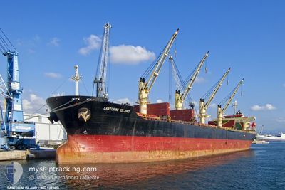
SANTORINI ISLAND
Bulk Carrier
Current Trip
| Time Travelled | 20 days |
|---|---|
| Remaining Time | --- |
| Distance Travelled | 4306.62 nm |
| Remaining Distance | --- |
| AVG Speed | 9.2 Knopen |
| MAX Speed | 9.2 Knopen |
| AVG Wind | 10.1 knots |
| MAX Wind | 19.7 knots |
| MIN Temp | 17.5°C / 63.5°F |
| MAX Temp | 29.1°C / 84.38°F |
| Diepgang | 11.6 M |
| Positie ontvangen | 1 m geleden |
Current Position
| Lengtegraad | -8.13223° |
|---|---|
| Breedtegraat | 34.37524° |
| Status | Under way using engine |
| Snelheid | 9.7 Knopen |
| Koers | 44.5° |
| Gebied | North Atlantic Ocean |
| Station | T-AIS |
| Positie ontvangen | 1 m geleden |
Info
Information
The current position of SANTORINI ISLAND is in North Atlantic Ocean with coordinates 34.37524° / -8.13223° as reported on 2024-04-19 00:39 by AIS to our vessel tracker app. The vessel's current speed is 9.7 Knopen and is heading at the port of JEDDAH. The estimated time of arrival as calculated by MyShipTracking vessel tracking app is 2024-04-28 10:00 LT
The vessel SANTORINI ISLAND (IMO: 9393618, MMSI: 374031000) is a Bulk Carrier that was built in 2007 ( 17 Jaar oud ). It's sailing under the flag of [PA] Panama.
In this page you can find informations about the vessels current position, last detected port calls, and current voyage information. If the vessels is not in coverage by AIS you will find the latest position.
The current position of SANTORINI ISLAND is detected by our AIS receivers and we are not responsible for the reliability of the data. The last position was recorded while the vessel was in Coverage by the Ais receivers of our vessel tracking app.
The current draught of SANTORINI ISLAND as reported by AIS is 11.6 meters
Weather
| Temperature | 17.5°C / 63.5°F |
|---|---|
| Wind Speed | 3 knots |
| Direction | 42° NE |
| Pressure | 1015.4 hPa |
| Humidity | 83.9 % |
| Cloud Coverage | 86 % |
Featured Company
Events
| Tijd | Evenement | Details | Positie / Bestemming | Info |
|---|---|---|---|---|
| 2024-04-18 15:48 | Status Changed | Under way using engine Default |
33.37116 / -9.31741
JEDDAH,SAUDI,ARABIA
|
Snelheid: 9.1 kn Koers: 42° |
| 2024-04-18 15:42 | Status Changed | Default Under way using engine |
33.36131 / -9.32835
JEDDAH,SAUDI,ARABIA
|
Snelheid: 9.2 kn Koers: 53.2° |
| 2024-04-18 15:21 | Status Changed | Under way using engine Default |
33.32630 / -9.37781
JEDDAH,SAUDI,ARABIA
|
Snelheid: 9.3 kn Koers: 48° |
| 2024-04-18 15:21 | Binnenbereik |
33.32811 / -9.37500
North Atlantic Ocean
JEDDAH,SAUDI,ARABIA
|
Snelheid: 8.9 kn Koers: 52.3° |
|
| 2024-04-18 14:10 | Status Changed | Default Under way using engine |
33.19817 / -9.53481
JEDDAH,SAUDI,ARABIA
|
Snelheid: 9 kn Koers: 41.7° |
| 2024-04-18 14:04 | Buitenbereik |
33.18756 / -9.54705
North Atlantic Ocean
JEDDAH,SAUDI,ARABIA
|
Snelheid: 9 kn Koers: 41.7° |
|
| 2024-04-18 13:19 | Status Changed | Under way using engine Default |
33.10614 / -9.63923
JEDDAH,SAUDI,ARABIA
|
Snelheid: 9 kn Koers: 45° |
| 2024-04-18 13:19 | Binnenbereik |
33.10614 / -9.63923
North Atlantic Ocean
JEDDAH,SAUDI,ARABIA
|
Snelheid: 8.8 kn Koers: 45.2° |
|
| 2024-04-18 12:07 | Status Changed | Default Under way using engine |
32.97929 / -9.78950
JEDDAH,SAUDI,ARABIA
|
Snelheid: 9.2 kn Koers: 46.2° |
| 2024-04-18 11:57 | Buitenbereik |
32.96102 / -9.81244
North Atlantic Ocean
JEDDAH,SAUDI,ARABIA
|
Snelheid: 9.2 kn Koers: 46.2° |