
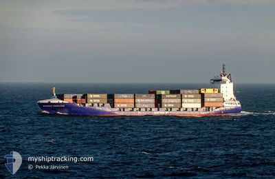
SAMSKIP ENDEAVOUR
Container Ship
Current Trip
| Time Travelled | 13 h, 27 mins |
|---|---|
| Remaining Time | 22 h, 16 mins |
| Distance Travelled | 214.06 nm |
| Remaining Distance | 363.32 nm |
| AVG Speed | 13.1 Knopen |
| MAX Speed | 17 Knopen |
| AVG Wind | 11.7 knots |
| MAX Wind | 19.9 knots |
| MIN Temp | 6.9°C / 44.42°F |
| MAX Temp | 11.2°C / 52.16°F |
| Diepgang | 7.7 M |
| Positie ontvangen | 1 m geleden |
Current Position
| Lengtegraad | -4.31276° |
|---|---|
| Breedtegraat | 50.03791° |
| Status | Under way using engine |
| Snelheid | 16 Knopen |
| Koers | 76.5° |
| Gebied | English Channel |
| Station | T-AIS |
| Positie ontvangen | 1 m geleden |
Info
Information
The current position of SAMSKIP ENDEAVOUR is in English Channel with coordinates 50.03791° / -4.31276° as reported on 2024-04-18 03:28 by AIS to our vessel tracker app. The vessel's current speed is 16 Knopen and is heading at the port of ROTTERDAM. The estimated time of arrival as calculated by MyShipTracking vessel tracking app is 2024-04-19 01:45 LT
The vessel SAMSKIP ENDEAVOUR (IMO: 9436290, MMSI: 209380000) is a Container Ship that was built in 2011 ( 13 Jaar oud ). It's sailing under the flag of [CY] Cyprus.
In this page you can find informations about the vessels current position, last detected port calls, and current voyage information. If the vessels is not in coverage by AIS you will find the latest position.
The current position of SAMSKIP ENDEAVOUR is detected by our AIS receivers and we are not responsible for the reliability of the data. The last position was recorded while the vessel was in Coverage by the Ais receivers of our vessel tracking app.
The current draught of SAMSKIP ENDEAVOUR as reported by AIS is 7.7 meters
Weather
| Temperature | 8.8°C / 47.84°F |
|---|---|
| Wind Speed | 15 knots |
| Direction | 39° NE |
| Pressure | 1022.3 hPa |
| Humidity | 73.1 % |
| Cloud Coverage | 23 % |
Featured Company
Last Port Calls
| Port | Arrival | Departure | Time In Port |
|---|---|---|---|
| 2024-04-17 07:27 | 2024-04-17 14:02 | 6 h | |
| 2024-04-17 01:44 | 2024-04-17 07:20 | 5 h | |
| 2024-04-14 17:52 | 2024-04-16 17:48 | 1 d | |
| 2024-04-11 19:25 | 2024-04-13 00:30 | 1 d | |
| 2024-04-09 18:00 | 2024-04-10 05:09 | 11 h | |
| 2024-04-08 08:18 | 2024-04-09 08:37 | 1 d | |
| 2024-04-05 03:30 | 2024-04-06 11:14 | 1 d | |
| 2024-04-02 22:10 | 2024-04-03 11:04 | 12 h | |
| 2024-03-31 22:02 | 2024-04-02 08:01 | 1 d | |
| 2024-03-28 10:34 | 2024-03-29 23:26 | 1 d |
Most Visited Ports (Last year)
| Port | Arrivals | |
|---|---|---|
| 53 | ||
| 48 | ||
| 31 | ||
| 18 | ||
| 4 | ||
| 2 |
Last Trips
| Origin | Departure | Destination | Arrival | Distance | |
|---|---|---|---|---|---|
| 2024-04-17 08:20 | 2024-04-17 08:27 | 0.11 nm | |||
| 2024-04-16 18:48 | 2024-04-17 02:44 | 121.96 nm | |||
| 2024-04-13 02:30 | 2024-04-14 18:52 | 638.83 nm | |||
| 2024-04-10 06:09 | 2024-04-11 21:25 | 592.65 nm | |||
| 2024-04-09 09:37 | 2024-04-09 19:00 | 125.77 nm | |||
| 2024-04-06 13:14 | 2024-04-08 09:18 | 637.97 nm | |||
| 2024-04-03 12:04 | 2024-04-05 05:30 | 593.58 nm | |||
| 2024-04-02 09:01 | 2024-04-02 23:10 | 122.08 nm | |||
| 2024-03-30 00:26 | 2024-03-31 23:02 | 638.32 nm | |||
| 2024-03-26 19:48 | 2024-03-28 11:34 | 593.18 nm |
Events
| Tijd | Evenement | Details | Positie / Bestemming | Info |
|---|---|---|---|---|
| 2024-04-18 00:26 | Wijzig zee gebeid | United Kingdom part of the English Channel United Kingdom part of the Celtic Sea |
49.91692 / -5.57035
English Channel
ROTTERDAM
|
Snelheid: 16.4 kn Koers: 92.2° |
| 2024-04-18 00:14 | Status Changed | Under way using engine Default |
49.92045 / -5.65096
ROTTERDAM
|
Snelheid: 16.5 kn Koers: 94° |
| 2024-04-17 23:39 | Status Changed | Default Under way using engine |
49.92730 / -5.90469
ROTTERDAM
|
Snelheid: 16.4 kn Koers: 116.1° |
| 2024-04-17 23:18 | Status Changed | Under way using engine Default |
49.97994 / -5.99836
ROTTERDAM
|
Snelheid: 16.3 kn Koers: 174° |
| 2024-04-17 22:51 | Status Changed | Default Under way using engine |
50.10236 / -6.01309
ROTTERDAM
|
Snelheid: 16.2 kn Koers: 174.9° |
| 2024-04-17 21:32 | Status Changed | Under way using engine Default |
50.45997 / -6.10090
ROTTERDAM
|
Snelheid: 16.6 kn Koers: 163° |
| 2024-04-17 21:15 | Status Changed | Default Under way using engine |
50.53357 / -6.13712
ROTTERDAM
|
Snelheid: 16.7 kn Koers: 162.9° |
| 2024-04-17 21:05 | Wijzig zee gebeid | United Kingdom part of the Celtic Sea Irish part of the Celtic Sea |
50.57983 / -6.15982
Celtic Sea
ROTTERDAM
|
Snelheid: 16.8 kn Koers: 162.7° |
| 2024-04-17 21:05 | Status Changed | Under way using engine Default |
50.57983 / -6.15982
ROTTERDAM
|
Snelheid: 16.7 kn Koers: 163° |
| 2024-04-17 21:05 | Binnenbereik |
50.57983 / -6.15982
Celtic Sea
ROTTERDAM
|
Snelheid: 16.8 kn Koers: 162.7° |