
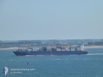
ROBIN 2
Container Ship
Current Trip
| Time Travelled | 1 day |
|---|---|
| Remaining Time | 2 days |
| Distance Travelled | 619.18 nm |
| Remaining Distance | 1084.57 nm |
| AVG Speed | 16.2 Knopen |
| MAX Speed | 17.5 Knopen |
| AVG Wind | 10.2 knots |
| MAX Wind | 19.2 knots |
| MIN Temp | 22.8°C / 73.04°F |
| MAX Temp | 27.7°C / 81.86°F |
| Diepgang | 8.6 M |
| Positie ontvangen | 8 h, 5 m geleden |
Current Position
| Lengtegraad | -83.59419° |
|---|---|
| Breedtegraat | 23.04332° |
| Status | Under way using engine |
| Snelheid | 16 Knopen |
| Koers | 69° |
| Gebied | Gulf of Mexico |
| Station | T-AIS |
| Positie ontvangen | 8 h, 5 m geleden |
Info
Information
The current position of ROBIN 2 is in Gulf of Mexico with coordinates 23.04332° / -83.59419° as reported on 2024-04-24 20:29 by AIS to our vessel tracker app. The vessel's current speed is 16 Knopen and is heading at the port of SANTA MARTA. The estimated time of arrival as calculated by MyShipTracking vessel tracking app is 2024-04-27 18:13 LT
The vessel ROBIN 2 (IMO: 9399739, MMSI: 636020353) is a Container Ship that was built in 2007 ( 17 Jaar oud ). It's sailing under the flag of [LR] Liberia.
In this page you can find informations about the vessels current position, last detected port calls, and current voyage information. If the vessels is not in coverage by AIS you will find the latest position.
The current position of ROBIN 2 is detected by our AIS receivers and we are not responsible for the reliability of the data. The last position was recorded while the vessel was in Coverage by the Ais receivers of our vessel tracking app.
The current draught of ROBIN 2 as reported by AIS is 8.6 meters
Weather
| Temperature | 24.8°C / 76.64°F |
|---|---|
| Wind Speed | 13 knots |
| Direction | 77° ENE |
| Pressure | 1019.4 hPa |
| Humidity | 68.8 % |
| Cloud Coverage | 1 % |
Featured Company
Last Port Calls
| Port | Arrival | Departure | Time In Port |
|---|---|---|---|
| 2024-04-23 07:18 | 2024-04-23 10:14 | 2 h | |
| 2024-04-20 00:42 | 2024-04-20 12:34 | 11 h | |
| 2024-04-14 04:34 | 2024-04-15 00:18 | 19 h | |
| 2024-04-09 08:49 | 2024-04-09 14:27 | 5 h | |
| 2024-04-06 00:04 | 2024-04-06 11:24 | 11 h | |
| 2024-03-31 04:30 | 2024-03-31 21:09 | 16 h | |
| 2024-03-26 13:10 | 2024-03-27 00:47 | 11 h | |
| 2024-03-25 16:32 | 2024-03-26 00:19 | 7 h | |
| 2024-03-23 03:55 | 2024-03-23 16:49 | 12 h | |
| 2024-03-18 03:17 |
Most Visited Ports (Last year)
| Port | Arrivals | |
|---|---|---|
| 9 | ||
| 9 | ||
| 8 | ||
| 4 | ||
| 3 | ||
| 3 |
Last Trips
| Origin | Departure | Destination | Arrival | Distance | |
|---|---|---|---|---|---|
| 2024-04-20 07:34 | 2024-04-23 01:18 | 929.55 nm | |||
| 2024-04-14 20:18 | 2024-04-19 19:42 | 1730.25 nm | |||
| 2024-04-09 08:27 | 2024-04-14 00:34 | 1760.37 nm | |||
| 2024-04-06 06:24 | 2024-04-09 02:49 | 928.05 nm | |||
| 2024-03-31 17:09 | 2024-04-05 19:04 | 1732.48 nm | |||
| 2024-03-26 18:47 | 2024-03-31 00:30 | 1751.59 nm | |||
| 2024-03-25 18:19 | 2024-03-26 07:10 | 150.02 nm | |||
| 2024-03-23 11:49 | 2024-03-25 10:32 | 756.96 nm | |||
| 2024-03-17 23:17 | 2024-03-22 22:55 | 1720.49 nm | |||
| 2024-03-09 11:42 | 2024-03-12 12:38 | 932.95 nm |
Events
| Tijd | Evenement | Details | Positie / Bestemming | Info |
|---|---|---|---|---|
| 2024-04-24 20:32 | Status Changed | Default Under way using engine |
23.04802 / -83.58115
COSMR
|
Snelheid: 16 kn Koers: 69° |
| 2024-04-24 20:29 | Buitenbereik |
23.04332 / -83.59419
Gulf of Mexico
|
Snelheid: 16 kn Koers: 69° |
|
| 2024-04-24 15:46 | Gevonden in zee | Cuban part of the Gulf of Mexico |
22.48753 / -84.83335
Gulf of Mexico
|
Snelheid: 16 kn Koers: 41° |
| 2024-04-24 15:46 | Binnenbereik |
22.48753 / -84.83335
Gulf of Mexico
|
Snelheid: 16 kn Koers: 41° |
|
| 2024-04-23 10:22 | Start beweging | 0.38 nm, North West of PUERTO BARRIOS |
15.74077 / -88.61274
COSMR
|
Snelheid: 4.7 kn Koers: 7° |
| 2024-04-23 10:14 | Vertrekhaven |
|
15.73740 / -88.61339
COSMR
|
Snelheid: 2.4 kn Koers: 108° |
| 2024-04-23 07:25 | Stop beweging |
15.73518 / -88.60807
[GT] PUERTO BARRIOS
|
Snelheid: 0.3 kn Koers: 98° |
|
| 2024-04-23 07:18 | Aankomsthaven |
|
15.73569 / -88.60829
[GT] PUERTO BARRIOS
|
Snelheid: 1.3 kn Koers: 106° |
| 2024-04-20 17:30 | Buitenbereik |
11.90980 / -75.37054
Caribbean Sea
|
Snelheid: 16.1 kn Koers: 301° |
|
| 2024-04-20 17:20 | Binnenbereik |
11.88657 / -75.33088
Caribbean Sea
|
Snelheid: 16 kn Koers: 300.6° |