
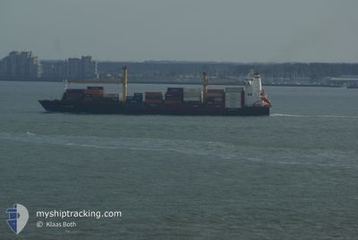
HANSA HORNEBURG
Container Ship
Current Trip
PAMIT>>PAPCN
| Time Travelled | 1 day |
|---|---|
| Remaining Time | --- |
| Distance Travelled | 469.60 nm |
| Remaining Distance | --- |
| AVG Speed | 19.5 Knopen |
| MAX Speed | 21 Knopen |
| AVG Wind | 10.2 knots |
| MAX Wind | 14 knots |
| MIN Temp | 19°C / 66.2°F |
| MAX Temp | 21.8°C / 71.24°F |
| Diepgang | 8.2 M |
| Positie ontvangen | 6 d geleden |
Current Position
| Lengtegraad | -79.45830° |
|---|---|
| Breedtegraat | 8.44327° |
| Status | Under way using engine |
| Snelheid | 20.2 Knopen |
| Koers | 178.3° |
| Gebied | North Pacific Ocean |
| Station | T-AIS |
| Positie ontvangen | 6 d geleden |
Info
Information
The current position of HANSA HORNEBURG is in North Pacific Ocean with coordinates 8.44327° / -79.45830° as reported on 2024-04-18 08:41 by AIS to our vessel tracker app. The vessel's current speed is 20.2 Knopen
The vessel HANSA HORNEBURG (IMO: 9373486, MMSI: 636091400) is a Container Ship that was built in 2007 ( 17 Jaar oud ). It's sailing under the flag of [LR] Liberia.
In this page you can find informations about the vessels current position, last detected port calls, and current voyage information. If the vessels is not in coverage by AIS you will find the latest position.
The current position of HANSA HORNEBURG is detected by our AIS receivers and we are not responsible for the reliability of the data. The last position was recorded while the vessel was in Coverage by the Ais receivers of our vessel tracking app.
The current draught of HANSA HORNEBURG as reported by AIS is 8.2 meters
Weather
| Temperature | 20.1°C / 68.18°F |
|---|---|
| Wind Speed | 10 knots |
| Direction | 151° SSE |
| Pressure | 1011.8 hPa |
| Humidity | 93.4 % |
| Cloud Coverage | 100 % |
Featured Company
Last Port Calls
| Port | Arrival | Departure | Time In Port |
|---|---|---|---|
| 2024-04-23 12:25 | 2024-04-24 07:05 | 18 h | |
| 2024-04-17 10:30 | 2024-04-17 20:40 | 10 h | |
| 2024-04-11 15:03 | 2024-04-12 21:43 | 1 d | |
| 2024-04-08 09:57 | 2024-04-08 22:37 | 12 h | |
| 2024-04-02 12:18 | 2024-04-03 02:50 | 14 h | |
| 2024-03-26 21:54 | 2024-03-27 12:19 | 14 h | |
| 2024-03-25 03:16 | 2024-03-25 17:34 | 14 h | |
| 2024-03-21 14:59 | 2024-03-22 17:51 | 1 d | |
| 2024-03-18 13:29 | 2024-03-18 23:01 | 9 h | |
| 2024-03-12 13:40 | 2024-03-13 08:07 | 18 h |
Most Visited Ports (Last year)
| Port | Arrivals | |
|---|---|---|
| 34 | ||
| 18 | ||
| 17 | ||
| 2 | ||
| 2 | ||
| 1 |
Last Trips
| Origin | Departure | Destination | Arrival | Distance | |
|---|---|---|---|---|---|
| 2024-04-17 15:40 | 2024-04-23 07:25 | 1814.88 nm | |||
| 2024-04-12 17:43 | 2024-04-17 05:30 | 1423.04 nm | |||
| 2024-04-08 17:37 | 2024-04-11 11:03 | 1219.18 nm | |||
| 2024-04-02 21:50 | 2024-04-08 04:57 | 1568.19 nm | |||
| 2024-03-27 07:19 | 2024-04-02 07:18 | 1825.88 nm | |||
| 2024-03-25 12:34 | 2024-03-26 16:54 | 511.92 nm | |||
| 2024-03-22 13:51 | 2024-03-24 22:16 | 1033.79 nm | |||
| 2024-03-18 18:01 | 2024-03-21 10:59 | 1217.53 nm | |||
| 2024-03-13 03:07 | 2024-03-18 08:29 | 1487.49 nm | |||
| 2024-03-06 10:38 | 2024-03-12 08:40 | 1564.78 nm |
Events
| Tijd | Evenement | Details | Positie / Bestemming | Info |
|---|---|---|---|---|
| 2024-04-24 07:05 | Start beweging | 0.91 nm, North West of CALLAO |
-12.04588 / -77.16701
PAMIT>>PAPCN
|
Snelheid: 6.5 kn Koers: 278° |
| 2024-04-24 07:05 | Vertrekhaven |
|
-12.04588 / -77.16701
PAMIT>>PAPCN
|
Snelheid: 1.7 kn Koers: 270° |
| 2024-04-23 12:37 | Stop beweging |
-12.05195 / -77.15114
[PE] CALLAO
|
Snelheid: 0.1 kn Koers: 131° |
|
| 2024-04-23 12:25 | Aankomsthaven |
|
-12.04843 / -77.15456
[PE] CALLAO
|
Snelheid: 6 kn Koers: 96° |
| 2024-04-23 12:01 | Start beweging | 2.12 nm, North West of CALLAO |
-12.03631 / -77.18536
PAMIT>>PAPCN
|
Snelheid: 6.6 kn Koers: 192° |
| 2024-04-23 10:17 | Stop beweging | 2.12 nm, North West of CALLAO |
-12.03167 / -77.18166
PAMIT>>PAPCN
|
Snelheid: Koers: -1° |
| 2024-04-22 21:41 | Start beweging |
-13.79500 / -76.28333
PAMIT>>PAPCN
|
Snelheid: 7 kn Koers: 22° |
|
| 2024-04-22 13:58 | Stop beweging |
-13.80204 / -76.29022
PAMIT>>PAPCN
|
Snelheid: Koers: 194° |
|
| 2024-04-20 03:13 | Stop beweging | 6.13 nm, South of GUAYAQUIL |
-2.28408 / -79.90055
PAMIT>>PAPCN
|
Snelheid: 0.2 kn Koers: 277° |
| 2024-04-18 08:41 | Buitenbereik |
8.44327 / -79.45830
North Pacific Ocean
|
Snelheid: 20.2 kn Koers: 178.3° |