
ASL YANGPU
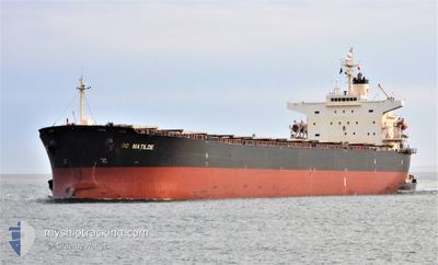
Bulk Carrier
Current Trip
| Trip Time | 51 days |
|---|---|
| Trip Distance | 8490.35 nm |
| AVG Speed | 11.3 Knopen |
| MAX Speed | 15.4 Knopen |
| Diepgang | 7.2 M |
| AVG Wind | 7.7 knots |
| MAX Wind | 23 knots |
| MIN Temp | 0.8°C / 33.44°F |
| MAX Temp | 30.6°C / 87.08°F |
| Positie ontvangen | 7 d geleden |
Current Position
| Lengtegraad | 106.92668° |
|---|---|
| Breedtegraat | 2.85717° |
| Status | Under way using engine |
| Snelheid | 11.2 Knopen |
| Koers | 12° |
| Gebied | South China Sea |
| Station | T-AIS |
| Positie ontvangen | 7 d geleden |
Info
Information
The current position of ASL YANGPU is in South China Sea with coordinates 2.85717° / 106.92668° as reported on 2024-04-15 16:21 by AIS to our vessel tracker app. The vessel's current speed is 11.2 Knopen and is currently inside the port of QINZHOU.
The vessel ASL YANGPU (IMO: 9244831, MMSI: 538006685) is a Bulk Carrier that was built in 2002 ( 22 Jaar oud ). It's sailing under the flag of [MH] Marshall Is.
In this page you can find informations about the vessels current position, last detected port calls, and current voyage information. If the vessels is not in coverage by AIS you will find the latest position.
The current position of ASL YANGPU is detected by our AIS receivers and we are not responsible for the reliability of the data. The last position was recorded while the vessel was in Coverage by the Ais receivers of our vessel tracking app.
The current draught of ASL YANGPU as reported by AIS is 7.2 meters
Weather
| Temperature | 27.6°C / 81.68°F |
|---|---|
| Wind Speed | 10 knots |
| Direction | 346° NNW |
| Pressure | 1005.3 hPa |
| Humidity | 74.2 % |
| Cloud Coverage | 86 % |
Featured Company
Last Port Calls
| Port | Arrival | Departure | Time In Port |
|---|---|---|---|
| 2024-04-21 23:16 | |||
| 2024-02-27 04:51 | 2024-03-01 09:22 | 3 d | |
| 2024-02-24 03:07 | 2024-02-26 12:35 | 2 d |
Most Visited Ports (Last year)
| Port | Arrivals | |
|---|---|---|
| 2 | ||
| 2 | ||
| 1 | ||
| 1 | ||
| 1 | ||
| 1 |
Last Trips
| Origin | Departure | Destination | Arrival | Distance | |
|---|---|---|---|---|---|
| 2024-03-01 17:22 | 2024-04-22 07:16 | 8490.35 nm | |||
| 2024-02-26 20:35 | 2024-02-27 12:51 | 145.33 nm | |||
| 2023-12-28 12:57 | 2024-02-24 11:07 | 12469.96 nm |
Events
| Tijd | Evenement | Details | Positie / Bestemming | Info |
|---|---|---|---|---|
| 2024-04-21 23:28 | Stop beweging |
21.72003 / 108.58417
[CN] QINZHOU
|
Snelheid: Koers: 327° |
|
| 2024-04-21 23:16 | Aankomsthaven |
|
21.71892 / 108.58318
[CN] QINZHOU
|
Snelheid: 1.1 kn Koers: 346° |
| 2024-04-21 19:20 | Start beweging | 17.64 nm, South of QINZHOU |
21.35587 / 108.67315
GUISHAN
|
Snelheid: 4.1 kn Koers: 309° |
| 2024-04-20 00:21 | Stop beweging | 17.43 nm, South of QINZHOU |
21.36038 / 108.68318
GUISHAN
|
Snelheid: Koers: 36° |
| 2024-04-15 16:30 | Status Changed | Default Under way using engine |
2.88880 / 106.93356
GUISHAN
|
Snelheid: 11.2 kn Koers: 12° |
| 2024-04-15 16:21 | Status Changed | Under way using engine Default |
2.85717 / 106.92668
GUISHAN
|
Snelheid: 11 kn Koers: 11° |
| 2024-04-15 16:21 | Binnenbereik |
2.85717 / 106.92668
South China Sea
|
Snelheid: 11.2 kn Koers: 12° |
|
| 2024-04-15 16:21 | Buitenbereik |
2.85717 / 106.92668
South China Sea
|
Snelheid: 11.2 kn Koers: 12° |
|
| 2024-04-15 14:12 | Status Changed | Default Under way using engine |
2.47467 / 106.84489
GUISHAN
|
Snelheid: 10.7 kn Koers: 13° |
| 2024-04-15 13:56 | Buitenbereik |
2.42920 / 106.83303
South China Sea
|
Snelheid: 10.7 kn Koers: 13° |