
PUNTA
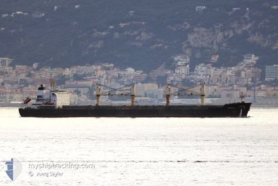
Bulk Carrier
Current Trip
| Time Travelled | 1 day |
|---|---|
| Remaining Time | 1 day |
| Distance Travelled | 221.83 nm |
| Remaining Distance | 520.52 nm |
| AVG Speed | 11.3 Knopen |
| MAX Speed | 13.7 Knopen |
| AVG Wind | 7.8 knots |
| MAX Wind | 12.6 knots |
| MIN Temp | 21.4°C / 70.52°F |
| MAX Temp | 24.6°C / 76.28°F |
| Diepgang | 11.9 M |
| Positie ontvangen | 20 h, 56 m geleden |
Current Position
| Lengtegraad | -89.41367° |
|---|---|
| Breedtegraat | 28.89233° |
| Status | Under way using engine |
| Snelheid | 7.7 Knopen |
| Koers | 118° |
| Gebied | Gulf of Mexico |
| Station | T-AIS |
| Positie ontvangen | 20 h, 56 m geleden |
Info
Information
The current position of PUNTA is in Gulf of Mexico with coordinates 28.89233° / -89.41367° as reported on 2024-04-18 06:39 by AIS to our vessel tracker app. The vessel's current speed is 7.7 Knopen and is heading at the port of VERACRUZ. The estimated time of arrival as calculated by MyShipTracking vessel tracking app is 2024-04-20 21:23 LT
The vessel PUNTA (IMO: 9606118, MMSI: 538010370) is a Bulk Carrier that was built in 2013 ( 11 Jaar oud ). It's sailing under the flag of [MH] Marshall Is.
In this page you can find informations about the vessels current position, last detected port calls, and current voyage information. If the vessels is not in coverage by AIS you will find the latest position.
The current position of PUNTA is detected by our AIS receivers and we are not responsible for the reliability of the data. The last position was recorded while the vessel was in Coverage by the Ais receivers of our vessel tracking app.
The current draught of PUNTA as reported by AIS is 11.9 meters
Weather
| Temperature | 24°C / 75.2°F |
|---|---|
| Wind Speed | 13 knots |
| Direction | 108° ESE |
| Pressure | 1016.3 hPa |
| Humidity | 90.3 % |
| Cloud Coverage | 84 % |
Featured Company
Last Port Calls
| Port | Arrival | Departure | Time In Port |
|---|---|---|---|
| 2024-04-14 05:41 | 2024-04-18 00:15 | 3 d | |
| 2024-03-30 23:37 | 2024-04-10 02:26 | 10 d | |
| 2024-03-12 16:47 | 2024-03-13 01:34 | 8 h | |
| 2024-03-05 06:33 | 2024-03-09 13:56 | 4 d | |
| 2024-02-08 17:56 |
Most Visited Ports (Last year)
| Port | Arrivals | |
|---|---|---|
| 3 | ||
| 2 | ||
| 1 | ||
| 1 | ||
| 1 | ||
| 1 |
Last Trips
| Origin | Departure | Destination | Arrival | Distance | |
|---|---|---|---|---|---|
| 2024-04-09 21:26 | 2024-04-14 00:41 | 780.84 nm | |||
| 2024-03-13 02:34 | 2024-03-30 18:37 | 4949.04 nm | |||
| 2024-03-09 14:56 | 2024-03-12 17:47 | 732.24 nm | |||
| 2024-02-08 20:56 | 2024-03-05 07:33 | 1767.08 nm |
Events
| Tijd | Evenement | Details | Positie / Bestemming | Info |
|---|---|---|---|---|
| 2024-04-18 06:53 | Status Changed | Default Under way using engine |
28.86033 / -89.41783
MXVER
|
Snelheid: 7.7 kn Koers: 118° |
| 2024-04-18 06:39 | Buitenbereik |
28.89233 / -89.41367
Gulf of Mexico
MXVER
|
Snelheid: 7.7 kn Koers: 118° |
|
| 2024-04-18 06:33 | Status Changed | Under way using engine Default |
28.89300 / -89.42833
MXVER
|
Snelheid: 11.3 kn Koers: 214° |
| 2024-04-18 06:33 | Binnenbereik |
28.89105 / -89.42406
Gulf of Mexico
MXVER
|
Snelheid: 7.3 kn Koers: 88.4° |
|
| 2024-04-18 02:34 | Status Changed | Default Under way using engine |
29.45247 / -89.60605
MXVER
|
Snelheid: 12.7 kn Koers: 92° |
| 2024-04-18 02:28 | Buitenbereik |
29.45729 / -89.62990
Gulf of Mexico
MXVER
|
Snelheid: 12.7 kn Koers: 92° |
|
| 2024-04-18 02:28 | Status Changed | Under way using engine Default |
29.45731 / -89.63064
MXVER
|
Snelheid: 12.4 kn Koers: 93° |
| 2024-04-18 02:15 | Binnenbereik |
29.45729 / -89.62990
Gulf of Mexico
MXVER
|
Snelheid: 12.7 kn Koers: 92° |
|
| 2024-04-18 00:15 | Status Changed | Default Under way using engine |
29.74064 / -90.00668
MXVER
|
Snelheid: 13.5 kn Koers: 167° |
| 2024-04-18 00:08 | Buitenbereik |
29.75850 / -90.02517
Gulf of Mexico
MXVER
|
Snelheid: 13.5 kn Koers: 178.9° |