
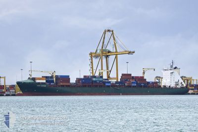
PORT GDYNIA
Container Ship
Current Trip
| Time Travelled | 17 h, 47 mins |
|---|---|
| Remaining Time | 10 h, 52 mins |
| Distance Travelled | 215.37 nm |
| Remaining Distance | 189.32 nm |
| AVG Speed | 12.1 Knopen |
| MAX Speed | 17 Knopen |
| AVG Wind | 13.7 knots |
| MAX Wind | 24.5 knots |
| MIN Temp | 13.8°C / 56.84°F |
| MAX Temp | 17.2°C / 62.96°F |
| Diepgang | 11.2 M |
| Positie ontvangen | 9 m geleden |
Current Position
| Lengtegraad | -1.79633° |
|---|---|
| Breedtegraat | 36.70885° |
| Status | Under way using engine |
| Snelheid | 12.3 Knopen |
| Koers | 227.3° |
| Gebied | Mediterranean Sea - Western Basin |
| Station | T-AIS |
| Positie ontvangen | 9 m geleden |
Info
Information
The current position of PORT GDYNIA is in Mediterranean Sea - Western Basin with coordinates 36.70885° / -1.79633° as reported on 2024-04-25 07:46 by AIS to our vessel tracker app. The vessel's current speed is 12.3 Knopen and is heading at the port of ALGECIRAS. The estimated time of arrival as calculated by MyShipTracking vessel tracking app is 2024-04-25 18:47 LT
The vessel PORT GDYNIA (IMO: 9334387, MMSI: 215761000) is a Container Ship that was built in 2011 ( 13 Jaar oud ). It's sailing under the flag of [MT] Malta.
In this page you can find informations about the vessels current position, last detected port calls, and current voyage information. If the vessels is not in coverage by AIS you will find the latest position.
The current position of PORT GDYNIA is detected by our AIS receivers and we are not responsible for the reliability of the data. The last position was recorded while the vessel was in Coverage by the Ais receivers of our vessel tracking app.
The current draught of PORT GDYNIA as reported by AIS is 11.2 meters
Weather
| Temperature | 17°C / 62.6°F |
|---|---|
| Wind Speed | 5 knots |
| Direction | 227° SW |
| Pressure | 1010.1 hPa |
| Humidity | 65.5 % |
| Cloud Coverage | 100 % |
Featured Company
Last Port Calls
| Port | Arrival | Departure | Time In Port |
|---|---|---|---|
| 2024-04-23 10:29 | 2024-04-24 14:08 | 1 d | |
| 2024-04-14 07:00 | 2024-04-14 20:08 | 13 h | |
| 2024-04-12 14:21 | 2024-04-13 09:34 | 19 h | |
| 2024-04-02 19:37 | 2024-04-03 21:21 | 1 d | |
| 2024-04-01 07:12 | 2024-04-02 11:04 | 1 d | |
| 2024-03-28 20:38 | 2024-03-30 04:25 | 1 d | |
| 2024-03-20 12:02 | 2024-03-22 00:04 | 1 d | |
| 2024-03-15 21:49 | 2024-03-16 21:56 | 1 d | |
| 2024-03-11 06:34 | 2024-03-12 03:39 | 21 h | |
| 2024-02-24 06:19 | 2024-02-26 12:51 | 2 d |
Last Trips
| Origin | Departure | Destination | Arrival | Distance | |
|---|---|---|---|---|---|
| 2024-04-14 20:08 | 2024-04-23 12:29 | 3220.53 nm | |||
| 2024-04-13 10:34 | 2024-04-14 07:00 | 284.35 nm | |||
| 2024-04-03 22:21 | 2024-04-12 15:21 | 1104.50 nm | |||
| 2024-04-02 12:04 | 2024-04-02 20:37 | 136.93 nm | |||
| 2024-03-30 04:25 | 2024-04-01 08:12 | 754.10 nm | |||
| 2024-03-22 00:04 | 2024-03-28 20:38 | 3017.91 nm | |||
| 2024-03-16 22:56 | 2024-03-20 12:02 | 252.98 nm | |||
| 2024-03-12 04:39 | 2024-03-15 22:49 | 568.09 nm | |||
| 2024-02-26 13:51 | 2024-03-11 07:34 | 4084.24 nm | |||
| 2024-02-23 17:41 | 2024-02-24 07:19 | 139.62 nm |
Events
| Tijd | Evenement | Details | Positie / Bestemming | Info |
|---|---|---|---|---|
| 2024-04-25 07:46 | Status Changed | Under way using engine Default |
36.70885 / -1.79633
ESALG
|
Snelheid: 12 kn Koers: 228° |
| 2024-04-25 07:35 | Status Changed | Default Under way using engine |
36.72333 / -1.77333
ESALG
|
Snelheid: 12.2 kn Koers: 228.7° |
| 2024-04-25 07:02 | Status Changed | Under way using engine Default |
36.80719 / -1.65773
ESALG
|
Snelheid: 14 kn Koers: 228° |
| 2024-04-25 06:47 | Status Changed | Default Under way using engine |
36.84073 / -1.61125
ESALG
|
Snelheid: 16.6 kn Koers: 228.5° |
| 2024-04-25 06:40 | Status Changed | Under way using engine Default |
36.86563 / -1.57620
ESALG
|
Snelheid: 16 kn Koers: 228° |
| 2024-04-25 06:05 | Status Changed | Default Under way using engine |
36.97333 / -1.42667
ESALG
|
Snelheid: 12.5 kn Koers: 227.4° |
| 2024-04-25 05:52 | Status Changed | Under way using engine Default |
37.01792 / -1.36761
ESALG
|
Snelheid: 12.5 kn Koers: 227° |
| 2024-04-25 05:47 | Status Changed | Default Under way using engine |
37.02377 / -1.35966
ESALG
|
Snelheid: 12.5 kn Koers: 227.5° |
| 2024-04-25 05:29 | Status Changed | Under way using engine Default |
37.06598 / -1.30283
ESALG
|
Snelheid: 12 kn Koers: 227° |
| 2024-04-25 05:13 | Status Changed | Default Under way using engine |
37.10079 / -1.25477
ESALG
|
Snelheid: 12.2 kn Koers: 231.1° |