
ALBERTE HOJ
Grab Dredger
Current Trip
HAVERSLEV
| Time Travelled | 17 days |
|---|---|
| Remaining Time | --- |
| Distance Travelled | 821.48 nm |
| Remaining Distance | --- |
| AVG Speed | 5.1 Knopen |
| MAX Speed | 8.3 Knopen |
| AVG Wind | 11.3 knots |
| MAX Wind | 25.5 knots |
| MIN Temp | 0.9°C / 33.62°F |
| MAX Temp | 14.5°C / 58.1°F |
| Diepgang | 2 M |
| Positie ontvangen | 3 m geleden |
Current Position
| Lengtegraad | 9.40319° |
|---|---|
| Breedtegraat | 57.02747° |
| Status | At anchor |
| Snelheid | |
| Koers | 306° |
| Gebied | Kattegat |
| Station | T-AIS |
| Positie ontvangen | 3 m geleden |
Info
Information
The current position of ALBERTE HOJ is in Kattegat with coordinates 57.02747° / 9.40319° as reported on 2024-04-19 19:23 by AIS to our vessel tracker app. The vessel's current speed is 0 Knopen
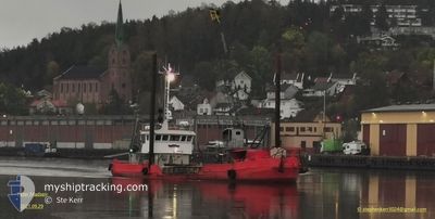
The vessel ALBERTE HOJ (IMO: 6825581, MMSI: 219001262) is a Grab Dredger that was built in 1968 ( 56 Jaar oud ). It's sailing under the flag of [DK] Denmark.
In this page you can find informations about the vessels current position, last detected port calls, and current voyage information. If the vessels is not in coverage by AIS you will find the latest position.
The current position of ALBERTE HOJ is detected by our AIS receivers and we are not responsible for the reliability of the data. The last position was recorded while the vessel was in Coverage by the Ais receivers of our vessel tracking app.
The current draught of ALBERTE HOJ as reported by AIS is 2 meters
Weather
| Temperature | 3.1°C / 37.58°F |
|---|---|
| Wind Speed | 9 knots |
| Direction | 30° NNE |
| Pressure | 1009.7 hPa |
| Humidity | 72.9 % |
| Cloud Coverage | 23 % |
Featured Company
Last Port Calls
| Port | Arrival | Departure | Time In Port |
|---|---|---|---|
| 2024-04-01 20:22 | 2024-04-02 06:49 | 10 h | |
| 2024-03-26 07:40 | 2024-03-26 09:35 | 1 h | |
| 2024-03-26 05:49 | 2024-03-26 06:53 | 1 h | |
| 2024-03-25 15:41 | 2024-03-26 05:03 | 13 h | |
| 2024-03-25 12:00 | 2024-03-25 12:53 | 53 m | |
| 2024-03-25 09:48 | 2024-03-25 10:39 | 50 m | |
| 2024-03-25 07:11 | 2024-03-25 08:43 | 1 h | |
| 2024-03-24 17:38 | 2024-03-25 06:22 | 12 h | |
| 2024-03-24 11:22 | 2024-03-24 12:22 | 59 m | |
| 2024-03-23 17:10 | 2024-03-24 06:49 | 13 h |
Last Trips
| Origin | Departure | Destination | Arrival | Distance | |
|---|---|---|---|---|---|
| 2024-03-26 10:35 | 2024-04-01 22:22 | 145.55 nm | |||
| 2024-03-26 07:53 | 2024-03-26 08:40 | 1.50 nm | |||
| 2024-03-26 06:03 | 2024-03-26 06:49 | 1.38 nm | |||
| 2024-03-25 13:53 | 2024-03-25 16:41 | 3.13 nm | |||
| 2024-03-25 11:39 | 2024-03-25 13:00 | 1.57 nm | |||
| 2024-03-25 09:43 | 2024-03-25 10:48 | 1.33 nm | |||
| 2024-03-25 07:22 | 2024-03-25 08:11 | 1.50 nm | |||
| 2024-03-24 13:22 | 2024-03-24 18:38 | 4.47 nm | |||
| 2024-03-24 07:49 | 2024-03-24 12:22 | 3.21 nm | |||
| 2024-03-23 07:38 | 2024-03-23 18:10 | 5.93 nm |
Events
| Tijd | Evenement | Details | Positie / Bestemming | Info |
|---|---|---|---|---|
| 2024-04-19 18:32 | Status Changed | At anchor Under way using engine |
57.02749 / 9.40319
HAVERSLEV
|
Snelheid: Koers: 306° |
| 2024-04-19 17:31 | Stop beweging | 18.36 nm, West of AALBORG |
57.02748 / 9.40320
HAVERSLEV
|
Snelheid: 0.2 kn Koers: 321° |
| 2024-04-19 16:40 | Wijzig zee gebeid | Danish part of the Kattegat Danish part of the North Sea |
57.01573 / 9.38798
Kattegat
HAVERSLEV
|
Snelheid: 6 kn Koers: 87.8° |
| 2024-04-19 15:13 | Destination Changed | HAVERSLEV LOEGSTOR |
56.96146 / 9.17840
HAVERSLEV
|
Snelheid: 5.1 kn Koers: 80.4° |
| 2024-04-19 15:13 | ETA Changed | 2024/04/19 19:00 2024/04/17 13:00 |
56.96146 / 9.17840
HAVERSLEV
|
Snelheid: 5.1 kn Koers: 80.4° |
| 2024-04-19 14:56 | Start beweging | 13.28 nm, North East of NYKOBING MORS |
56.94267 / 9.15893
LOEGSTOR
|
Snelheid: 4.6 kn Koers: 9° |
| 2024-04-19 14:55 | Status Changed | Under way using engine Restricted manoeuverability |
56.94247 / 9.15887
LOEGSTOR
|
Snelheid: 4.4 kn Koers: 9° |
| 2024-04-19 14:25 | Stop beweging | 13.23 nm, North East of NYKOBING MORS |
56.94090 / 9.15973
LOEGSTOR
|
Snelheid: 0.3 kn Koers: 177° |
| 2024-04-19 13:42 | Start beweging | 16.77 nm, North East of NYKOBING MORS |
56.97102 / 9.25532
LOEGSTOR
|
Snelheid: 5.7 kn Koers: 255.4° |
| 2024-04-19 13:06 | Stop beweging | 16.85 nm, North East of NYKOBING MORS |
56.97083 / 9.25872
LOEGSTOR
|
Snelheid: 0.3 kn Koers: 70° |