
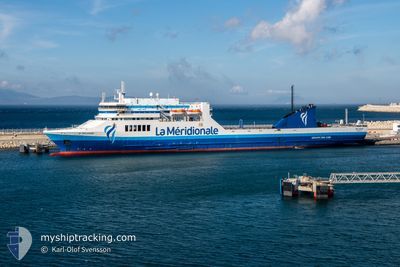
PELAGOS
Ro-Ro/Passenger Ship
Current Trip
| Time Travelled | 11 h, 38 mins |
|---|---|
| Remaining Time | 1 day |
| Distance Travelled | 210.95 nm |
| Remaining Distance | 508.76 nm |
| AVG Speed | 18.8 Knopen |
| MAX Speed | 20.5 Knopen |
| AVG Wind | 4.6 knots |
| MAX Wind | 6.9 knots |
| MIN Temp | 15°C / 59°F |
| MAX Temp | 17.2°C / 62.96°F |
| Diepgang | 5.6 M |
| Positie ontvangen | 3 m geleden |
Current Position
| Lengtegraad | -1.43658° |
|---|---|
| Breedtegraat | 36.89298° |
| Status | Under way using engine |
| Snelheid | 18.5 Knopen |
| Koers | 48.7° |
| Gebied | Mediterranean Sea - Western Basin |
| Station | T-AIS |
| Positie ontvangen | 3 m geleden |
Info
Information
The current position of PELAGOS is in Mediterranean Sea - Western Basin with coordinates 36.89298° / -1.43658° as reported on 2024-04-25 08:25 by AIS to our vessel tracker app. The vessel's current speed is 18.5 Knopen and is heading at the port of MARSEILLE. The estimated time of arrival as calculated by MyShipTracking vessel tracking app is 2024-04-26 11:06 LT
The vessel PELAGOS (IMO: 9136034, MMSI: 228393700) is a Ro-Ro/Passenger Ship that was built in 1997 ( 27 Jaar oud ). It's sailing under the flag of [FR] France.
In this page you can find informations about the vessels current position, last detected port calls, and current voyage information. If the vessels is not in coverage by AIS you will find the latest position.
The current position of PELAGOS is detected by our AIS receivers and we are not responsible for the reliability of the data. The last position was recorded while the vessel was in Coverage by the Ais receivers of our vessel tracking app.
The current draught of PELAGOS as reported by AIS is 5.6 meters
Weather
| Temperature | 16.9°C / 62.42°F |
|---|---|
| Wind Speed | 6 knots |
| Direction | 220° SW |
| Pressure | 1010.3 hPa |
| Humidity | 66.6 % |
| Cloud Coverage | 83 % |
Featured Company
Last Port Calls
| Port | Arrival | Departure | Time In Port |
|---|---|---|---|
| 2024-04-24 16:07 | 2024-04-24 20:50 | 4 h | |
| 2024-04-22 16:35 | 2024-04-22 21:59 | 5 h | |
| 2024-04-20 13:14 | 2024-04-20 23:29 | 10 h | |
| 2024-04-05 11:01 | 2024-04-18 19:45 | 13 d | |
| 2024-04-03 10:59 | 2024-04-03 17:51 | 6 h | |
| 2024-04-01 11:02 | 2024-04-01 17:19 | 6 h | |
| 2024-03-30 08:25 | 2024-03-30 18:08 | 9 h | |
| 2024-03-29 05:38 | 2024-03-29 15:25 | 9 h | |
| 2024-03-27 10:13 | 2024-03-27 20:28 | 10 h | |
| 2024-03-25 09:34 | 2024-03-25 19:05 | 9 h |
Most Visited Ports (Last year)
| Port | Arrivals | |
|---|---|---|
| 52 | ||
| 48 | ||
| 6 | ||
| 5 | ||
| 5 | ||
| 3 |
Last Trips
| Origin | Departure | Destination | Arrival | Distance | |
|---|---|---|---|---|---|
| 2024-04-22 23:59 | 2024-04-24 17:07 | 739.03 nm | |||
| 2024-04-21 00:29 | 2024-04-22 18:35 | 739.75 nm | |||
| 2024-04-18 21:45 | 2024-04-20 14:14 | 718.69 nm | |||
| 2024-04-03 17:51 | 2024-04-05 13:01 | 716.06 nm | |||
| 2024-04-01 19:19 | 2024-04-03 10:59 | 712.51 nm | |||
| 2024-03-30 18:08 | 2024-04-01 13:02 | 717.12 nm | |||
| 2024-03-29 16:25 | 2024-03-30 08:25 | 279.25 nm | |||
| 2024-03-27 21:28 | 2024-03-29 06:38 | 516.84 nm | |||
| 2024-03-25 19:05 | 2024-03-27 11:13 | 714.47 nm | |||
| 2024-03-23 14:28 | 2024-03-25 09:34 | 712.18 nm |
Events
| Tijd | Evenement | Details | Positie / Bestemming | Info |
|---|---|---|---|---|
| 2024-04-25 06:30 | Gevonden in zee | Spanish part of the Mediterranean Sea - Western Basin |
36.51189 / -1.96252
Mediterranean Sea - Western Basin
FRMRS
|
Snelheid: 18.5 kn Koers: 49.6° |
| 2024-04-25 06:19 | Status Changed | Under way using engine Default |
36.47471 / -2.01916
FRMRS
|
Snelheid: 18.8 kn Koers: 50° |
| 2024-04-25 05:31 | Status Changed | Default Under way using engine |
36.35016 / -2.25617
FRMRS
|
Snelheid: 18.8 kn Koers: 73.5° |
| 2024-04-25 05:28 | Status Changed | Under way using engine Default |
36.34502 / -2.27816
FRMRS
|
Snelheid: 18.7 kn Koers: 76° |
| 2024-04-25 04:40 | Status Changed | Default Under way using engine |
36.29270 / -2.57837
FRMRS
|
Snelheid: 18.5 kn Koers: 86.2° |
| 2024-04-25 04:29 | Status Changed | Under way using engine Default |
36.28670 / -2.64895
FRMRS
|
Snelheid: 18.1 kn Koers: 81° |
| 2024-04-25 04:20 | Status Changed | Default Under way using engine |
36.27988 / -2.70249
FRMRS
|
Snelheid: 18.1 kn Koers: 81.2° |
| 2024-04-25 02:48 | Status Changed | Under way using engine Default |
36.21397 / -3.27988
FRMRS
|
Snelheid: 17.7 kn Koers: 82° |
| 2024-04-25 02:45 | Status Changed | Default Under way using engine |
36.21291 / -3.28904
FRMRS
|
Snelheid: 17.6 kn Koers: 82.3° |
| 2024-04-25 02:00 | Status Changed | Under way using engine Default |
36.19699 / -3.57125
FRMRS
|
Snelheid: 18.3 kn Koers: 89° |