
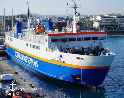
PANAGIA SKIADENI
Ro-Ro/Passenger Ship
Current Trip
| Time Travelled | 47 mins |
|---|---|
| Remaining Time | --- |
| Distance Travelled | 8.74 nm |
| Remaining Distance | --- |
| AVG Speed | 14.7 Knopen |
| MAX Speed | 15.4 Knopen |
| AVG Wind | 6.9 knots |
| MAX Wind | 7 knots |
| MIN Temp | 19.8°C / 67.64°F |
| MAX Temp | 20°C / 68°F |
| Diepgang | 4.2 M |
| Positie ontvangen | 11 m geleden |
Current Position
| Lengtegraad | 28.05932° |
|---|---|
| Breedtegraat | 36.51478° |
| Status | Under way using engine |
| Snelheid | 15.5 Knopen |
| Koers | 292.7° |
| Gebied | Aegean Sea |
| Station | T-AIS |
| Positie ontvangen | 11 m geleden |
Info
Information
The current position of PANAGIA SKIADENI is in Aegean Sea with coordinates 36.51478° / 28.05932° as reported on 2024-04-16 06:44 by AIS to our vessel tracker app. The vessel's current speed is 15.5 Knopen
The vessel PANAGIA SKIADENI (IMO: 8520288, MMSI: 240192000) is a Ro-Ro/Passenger Ship that was built in 1986 ( 38 Jaar oud ). It's sailing under the flag of [GR] Greece.
In this page you can find informations about the vessels current position, last detected port calls, and current voyage information. If the vessels is not in coverage by AIS you will find the latest position.
The current position of PANAGIA SKIADENI is detected by our AIS receivers and we are not responsible for the reliability of the data. The last position was recorded while the vessel was in Coverage by the Ais receivers of our vessel tracking app.
The current draught of PANAGIA SKIADENI as reported by AIS is 4.2 meters
Weather
| Temperature | 19.6°C / 67.28°F |
|---|---|
| Wind Speed | 5 knots |
| Direction | 105° ESE |
| Pressure | 1015.7 hPa |
| Humidity | 66.8 % |
| Cloud Coverage | 62 % |
Featured Company
Events
| Tijd | Evenement | Details | Positie / Bestemming | Info |
|---|---|---|---|---|
| 2024-04-16 06:40 | Wijzig zee gebeid | Turkish part of the Aegean Sea Greek part of the Aegean Sea |
36.50736 / 28.08086
Aegean Sea
GRSYM
|
Snelheid: 15.3 kn Koers: 293.4° |
| 2024-04-16 06:23 | Destination Changed | GRSYM GRRHO |
36.48137 / 28.16157
GRSYM
|
Snelheid: 14.7 kn Koers: 282.3° |
| 2024-04-16 06:23 | ETA Changed | 2024/04/16 10:30 2024/04/15 21:30 |
36.48137 / 28.16157
GRSYM
|
Snelheid: 14.7 kn Koers: 282.3° |
| 2024-04-16 06:13 | Wijzig zee gebeid | Greek part of the Aegean Sea Greek part of the Mediterranean Sea - Eastern Basin |
36.46851 / 28.20803
Aegean Sea
|
Snelheid: 14.6 kn Koers: 294° |
| 2024-04-16 06:09 | Vertrekhaven |
|
36.46085 / 28.22675
GRRHO
|
Snelheid: 13.8 kn Koers: 352.2° |
| 2024-04-16 06:06 | Start beweging |
36.45132 / 28.23394
[GR] RHODES
|
Snelheid: 13.8 kn Koers: 352.2° |
|
| 2024-04-16 05:53 | Binnenbereik |
36.44249 / 28.23638
Mediterranean Sea - Eastern Basin
[GR] RHODES
|
Snelheid: Koers: 155.2° |
|
| 2024-04-15 18:08 | Status Changed | Default Under way using engine |
36.44252 / 28.23639
[GR] RHODES
|
Snelheid: 1.1 kn Koers: 511° |
| 2024-04-15 18:08 | Stop beweging |
36.44252 / 28.23639
[GR] RHODES
|
Snelheid: 0.2 kn Koers: -1° |
|
| 2024-04-15 18:04 | Buitenbereik |
36.44272 / 28.23601
Mediterranean Sea - Eastern Basin
[GR] RHODES
|
Snelheid: 1.1 kn Koers: 25.6° |