
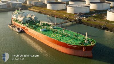
PACIFIC DIAMOND
Crude Oil Tanker
Current Trip
VN SGN
| Time Travelled | 20 days |
|---|---|
| Remaining Time | --- |
| Distance Travelled | 3367.41 nm |
| Remaining Distance | --- |
| AVG Speed | 10.9 Knopen |
| MAX Speed | 14.7 Knopen |
| AVG Wind | 9.4 knots |
| MAX Wind | 23.5 knots |
| MIN Temp | 9.3°C / 48.74°F |
| MAX Temp | 37.2°C / 98.96°F |
| Diepgang | 10.8 M |
| Positie ontvangen | 1 m geleden |
Current Position
| Lengtegraad | 106.75147° |
|---|---|
| Breedtegraat | 10.69385° |
| Status | At anchor |
| Snelheid | |
| Koers | 337° |
| Gebied | South China Sea |
| Station | T-AIS |
| Positie ontvangen | 1 m geleden |
Info
Information
The current position of PACIFIC DIAMOND is in South China Sea with coordinates 10.69385° / 106.75147° as reported on 2024-04-19 08:55 by AIS to our vessel tracker app. The vessel's current speed is 0 Knopen
The vessel PACIFIC DIAMOND (IMO: 9573660, MMSI: 636014743) is a Crude Oil Tanker that was built in 2010 ( 14 Jaar oud ). It's sailing under the flag of [LR] Liberia.
In this page you can find informations about the vessels current position, last detected port calls, and current voyage information. If the vessels is not in coverage by AIS you will find the latest position.
The current position of PACIFIC DIAMOND is detected by our AIS receivers and we are not responsible for the reliability of the data. The last position was recorded while the vessel was in Coverage by the Ais receivers of our vessel tracking app.
The current draught of PACIFIC DIAMOND as reported by AIS is 10.8 meters
Weather
| Temperature | 36.5°C / 97.7°F |
|---|---|
| Wind Speed | 12 knots |
| Direction | 149° SSE |
| Pressure | 1003.8 hPa |
| Humidity | 38.5 % |
| Cloud Coverage | 1 % |
Featured Company
Last Trips
Events
| Tijd | Evenement | Details | Positie / Bestemming | Info |
|---|---|---|---|---|
| 2024-04-19 08:49 | Status Changed | At anchor Under way using engine |
10.69377 / 106.75147
VN SGN
|
Snelheid: Koers: 337° |
| 2024-04-19 08:37 | Stop beweging | 17.03 nm, West of PHU MY |
10.69370 / 106.75173
VN SGN
|
Snelheid: 0.3 kn Koers: 334° |
| 2024-04-19 06:45 | Draught Changed | 10.8 8.6 |
10.59067 / 106.85940
VN SGN
|
Snelheid: 7.9 kn Koers: 16° |
| 2024-04-19 06:45 | Destination Changed | VN SGN JP NAK |
10.59067 / 106.85940
VN SGN
|
Snelheid: 7.9 kn Koers: 16° |
| 2024-04-19 06:45 | ETA Changed | 2024/04/18 18:00 2024/03/31 08:00 |
10.59067 / 106.85940
VN SGN
|
Snelheid: 7.9 kn Koers: 16° |
| 2024-04-19 05:16 | Gevonden in zee | Vietnamese part of the South China Sea |
10.49372 / 106.95092
South China Sea
|
Snelheid: 9.7 kn Koers: 355° |
| 2024-04-19 05:16 | Binnenbereik |
10.49372 / 106.95092
South China Sea
|
Snelheid: 9.7 kn Koers: 355° |
|
| 2024-04-11 07:07 | Start beweging | 5.64 nm, South East of GWANGYANG |
34.84472 / 127.78912
JP NAK
|
Snelheid: 5.2 kn Koers: 164° |
| 2024-04-10 00:55 | Stop beweging | 5.22 nm, South East of GWANGYANG |
34.84900 / 127.78239
JP NAK
|
Snelheid: Koers: 345° |
| 2024-04-09 23:45 | Start beweging | 5.93 nm, East of YEOSU |
34.74898 / 127.78313
JP NAK
|
Snelheid: 3.7 kn Koers: 104° |