
OUTRIDER
Cargo
Current Trip
| Time Travelled | 12 days |
|---|---|
| Remaining Time | 22 h, 19 mins |
| Distance Travelled | 3516.70 nm |
| Remaining Distance | 294.46 nm |
| AVG Speed | 11.8 Knopen |
| MAX Speed | 14.8 Knopen |
| AVG Wind | 12.1 knots |
| MAX Wind | 23 knots |
| MIN Temp | 2.8°C / 37.04°F |
| MAX Temp | 18.6°C / 65.48°F |
| Diepgang | 8.7 M |
| Positie ontvangen | 1 h, 57 m geleden |
Current Position
| Lengtegraad | -3.35252° |
|---|---|
| Breedtegraat | 49.72716° |
| Status | Under way using engine |
| Snelheid | 13.1 Knopen |
| Koers | 72.4° |
| Gebied | English Channel |
| Station | T-AIS |
| Positie ontvangen | 1 h, 57 m geleden |
Info
Information
The current position of OUTRIDER is in English Channel with coordinates 49.72716° / -3.35252° as reported on 2024-04-19 01:51 by AIS to our vessel tracker app. The vessel's current speed is 13.1 Knopen and is heading at the port of GENT. The estimated time of arrival as calculated by MyShipTracking vessel tracking app is 2024-04-20 02:07 LT
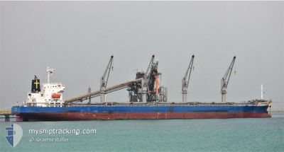
The vessel OUTRIDER (IMO: 9701061, MMSI: 636021127) is a Cargo It's sailing under the flag of [LR] Liberia.
In this page you can find informations about the vessels current position, last detected port calls, and current voyage information. If the vessels is not in coverage by AIS you will find the latest position.
The current position of OUTRIDER is detected by our AIS receivers and we are not responsible for the reliability of the data. The last position was recorded while the vessel was in Coverage by the Ais receivers of our vessel tracking app.
The current draught of OUTRIDER as reported by AIS is 8.7 meters
Weather
| Temperature | 10.5°C / 50.9°F |
|---|---|
| Wind Speed | 17 knots |
| Direction | 282° WNW |
| Pressure | 1022 hPa |
| Humidity | 83 % |
| Cloud Coverage | 31 % |
Featured Company
Last Port Calls
| Port | Arrival | Departure | Time In Port |
|---|---|---|---|
| 2024-04-03 17:06 | 2024-04-06 19:16 | 3 d | |
| 2024-03-29 12:35 | 2024-03-31 11:34 | 1 d | |
| 2024-03-01 12:49 | 2024-03-05 20:17 | 4 d | |
| 2024-02-29 03:31 | 2024-02-29 22:03 | 18 h |
Most Visited Ports (Last year)
| Port | Arrivals | |
|---|---|---|
| 2 | ||
| 2 | ||
| 1 | ||
| 1 | ||
| 1 | ||
| 1 |
Last Trips
| Origin | Departure | Destination | Arrival | Distance | |
|---|---|---|---|---|---|
| 2024-03-31 07:34 | 2024-04-03 13:06 | 180.62 nm | |||
| 2024-03-05 22:17 | 2024-03-29 08:35 | 6009.85 nm | |||
| 2023-12-27 12:31 | 2024-03-01 14:49 | 5266.50 nm | |||
| 2023-12-27 12:31 | 2024-02-29 05:31 | 13365.69 nm |
Events
| Tijd | Evenement | Details | Positie / Bestemming | Info |
|---|---|---|---|---|
| 2024-04-19 01:57 | Status Changed | Default Under way using engine |
49.73445 / -3.31756
BE GNE
|
Snelheid: 13.1 kn Koers: 72.4° |
| 2024-04-19 01:51 | Gevonden in zee | Guernsey part of the English Channel |
49.72716 / -3.35252
English Channel
BE GNE
|
Snelheid: 13.1 kn Koers: 72.4° |
| 2024-04-19 01:51 | Buitenbereik |
49.72716 / -3.35252
English Channel
BE GNE
|
Snelheid: 13.1 kn Koers: 72.4° |
|
| 2024-04-19 01:21 | Status Changed | Under way using engine Default |
49.69392 / -3.51259
BE GNE
|
Snelheid: 13.1 kn Koers: 72° |
| 2024-04-19 01:15 | Status Changed | Default Under way using engine |
49.68767 / -3.54284
BE GNE
|
Snelheid: 13 kn Koers: 72.3° |
| 2024-04-18 23:13 | Status Changed | Under way using engine Default |
49.54083 / -4.17482
BE GNE
|
Snelheid: 12.7 kn Koers: 82° |
| 2024-04-18 23:11 | Status Changed | Default Under way using engine |
49.53988 / -4.18662
BE GNE
|
Snelheid: 12.6 kn Koers: 70.3° |
| 2024-04-18 22:44 | Status Changed | Under way using engine Default |
49.52335 / -4.33170
BE GNE
|
Snelheid: 12.6 kn Koers: 72° |
| 2024-04-18 22:41 | Status Changed | Default Under way using engine |
49.52055 / -4.34454
BE GNE
|
Snelheid: 12.5 kn Koers: 71.9° |
| 2024-04-18 22:12 | Status Changed | Under way using engine Default |
49.48905 / -4.49471
BE GNE
|
Snelheid: 12.4 kn Koers: 72° |