
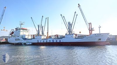
ORANGE SEA
Cargo
Current Trip
MRNDB
| Time Travelled | 12 days |
|---|---|
| Remaining Time | --- |
| Distance Travelled | 2647.34 nm |
| Remaining Distance | --- |
| AVG Speed | 13 Knopen |
| MAX Speed | 18.4 Knopen |
| AVG Wind | 7.8 knots |
| MAX Wind | 20 knots |
| MIN Temp | 22.8°C / 73.04°F |
| MAX Temp | 30.4°C / 86.72°F |
| Diepgang | 5.8 M |
| Positie ontvangen | 1 m geleden |
Current Position
| Lengtegraad | -17.80887° |
|---|---|
| Breedtegraat | 16.11858° |
| Status | Under way using engine |
| Snelheid | 12 Knopen |
| Koers | 357.4° |
| Gebied | North Atlantic Ocean |
| Station | T-AIS |
| Positie ontvangen | 1 m geleden |
Info
Information
The current position of ORANGE SEA is in North Atlantic Ocean with coordinates 16.11858° / -17.80887° as reported on 2024-04-19 16:37 by AIS to our vessel tracker app. The vessel's current speed is 12 Knopen
The vessel ORANGE SEA (IMO: 9795971, MMSI: 311000713) is a Cargo It's sailing under the flag of [BS] Bahamas.
In this page you can find informations about the vessels current position, last detected port calls, and current voyage information. If the vessels is not in coverage by AIS you will find the latest position.
The current position of ORANGE SEA is detected by our AIS receivers and we are not responsible for the reliability of the data. The last position was recorded while the vessel was in Coverage by the Ais receivers of our vessel tracking app.
The current draught of ORANGE SEA as reported by AIS is 5.8 meters
Weather
| Temperature | 23.1°C / 73.58°F |
|---|---|
| Wind Speed | 14 knots |
| Direction | 357° N |
| Pressure | 1009.4 hPa |
| Humidity | 77.4 % |
| Cloud Coverage | 36 % |
Featured Company
Most Visited Ports (Last year)
| Port | Arrivals | |
|---|---|---|
| 2 | ||
| 1 | ||
| 1 | ||
| 1 | ||
| 1 | ||
| 1 |
Events
| Tijd | Evenement | Details | Positie / Bestemming | Info |
|---|---|---|---|---|
| 2024-04-19 16:28 | Gevonden in zee | Mauritanian part of the North Atlantic Ocean |
16.08697 / -17.80688
North Atlantic Ocean
|
Snelheid: 11.8 kn Koers: 356.3° |
| 2024-04-19 15:57 | Status Changed | Under way using engine Default |
15.98715 / -17.80373
MRNDB
|
Snelheid: 11.5 kn Koers: 4° |
| 2024-04-19 15:54 | Status Changed | Default Under way using engine |
15.97640 / -17.80413
MRNDB
|
Snelheid: 11.6 kn Koers: 4.1° |
| 2024-04-19 14:16 | Binnenbereik |
15.66063 / -17.82767
North Atlantic Ocean
|
Snelheid: 11.7 kn Koers: 4.2° |
|
| 2024-04-19 14:14 | Status Changed | Under way using engine Default |
15.65312 / -17.82827
MRNDB
|
Snelheid: 11.8 kn Koers: 3° |
| 2024-04-19 12:00 | Status Changed | Default Under way using engine |
15.21780 / -17.86102
MRNDB
|
Snelheid: 11.4 kn Koers: 1.9° |
| 2024-04-19 11:57 | Buitenbereik |
15.20967 / -17.86137
North Atlantic Ocean
|
Snelheid: 11.4 kn Koers: 1.9° |
|
| 2024-04-19 09:09 | Status Changed | Under way using engine Default |
14.66097 / -17.88300
MRNDB
|
Snelheid: 12.2 kn Koers: 353° |
| 2024-04-19 09:06 | Status Changed | Default Under way using engine |
14.65142 / -17.88207
MRNDB
|
Snelheid: 11.7 kn Koers: 357.3° |
| 2024-04-19 05:28 | Gevonden in zee | Senegalese part of the North Atlantic Ocean |
13.93777 / -17.82765
North Atlantic Ocean
|
Snelheid: 11.8 kn Koers: 353.9° |