
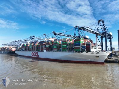
OOCL JAPAN
Cargo
Current Trip
| Time Travelled | 9 days |
|---|---|
| Remaining Time | --- |
| Distance Travelled | 3721.10 nm |
| Remaining Distance | --- |
| AVG Speed | 15 Knopen |
| MAX Speed | 19.2 Knopen |
| AVG Wind | 16.2 knots |
| MAX Wind | 36.6 knots |
| MIN Temp | 8.1°C / 46.58°F |
| MAX Temp | 29.2°C / 84.56°F |
| Diepgang | 11.7 M |
| Positie ontvangen | 2 d geleden |
Current Position
| Lengtegraad | -17.71962° |
|---|---|
| Breedtegraat | 12.70079° |
| Status | Under way using engine |
| Snelheid | 15.9 Knopen |
| Koers | 174.6° |
| Gebied | North Atlantic Ocean |
| Station | T-AIS |
| Positie ontvangen | 2 d geleden |
Info
Information
The current position of OOCL JAPAN is in North Atlantic Ocean with coordinates 12.70079° / -17.71962° as reported on 2024-04-21 16:45 by AIS to our vessel tracker app. The vessel's current speed is 15.9 Knopen and is heading at the port of PORT KLANG. The estimated time of arrival as calculated by MyShipTracking vessel tracking app is 2024-05-18 13:00 LT
The vessel OOCL JAPAN (IMO: 9776195, MMSI: 477100400) is a Cargo It's sailing under the flag of [HK] Hong Kong.
In this page you can find informations about the vessels current position, last detected port calls, and current voyage information. If the vessels is not in coverage by AIS you will find the latest position.
The current position of OOCL JAPAN is detected by our AIS receivers and we are not responsible for the reliability of the data. The last position was recorded while the vessel was in Coverage by the Ais receivers of our vessel tracking app.
The current draught of OOCL JAPAN as reported by AIS is 11.7 meters
Weather
| Temperature | 28.6°C / 83.48°F |
|---|---|
| Wind Speed | 11 knots |
| Direction | 147° SSE |
| Pressure | 1011.8 hPa |
| Humidity | 77.5 % |
| Cloud Coverage | 100 % |
Featured Company
Last Port Calls
| Port | Arrival | Departure | Time In Port |
|---|---|---|---|
| 2024-04-11 09:21 | 2024-04-14 19:59 | 3 d | |
| 2024-04-04 22:42 | 2024-04-07 17:41 | 2 d | |
| 2024-03-26 03:37 | 2024-04-01 02:01 | 5 d | |
| 2024-02-25 12:31 | 2024-02-26 11:30 | 22 h | |
| 2024-02-19 12:36 | 2024-02-20 00:59 | 12 h | |
| 2024-02-18 18:38 | 2024-02-19 07:21 | 12 h | |
| 2024-02-17 12:39 | 2024-02-18 07:21 | 18 h | |
| 2024-02-10 20:58 | 2024-02-12 11:06 | 1 d | |
| 2024-02-03 16:25 | 2024-02-04 12:34 | 20 h |
Most Visited Ports (Last year)
| Port | Arrivals | |
|---|---|---|
| 7 | ||
| 7 | ||
| 5 | ||
| 5 | ||
| 4 | ||
| 3 |
Last Trips
| Origin | Departure | Destination | Arrival | Distance | |
|---|---|---|---|---|---|
| 2024-04-07 19:41 | 2024-04-11 11:21 | 472.99 nm | |||
| 2024-04-01 04:01 | 2024-04-05 00:42 | 523.50 nm | |||
| 2024-02-26 19:30 | 2024-03-26 04:37 | 11765.42 nm | |||
| 2024-02-20 08:59 | 2024-02-25 20:31 | 1564.70 nm | |||
| 2024-02-19 15:21 | 2024-02-19 20:36 | 57.39 nm | |||
| 2024-02-18 15:21 | 2024-02-19 02:38 | 112.45 nm | |||
| 2024-02-12 19:06 | 2024-02-17 20:39 | 1015.22 nm | |||
| 2024-02-04 20:34 | 2024-02-11 04:58 | 1023.33 nm | |||
| 2024-01-30 06:23 | 2024-02-04 00:25 | 1481.63 nm |
Events
| Tijd | Evenement | Details | Positie / Bestemming | Info |
|---|---|---|---|---|
| 2024-04-21 16:50 | Status Changed | Default Under way using engine |
12.67699 / -17.71744
NLRTM>MYPKG
|
Snelheid: 15.9 kn Koers: 174.6° |
| 2024-04-21 16:45 | Buitenbereik |
12.70079 / -17.71962
North Atlantic Ocean
NLRTM>MYPKG
|
Snelheid: 15.9 kn Koers: 174.6° |
|
| 2024-04-21 16:29 | Status Changed | Under way using engine Default |
12.77246 / -17.72662
NLRTM>MYPKG
|
Snelheid: 15.9 kn Koers: 175° |
| 2024-04-21 16:18 | Status Changed | Default Under way using engine |
12.81921 / -17.73078
NLRTM>MYPKG
|
Snelheid: 16.4 kn Koers: 175.6° |
| 2024-04-21 16:09 | Status Changed | Under way using engine Default |
12.86325 / -17.73457
NLRTM>MYPKG
|
Snelheid: 16.4 kn Koers: 176° |
| 2024-04-21 16:02 | Status Changed | Default Under way using engine |
12.89169 / -17.73674
NLRTM>MYPKG
|
Snelheid: 16.4 kn Koers: 175.2° |
| 2024-04-21 15:54 | Gevonden in zee | Senegalese part of the North Atlantic Ocean |
12.92865 / -17.73978
North Atlantic Ocean
NLRTM>MYPKG
|
Snelheid: 16.4 kn Koers: 175.2° |
| 2024-04-21 15:54 | Status Changed | Under way using engine Default |
12.92865 / -17.73978
NLRTM>MYPKG
|
Snelheid: 16.4 kn Koers: 175° |
| 2024-04-21 15:46 | Binnenbereik |
12.92865 / -17.73978
North Atlantic Ocean
NLRTM>MYPKG
|
Snelheid: 16.4 kn Koers: 175.2° |
|
| 2024-04-21 14:04 | Buitenbereik |
13.42281 / -17.78735
North Atlantic Ocean
NLRTM>MYPKG
|
Snelheid: 16.5 kn Koers: 174.9° |