
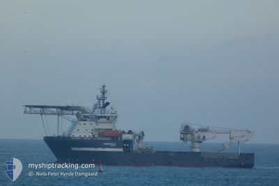
OLYMPIC TRITON
Offshore Supply Ship
Current Trip
EKOFISK OFFSHORE
| Time Travelled | 2 h, 37 mins |
|---|---|
| Remaining Time | --- |
| Distance Travelled | 26.49 nm |
| Remaining Distance | --- |
| AVG Speed | 10.5 Knopen |
| MAX Speed | 11.2 Knopen |
| AVG Wind | 9.1 knots |
| MAX Wind | 11.3 knots |
| MIN Temp | 4.8°C / 40.64°F |
| MAX Temp | 4.9°C / 40.82°F |
| Diepgang | 6.5 M |
| Positie ontvangen | Nu |
Current Position
| Lengtegraad | 5.12645° |
|---|---|
| Breedtegraat | 58.54951° |
| Status | Under way using engine |
| Snelheid | 10.5 Knopen |
| Koers | 205.6° |
| Gebied | North Sea |
| Station | T-AIS |
| Positie ontvangen | Nu |
Info
Information
The current position of OLYMPIC TRITON is in North Sea with coordinates 58.54951° / 5.12645° as reported on 2024-04-24 22:17 by AIS to our vessel tracker app. The vessel's current speed is 10.5 Knopen
The vessel OLYMPIC TRITON (IMO: 9383754, MMSI: 259424000) is a Offshore Supply Ship that was built in 2007 ( 17 Jaar oud ). It's sailing under the flag of [NO] Norway.
In this page you can find informations about the vessels current position, last detected port calls, and current voyage information. If the vessels is not in coverage by AIS you will find the latest position.
The current position of OLYMPIC TRITON is detected by our AIS receivers and we are not responsible for the reliability of the data. The last position was recorded while the vessel was in Coverage by the Ais receivers of our vessel tracking app.
The current draught of OLYMPIC TRITON as reported by AIS is 6.5 meters
Weather
| Temperature | 4.9°C / 40.82°F |
|---|---|
| Wind Speed | 5 knots |
| Direction | 356° N |
| Pressure | 1005.4 hPa |
| Humidity | 64.7 % |
| Cloud Coverage | 100 % |
Featured Company
Last Port Calls
| Port | Arrival | Departure | Time In Port |
|---|---|---|---|
| 2024-04-24 04:28 | 2024-04-24 19:41 | 15 h | |
| 2024-04-07 19:04 | 2024-04-08 11:34 | 16 h | |
| 2024-04-07 10:29 | 2024-04-07 16:23 | 5 h | |
| 2024-04-04 20:35 | 2024-04-06 01:22 | 1 d | |
| 2024-03-20 01:38 | 2024-03-24 12:10 | 4 d | |
| 2024-03-18 09:44 | 2024-03-19 22:53 | 1 d | |
| 2024-03-08 04:31 | 2024-03-09 14:53 | 1 d | |
| 2024-02-28 14:59 | 2024-02-29 14:25 | 23 h | |
| 2024-02-13 12:25 | 2024-02-15 11:32 | 1 d | |
| 2024-02-06 08:28 | 2024-02-09 08:47 | 3 d |
Most Visited Ports (Last year)
| Port | Arrivals | |
|---|---|---|
| 9 | ||
| 5 | ||
| 4 | ||
| 3 | ||
| 2 | ||
| 1 |
Last Trips
| Origin | Departure | Destination | Arrival | Distance | |
|---|---|---|---|---|---|
| 2024-04-08 13:34 | 2024-04-24 06:28 | 369.85 nm | |||
| 2024-04-07 18:23 | 2024-04-07 21:04 | 26.98 nm | |||
| 2024-04-06 02:22 | 2024-04-07 12:29 | 345.37 nm | |||
| 2024-03-24 12:10 | 2024-04-04 21:35 | 435.86 nm | |||
| 2024-03-19 22:53 | 2024-03-20 01:38 | 24.55 nm | |||
| 2024-03-09 15:53 | 2024-03-18 09:44 | 2463.03 nm | |||
| 2024-02-29 15:25 | 2024-03-08 05:31 | 95.84 nm | |||
| 2024-02-15 12:32 | 2024-02-28 15:59 | 93.51 nm | |||
| 2024-02-09 09:47 | 2024-02-13 13:25 | 105.07 nm | |||
| 2024-01-31 13:40 | 2024-02-06 09:28 | 1457.62 nm |
Events
| Tijd | Evenement | Details | Positie / Bestemming | Info |
|---|---|---|---|---|
| 2024-04-24 19:41 | Vertrekhaven |
|
58.93064 / 5.56834
EKOFISK OFFSHORE
|
Snelheid: 8.8 kn Koers: 278° |
| 2024-04-24 19:35 | Start beweging |
58.92679 / 5.59246
[NO] TANANGER
|
Snelheid: 3.5 kn Koers: 279° |
|
| 2024-04-24 18:56 | Status Changed | Under way using engine Moored |
58.92828 / 5.59409
[NO] TANANGER
|
Snelheid: Koers: 76° |
| 2024-04-24 18:54 | Draught Changed | 6.5 6.2 |
58.92829 / 5.59409
[NO] TANANGER
|
Snelheid: Koers: 76° |
| 2024-04-24 18:54 | ETA Changed | 2024/04/26 13:40 2024/04/24 06:30 |
58.92829 / 5.59409
[NO] TANANGER
|
Snelheid: Koers: 76° |
| 2024-04-24 18:47 | Destination Changed | EKOFISK OFFSHORE TANAGER |
58.92829 / 5.59409
[NO] TANANGER
|
Snelheid: Koers: 76° |
| 2024-04-24 15:34 | Status Changed | Moored Under way using engine |
58.92826 / 5.59412
[NO] TANANGER
|
Snelheid: Koers: 76° |
| 2024-04-24 13:57 | Status Changed | Under way using engine Moored |
58.92842 / 5.58730
[NO] TANANGER
|
Snelheid: Koers: 135° |
| 2024-04-24 05:01 | Status Changed | Moored Under way using engine |
58.92843 / 5.58734
[NO] TANANGER
|
Snelheid: Koers: 135° |
| 2024-04-24 04:45 | Stop beweging |
58.92839 / 5.58726
[NO] TANANGER
|
Snelheid: 0.3 kn Koers: 133° |