
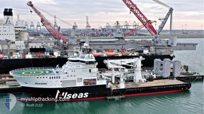
OCEANIC
Other Type
Current Trip
ALLSEAS TEST PLATFOR
| Time Travelled | 9 days |
|---|---|
| Remaining Time | --- |
| Distance Travelled | 554.92 nm |
| Remaining Distance | --- |
| AVG Speed | 11.1 Knopen |
| MAX Speed | 13.9 Knopen |
| AVG Wind | 17.8 knots |
| MAX Wind | 27 knots |
| MIN Temp | 4.2°C / 39.56°F |
| MAX Temp | 9.2°C / 48.56°F |
| Diepgang | 6.7 M |
| Positie ontvangen | 22 h, 54 m geleden |
Current Position
| Lengtegraad | 3.81478° |
|---|---|
| Breedtegraat | 54.69030° |
| Status | Under way using engine |
| Snelheid | 12.6 Knopen |
| Koers | 151° |
| Gebied | North Sea |
| Station | T-AIS |
| Positie ontvangen | 22 h, 54 m geleden |
Info
Information
The current position of OCEANIC is in North Sea with coordinates 54.69030° / 3.81478° as reported on 2024-04-18 06:32 by AIS to our vessel tracker app. The vessel's current speed is 12.6 Knopen
The vessel OCEANIC (IMO: 9703382, MMSI: 249903000) is a Other Type It's sailing under the flag of [MT] Malta.
In this page you can find informations about the vessels current position, last detected port calls, and current voyage information. If the vessels is not in coverage by AIS you will find the latest position.
The current position of OCEANIC is detected by our AIS receivers and we are not responsible for the reliability of the data. The last position was recorded while the vessel was in Coverage by the Ais receivers of our vessel tracking app.
The current draught of OCEANIC as reported by AIS is 6.7 meters
Weather
| Temperature | 6.7°C / 44.06°F |
|---|---|
| Wind Speed | 12 knots |
| Direction | 331° NNW |
| Pressure | 1018.7 hPa |
| Humidity | 66.9 % |
| Cloud Coverage | 57 % |
Featured Company
Last Port Calls
| Port | Arrival | Departure | Time In Port |
|---|---|---|---|
| 2024-04-09 10:14 | 2024-04-10 04:31 | 18 h | |
| 2024-04-04 08:07 | 2024-04-04 14:23 | 6 h | |
| 2024-03-15 15:56 | 2024-03-19 19:33 | 4 d |
Most Visited Ports (Last year)
| Port | Arrivals | |
|---|---|---|
| 5 | ||
| 3 | ||
| 1 | ||
| 1 |
Last Trips
| Origin | Departure | Destination | Arrival | Distance | |
|---|---|---|---|---|---|
| 2024-04-04 16:23 | 2024-04-09 12:14 | 404.61 nm | |||
| 2024-03-19 20:33 | 2024-04-04 10:07 | 540.57 nm |
Events
| Tijd | Evenement | Details | Positie / Bestemming | Info |
|---|---|---|---|---|
| 2024-04-18 06:32 | Buitenbereik |
54.69030 / 3.81478
North Sea
ALLSEAS TEST PLATFOR
|
Snelheid: 12.6 kn Koers: 151° |
|
| 2024-04-18 05:25 | Gevonden in zee | Dutch part of the North Sea |
54.89528 / 3.62242
North Sea
ALLSEAS TEST PLATFOR
|
Snelheid: 12.7 kn Koers: 151.4° |
| 2024-04-18 05:25 | Binnenbereik |
54.89528 / 3.62242
North Sea
ALLSEAS TEST PLATFOR
|
Snelheid: 12.7 kn Koers: 151.4° |
|
| 2024-04-18 01:20 | Buitenbereik |
55.65158 / 2.85940
North Sea
ALLSEAS TEST PLATFOR
|
Snelheid: 12.8 kn Koers: 148.8° |
|
| 2024-04-18 01:20 | Binnenbereik |
55.65158 / 2.85940
North Sea
ALLSEAS TEST PLATFOR
|
Snelheid: 12.8 kn Koers: 148.8° |
|
| 2024-04-17 23:52 | Buitenbereik |
55.92438 / 2.61048
North Sea
ALLSEAS TEST PLATFOR
|
Snelheid: 12.6 kn Koers: 151° |
|
| 2024-04-17 22:30 | Draught Changed | 6.7 6.8 |
56.17198 / 2.36987
ALLSEAS TEST PLATFOR
|
Snelheid: 12.5 kn Koers: 151.6° |
| 2024-04-17 22:30 | Destination Changed | ALLSEAS TEST PLATFOR BRENT OIL FIELD |
56.17198 / 2.36987
ALLSEAS TEST PLATFOR
|
Snelheid: 12.5 kn Koers: 151.6° |
| 2024-04-17 22:30 | ETA Changed | 2024/04/18 12:00 2024/04/10 18:00 |
56.17198 / 2.36987
ALLSEAS TEST PLATFOR
|
Snelheid: 12.5 kn Koers: 151.6° |
| 2024-04-17 22:27 | Binnenbereik |
56.18327 / 2.35898
North Sea
|
Snelheid: 12.5 kn Koers: 152.5° |