
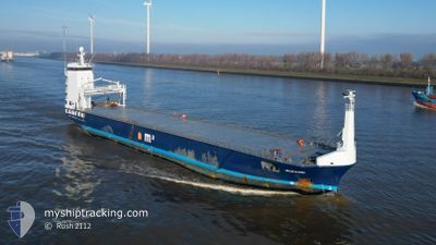
OCEANIC
General Cargo
Current Trip
| Time Travelled | 13 h, 26 mins |
|---|---|
| Remaining Time | --- |
| Distance Travelled | 150.03 nm |
| Remaining Distance | --- |
| AVG Speed | 11.3 Knopen |
| MAX Speed | 11.8 Knopen |
| AVG Wind | 11.4 knots |
| MAX Wind | 17.8 knots |
| MIN Temp | 2.7°C / 36.86°F |
| MAX Temp | 4.5°C / 40.1°F |
| Diepgang | 4.2 M |
| Positie ontvangen | 4 h, 32 m geleden |
Current Position
| Lengtegraad | 21.65789° |
|---|---|
| Breedtegraat | 59.17867° |
| Status | Under way using engine |
| Snelheid | 11.3 Knopen |
| Koers | 222.8° |
| Gebied | Baltic Sea |
| Station | T-AIS |
| Positie ontvangen | 4 h, 32 m geleden |
Info
Information
The current position of OCEANIC is in Baltic Sea with coordinates 59.17867° / 21.65789° as reported on 2024-04-25 01:19 by AIS to our vessel tracker app. The vessel's current speed is 11.3 Knopen and is heading at the port of RIJEKA. The estimated time of arrival as calculated by MyShipTracking vessel tracking app is 2024-05-10 08:00 LT
The vessel OCEANIC (IMO: 9624550, MMSI: 244918000) is a General Cargo that was built in 2012 ( 12 Jaar oud ). It's sailing under the flag of [NL] Netherlands.
In this page you can find informations about the vessels current position, last detected port calls, and current voyage information. If the vessels is not in coverage by AIS you will find the latest position.
The current position of OCEANIC is detected by our AIS receivers and we are not responsible for the reliability of the data. The last position was recorded while the vessel was in Coverage by the Ais receivers of our vessel tracking app.
The current draught of OCEANIC as reported by AIS is 4.2 meters
Weather
| Temperature | 2.9°C / 37.22°F |
|---|---|
| Wind Speed | 13 knots |
| Direction | 56° NE |
| Pressure | 1004.2 hPa |
| Humidity | 97.7 % |
| Cloud Coverage | 100 % |
Featured Company
Last Port Calls
| Port | Arrival | Departure | Time In Port |
|---|---|---|---|
| 2024-04-23 04:55 | 2024-04-24 16:25 | 1 d | |
| 2024-04-14 09:36 | 2024-04-16 15:55 | 2 d | |
| 2024-03-24 09:24 | 2024-03-28 01:26 | 3 d | |
| 2024-03-22 08:27 | 2024-03-23 04:21 | 19 h | |
| 2024-03-19 17:38 | 2024-03-20 18:12 | 1 d | |
| 2024-03-05 21:33 | 2024-03-07 19:54 | 1 d | |
| 2024-02-29 14:36 | 2024-03-05 17:32 | 5 d | |
| 2024-02-26 18:28 | 2024-02-27 19:01 | 1 d | |
| 2024-02-20 12:44 | 2024-02-21 20:03 | 1 d | |
| 2024-02-18 07:33 | 2024-02-19 18:26 | 1 d |
Last Trips
| Origin | Departure | Destination | Arrival | Distance | |
|---|---|---|---|---|---|
| 2024-04-16 17:55 | 2024-04-23 07:55 | 286.47 nm | |||
| 2024-03-28 04:26 | 2024-04-14 11:36 | 4168.44 nm | |||
| 2024-03-23 07:21 | 2024-03-24 12:24 | 313.17 nm | |||
| 2024-03-20 21:12 | 2024-03-22 11:27 | 304.73 nm | |||
| 2024-03-07 20:54 | 2024-03-19 20:38 | 2722.57 nm | |||
| 2024-03-05 18:32 | 2024-03-05 22:33 | 38.67 nm | |||
| 2024-02-27 20:01 | 2024-02-29 15:36 | 223.33 nm | |||
| 2024-02-21 20:03 | 2024-02-26 19:28 | 787.06 nm | |||
| 2024-02-19 18:26 | 2024-02-20 12:44 | 68.44 nm | |||
| 2024-02-14 11:53 | 2024-02-18 07:33 | 854.59 nm |
Events
| Tijd | Evenement | Details | Positie / Bestemming | Info |
|---|---|---|---|---|
| 2024-04-25 01:23 | Status Changed | Default Under way using engine |
59.16920 / 21.64065
HRRJK
|
Snelheid: 11.3 kn Koers: 222.8° |
| 2024-04-25 01:19 | Buitenbereik |
59.17867 / 21.65789
Baltic Sea
HRRJK
|
Snelheid: 11.3 kn Koers: 222.8° |
|
| 2024-04-24 23:37 | Gevonden in zee | Estonian part of the Baltic Sea |
59.37431 / 22.14247
Baltic Sea
HRRJK
|
Snelheid: 11.2 kn Koers: 232.9° |
| 2024-04-24 22:47 | Status Changed | Under way using engine Default |
59.46812 / 22.38635
HRRJK
|
Snelheid: 11.2 kn Koers: 237° |
| 2024-04-24 22:39 | Status Changed | Default Under way using engine |
59.48181 / 22.42691
HRRJK
|
Snelheid: 11.3 kn Koers: 238.4° |
| 2024-04-24 20:41 | Wijzig zee gebeid | Finnish part of the Baltic Sea Finnish part of the Gulf of Finland |
59.53582 / 23.14254
Baltic Sea
HRRJK
|
Snelheid: 11.6 kn Koers: 272.9° |
| 2024-04-24 19:43 | Wijzig zee gebeid | Finnish part of the Gulf of Finland Estonian part of the Gulf of Finland |
59.52887 / 23.49875
Gulf of Finland
HRRJK
|
Snelheid: 11.4 kn Koers: 273.7° |
| 2024-04-24 18:13 | Status Changed | Under way using engine Default |
59.51313 / 24.06431
HRRJK
|
Snelheid: 11 kn Koers: 271° |
| 2024-04-24 17:36 | Status Changed | Default Under way using engine |
59.50686 / 24.29420
HRRJK
|
Snelheid: 11.3 kn Koers: 270.3° |
| 2024-04-24 16:27 | Status Changed | Under way using engine Moored |
59.45493 / 24.65139
HRRJK
|
Snelheid: 5.3 kn Koers: 277.5° |