
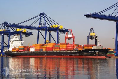
MSC VIGOUR III
Container Ship
Current Trip
| Time Travelled | 11 h, 29 mins |
|---|---|
| Remaining Time | 1 day |
| Distance Travelled | 134.09 nm |
| Remaining Distance | 542.58 nm |
| AVG Speed | 13 Knopen |
| MAX Speed | 15.1 Knopen |
| AVG Wind | 2.2 knots |
| MAX Wind | 3.2 knots |
| MIN Temp | 14.9°C / 58.82°F |
| MAX Temp | 17.4°C / 63.32°F |
| Diepgang | 10.5 M |
| Positie ontvangen | 1 h, 3 m geleden |
Current Position
| Lengtegraad | 130.95594° |
|---|---|
| Breedtegraat | 33.95788° |
| Status | Under way using engine |
| Snelheid | 12.9 Knopen |
| Koers | 35.8° |
| Gebied | Inland Sea |
| Station | T-AIS |
| Positie ontvangen | 1 h, 3 m geleden |
Info
Information
The current position of MSC VIGOUR III is in Inland Sea with coordinates 33.95788° / 130.95594° as reported on 2024-04-19 00:07 by AIS to our vessel tracker app. The vessel's current speed is 12.9 Knopen and is heading at the port of TOKYO. The estimated time of arrival as calculated by MyShipTracking vessel tracking app is 2024-04-20 13:02 LT
The vessel MSC VIGOUR III (IMO: 9304708, MMSI: 255805575) is a Container Ship that was built in 2005 ( 19 Jaar oud ). It's sailing under the flag of [PT] Portugal.
In this page you can find informations about the vessels current position, last detected port calls, and current voyage information. If the vessels is not in coverage by AIS you will find the latest position.
The current position of MSC VIGOUR III is detected by our AIS receivers and we are not responsible for the reliability of the data. The last position was recorded while the vessel was in Coverage by the Ais receivers of our vessel tracking app.
The current draught of MSC VIGOUR III as reported by AIS is 10.5 meters
Weather
| Temperature | 17.6°C / 63.68°F |
|---|---|
| Wind Speed | 3 knots |
| Direction | 261° W |
| Pressure | 1014.5 hPa |
| Humidity | 53.6 % |
| Cloud Coverage | --- |
Featured Company
Last Port Calls
| Port | Arrival | Departure | Time In Port |
|---|---|---|---|
| 2024-04-16 22:47 | 2024-04-18 13:42 | 1 d | |
| 2024-04-11 22:18 | 2024-04-12 09:56 | 11 h | |
| 2024-04-09 03:22 | 2024-04-09 15:36 | 12 h | |
| 2024-04-03 22:13 | 2024-04-04 11:57 | 13 h | |
| 2024-03-20 19:27 | 2024-03-21 02:16 | 6 h | |
| 2024-03-16 01:12 | 2024-03-16 22:30 | 21 h | |
| 2024-03-14 18:49 | 2024-03-15 07:53 | 13 h | |
| 2024-03-12 22:25 | 2024-03-13 13:27 | 15 h | |
| 2024-03-12 02:51 | 2024-03-12 21:45 | 18 h | |
| 2024-03-09 09:28 | 2024-03-09 14:52 | 5 h |
Most Visited Ports (Last year)
| Port | Arrivals | |
|---|---|---|
| 12 | ||
| 6 | ||
| 6 | ||
| 5 | ||
| 5 | ||
| 5 |
Last Trips
| Origin | Departure | Destination | Arrival | Distance | |
|---|---|---|---|---|---|
| 2024-04-12 17:56 | 2024-04-17 07:47 | 1419.30 nm | |||
| 2024-04-09 23:36 | 2024-04-12 06:18 | 22.30 nm | |||
| 2024-04-04 18:57 | 2024-04-09 11:22 | 1427.99 nm | |||
| 2024-03-21 10:16 | 2024-04-04 05:13 | 3072.57 nm | |||
| 2024-03-17 07:30 | 2024-03-21 03:27 | 460.34 nm | |||
| 2024-03-15 16:53 | 2024-03-16 10:12 | 120.82 nm | |||
| 2024-03-13 22:27 | 2024-03-15 03:49 | 412.96 nm | |||
| 2024-03-13 06:45 | 2024-03-13 07:25 | 7.62 nm | |||
| 2024-03-09 23:52 | 2024-03-12 11:51 | 407.64 nm | |||
| 2024-02-27 03:58 | 2024-03-09 18:28 | 2248.81 nm |
Events
| Tijd | Evenement | Details | Positie / Bestemming | Info |
|---|---|---|---|---|
| 2024-04-19 00:07 | Buitenbereik |
33.95788 / 130.95594
Inland Sea
JPTYO/E
|
Snelheid: 12.9 kn Koers: 35.8° |
|
| 2024-04-18 23:41 | Wijzig zee gebeid | Japanese part of the Inland Sea Japanese part of the Japan Sea |
33.90843 / 130.89741
Inland Sea
JPTYO/E
|
Snelheid: 8.1 kn Koers: 149.9° |
| 2024-04-18 23:05 | Binnenbereik |
34.02098 / 130.85182
Japan Sea
JPTYO/E
|
Snelheid: 10.4 kn Koers: 126.5° |
|
| 2024-04-18 21:42 | Buitenbereik |
34.18990 / 130.58385
Japan Sea
JPTYO/E
|
Snelheid: 13 kn Koers: 126.4° |
|
| 2024-04-18 15:50 | Wijzig zee gebeid | Japanese part of the Japan Sea South Korean part of the Japan Sea |
34.81135 / 129.19061
Japan Sea
JPTYO/E
|
Snelheid: 14.4 kn Koers: 90° |
| 2024-04-18 14:52 | Destination Changed | JPTYO/E JPHKTWM |
34.84063 / 128.92243
JPTYO/E
|
Snelheid: 14 kn Koers: 138.9° |
| 2024-04-18 14:52 | ETA Changed | 2024/04/18 23:15 2024/04/20 09:00 |
34.84063 / 128.92243
JPTYO/E
|
Snelheid: 14 kn Koers: 138.9° |
| 2024-04-18 14:42 | Destination Changed | JPHKTWM JPTYO |
34.86872 / 128.89231
JPHKTWM
|
Snelheid: 13.9 kn Koers: 138.5° |
| 2024-04-18 14:34 | Draught Changed | 10.5 11.1 |
34.89186 / 128.86721
JPTYO
|
Snelheid: 13.9 kn Koers: 137.9° |
| 2024-04-18 14:08 | Draught Changed | 11.1 7.6 |
34.97843 / 128.80069
JPTYO
|
Snelheid: 14.2 kn Koers: 162° |