
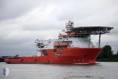
NORMAND JARSTEIN
Cargo
Current Trip
| Time Travelled | 29 days |
|---|---|
| Remaining Time | --- |
| Distance Travelled | 677.22 nm |
| Remaining Distance | --- |
| AVG Speed | 7 Knopen |
| MAX Speed | 11.3 Knopen |
| AVG Wind | 18.2 knots |
| MAX Wind | 27.4 knots |
| MIN Temp | 2.3°C / 36.14°F |
| MAX Temp | 9.3°C / 48.74°F |
| Diepgang | 6.5 M |
| Positie ontvangen | 5 h, 9 m geleden |
Current Position
| Lengtegraad | -1.36290° |
|---|---|
| Breedtegraat | 57.11438° |
| Status | Under way using engine |
| Snelheid | 9.8 Knopen |
| Koers | 97.7° |
| Gebied | North Sea |
| Station | T-AIS |
| Positie ontvangen | 5 h, 9 m geleden |
Info
Information
The current position of NORMAND JARSTEIN is in North Sea with coordinates 57.11438° / -1.36290° as reported on 2024-04-24 17:28 by AIS to our vessel tracker app. The vessel's current speed is 9.8 Knopen and is heading at the port of BANFF. The estimated time of arrival as calculated by MyShipTracking vessel tracking app is 2024-04-25 03:00 LT
The vessel NORMAND JARSTEIN (IMO: 9686821, MMSI: 257001590) is a Cargo It's sailing under the flag of [NO] Norway.
In this page you can find informations about the vessels current position, last detected port calls, and current voyage information. If the vessels is not in coverage by AIS you will find the latest position.
The current position of NORMAND JARSTEIN is detected by our AIS receivers and we are not responsible for the reliability of the data. The last position was recorded while the vessel was in Coverage by the Ais receivers of our vessel tracking app.
The current draught of NORMAND JARSTEIN as reported by AIS is 6.5 meters
Weather
| Temperature | 6.2°C / 43.16°F |
|---|---|
| Wind Speed | 13 knots |
| Direction | 358° N |
| Pressure | 1012.5 hPa |
| Humidity | 68.9 % |
| Cloud Coverage | 100 % |
Featured Company
Last Port Calls
| Port | Arrival | Departure | Time In Port |
|---|---|---|---|
| 2024-03-26 08:48 | 2024-03-26 17:15 | 8 h | |
| 2024-03-23 20:48 | 2024-03-26 08:25 | 2 d | |
| 2024-03-23 15:39 | 2024-03-23 19:56 | 4 h | |
| 2024-03-22 16:04 | 2024-03-23 15:24 | 23 h | |
| 2024-02-26 06:14 | 2024-03-22 06:50 | 25 d | |
| 2024-02-25 13:27 | 2024-02-26 05:10 | 15 h | |
| 2024-02-18 19:30 | 2024-02-19 22:28 | 1 d | |
| 2024-02-11 03:25 | 2024-02-11 15:24 | 11 h |
Last Trips
| Origin | Departure | Destination | Arrival | Distance | |
|---|---|---|---|---|---|
| 2024-03-26 09:25 | 2024-03-26 09:48 | 3.14 nm | |||
| 2024-03-23 20:56 | 2024-03-23 21:48 | 7.67 nm | |||
| 2024-03-23 16:24 | 2024-03-23 16:39 | 0.40 nm | |||
| 2024-03-22 07:50 | 2024-03-22 17:04 | 59.93 nm | |||
| 2024-02-26 06:10 | 2024-02-26 07:14 | 8.19 nm | |||
| 2024-02-19 22:28 | 2024-02-25 14:27 | 586.91 nm | |||
| 2024-02-11 15:24 | 2024-02-18 19:30 | 383.79 nm | |||
| 2024-01-31 19:27 | 2024-02-11 03:25 | 378.45 nm |
Events
| Tijd | Evenement | Details | Positie / Bestemming | Info |
|---|---|---|---|---|
| 2024-04-24 17:28 | Buitenbereik |
57.11438 / -1.36290
North Sea
BANFF FIELD
|
Snelheid: 9.8 kn Koers: 97.7° |
|
| 2024-04-24 15:11 | Start beweging | 1.04 nm, South East of ABERDEEN |
57.13105 / -2.05131
BANFF FIELD
|
Snelheid: 3.1 kn Koers: 88° |
| 2024-04-24 14:50 | Status Changed | Under way using engine Moored |
57.13263 / -2.04993
BANFF FIELD
|
Snelheid: Koers: 180° |
| 2024-04-24 13:54 | Destination Changed | BANFF FIELD ABERDEEN |
57.13260 / -2.05003
BANFF FIELD
|
Snelheid: Koers: 179° |
| 2024-04-24 13:54 | ETA Changed | 2024/04/25 03:00 2024/04/23 20:00 |
57.13260 / -2.05003
BANFF FIELD
|
Snelheid: Koers: 179° |
| 2024-04-24 12:56 | Draught Changed | 6.5 6.7 |
57.13261 / -2.05001
ABERDEEN
|
Snelheid: Koers: 179° |
| 2024-04-23 19:12 | Status Changed | Moored Under way using engine |
57.13264 / -2.04997
ABERDEEN
|
Snelheid: Koers: 180° |
| 2024-04-23 18:56 | Stop beweging | 0.98 nm, South East of ABERDEEN |
57.13296 / -2.05136
ABERDEEN
|
Snelheid: 0.3 kn Koers: 135° |
| 2024-04-23 18:22 | Start beweging | 2.29 nm, South of ABERDEEN ANCH |
57.15551 / -2.00369
ABERDEEN
|
Snelheid: 3.3 kn Koers: 231° |
| 2024-04-23 17:56 | Stop beweging | 2.2 nm, South East of ABERDEEN ANCH |
57.15749 / -2.00190
ABERDEEN
|
Snelheid: 0.3 kn Koers: 228° |