
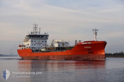
NORMA
Tanker
Current Trip
| Time Travelled | 2 days |
|---|---|
| Remaining Time | 7 h, 37 mins |
| Distance Travelled | 722.77 nm |
| Remaining Distance | 104.36 nm |
| AVG Speed | 10.9 Knopen |
| MAX Speed | 13.9 Knopen |
| AVG Wind | 9 knots |
| MAX Wind | 14.8 knots |
| MIN Temp | -0.1°C / 31.82°F |
| MAX Temp | 6.9°C / 44.42°F |
| Diepgang | 7.2 M |
| Positie ontvangen | 5 h, 52 m geleden |
Current Position
| Lengtegraad | 19.02373° |
|---|---|
| Breedtegraat | 60.39305° |
| Status | Under way using engine |
| Snelheid | 13.8 Knopen |
| Koers | 3.5° |
| Gebied | Gulf of Bothnia |
| Station | T-AIS |
| Positie ontvangen | 5 h, 52 m geleden |
Info
Information
The current position of NORMA is in Gulf of Bothnia with coordinates 60.39305° / 19.02373° as reported on 2024-04-24 19:11 by AIS to our vessel tracker app. The vessel's current speed is 13.8 Knopen and is heading at the port of HUSUM. The estimated time of arrival as calculated by MyShipTracking vessel tracking app is 2024-04-25 08:41 LT
The vessel NORMA (IMO: 9870666, MMSI: 210048000) is a Tanker It's sailing under the flag of [CY] Cyprus.
In this page you can find informations about the vessels current position, last detected port calls, and current voyage information. If the vessels is not in coverage by AIS you will find the latest position.
The current position of NORMA is detected by our AIS receivers and we are not responsible for the reliability of the data. The last position was recorded while the vessel was in Coverage by the Ais receivers of our vessel tracking app.
The current draught of NORMA as reported by AIS is 7.2 meters
Weather
| Temperature | 0.9°C / 33.62°F |
|---|---|
| Wind Speed | 10 knots |
| Direction | 146° SE |
| Pressure | 1010.7 hPa |
| Humidity | 88.3 % |
| Cloud Coverage | 59 % |
Featured Company
Last Port Calls
| Port | Arrival | Departure | Time In Port |
|---|---|---|---|
| 2024-04-21 12:06 | 2024-04-22 09:13 | 21 h | |
| 2024-04-18 15:24 | 2024-04-19 18:29 | 1 d | |
| 2024-04-17 12:27 | 2024-04-18 14:34 | 1 d | |
| 2024-04-08 17:49 | 2024-04-09 11:26 | 17 h | |
| 2024-04-06 20:13 | 2024-04-07 15:13 | 18 h | |
| 2024-04-05 09:10 | 2024-04-05 17:26 | 8 h | |
| 2024-04-01 15:05 | 2024-04-01 19:04 | 3 h | |
| 2024-03-28 20:50 | 2024-03-30 02:33 | 1 d | |
| 2024-03-25 11:43 | 2024-03-26 19:01 | 1 d | |
| 2024-03-13 16:44 | 2024-03-14 06:42 | 13 h |
Last Trips
| Origin | Departure | Destination | Arrival | Distance | |
|---|---|---|---|---|---|
| 2024-04-19 20:29 | 2024-04-21 14:06 | 365.25 nm | |||
| 2024-04-18 16:34 | 2024-04-18 17:24 | 4.95 nm | |||
| 2024-04-09 13:26 | 2024-04-17 14:27 | 1460.06 nm | |||
| 2024-04-07 17:13 | 2024-04-08 19:49 | 312.83 nm | |||
| 2024-04-05 19:26 | 2024-04-06 22:13 | 166.76 nm | |||
| 2024-04-01 21:04 | 2024-04-05 11:10 | 526.55 nm | |||
| 2024-03-30 03:33 | 2024-04-01 17:05 | 669.57 nm | |||
| 2024-03-26 20:01 | 2024-03-28 21:50 | 389.46 nm | |||
| 2024-03-14 07:42 | 2024-03-25 12:43 | 1541.11 nm | |||
| 2024-03-11 01:40 | 2024-03-13 17:44 | 629.40 nm |
Events
| Tijd | Evenement | Details | Positie / Bestemming | Info |
|---|---|---|---|---|
| 2024-04-24 19:17 | Status Changed | Default Under way using engine |
60.41260 / 19.02670
HUSUM
|
Snelheid: 13.8 kn Koers: 3.5° |
| 2024-04-24 19:11 | Buitenbereik |
60.39305 / 19.02373
Gulf of Bothnia
HUSUM
|
Snelheid: 13.8 kn Koers: 3.5° |
|
| 2024-04-24 18:17 | Wijzig zee gebeid | Swedish part of the Gulf of Bothnia Finnish part of the Gulf of Bothnia |
60.19477 / 19.08350
Gulf of Bothnia
HUSUM
|
Snelheid: 13 kn Koers: 325.7° |
| 2024-04-24 15:50 | Wijzig zee gebeid | Finnish part of the Gulf of Bothnia Finnish part of the Baltic Sea |
59.79195 / 19.75220
Gulf of Bothnia
HUSUM
|
Snelheid: 12.8 kn Koers: 321.2° |
| 2024-04-24 14:18 | Status Changed | Under way using engine Default |
59.55792 / 20.18862
HUSUM
|
Snelheid: 12.8 kn Koers: 358° |
| 2024-04-24 14:16 | Status Changed | Default Under way using engine |
59.55262 / 20.18896
HUSUM
|
Snelheid: 12.7 kn Koers: 3.1° |
| 2024-04-24 14:01 | Status Changed | Under way using engine Default |
59.49826 / 20.19027
HUSUM
|
Snelheid: 12.8 kn Koers: 357° |
| 2024-04-24 14:00 | Status Changed | Default Under way using engine |
59.49591 / 20.19015
HUSUM
|
Snelheid: 12.9 kn Koers: 2.6° |
| 2024-04-24 13:54 | Wijzig zee gebeid | Finnish part of the Baltic Sea Swedish part of the Baltic Sea |
59.47161 / 20.19028
Baltic Sea
HUSUM
|
Snelheid: 12.9 kn Koers: 2.6° |
| 2024-04-24 13:53 | Status Changed | Under way using engine Default |
59.47041 / 20.19018
HUSUM
|
Snelheid: 12.7 kn Koers: 1° |