
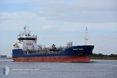
NORDIC SUND
Oil/Chemical Tanker
Current Trip
| Time Travelled | 1 day |
|---|---|
| Remaining Time | 5 h, 10 mins |
| Distance Travelled | 390.31 nm |
| Remaining Distance | 42.06 nm |
| AVG Speed | 10.4 Knopen |
| MAX Speed | 12.8 Knopen |
| AVG Wind | 11.3 knots |
| MAX Wind | 18.3 knots |
| MIN Temp | 4.1°C / 39.38°F |
| MAX Temp | 6.9°C / 44.42°F |
| Diepgang | 4.8 M |
| Positie ontvangen | 1 m geleden |
Current Position
| Lengtegraad | 10.79875° |
|---|---|
| Breedtegraat | 57.92735° |
| Status | Under way using engine |
| Snelheid | 7.6 Knopen |
| Koers | 87° |
| Gebied | Skaggerak |
| Station | T-AIS |
| Positie ontvangen | 1 m geleden |
Info
Information
The current position of NORDIC SUND is in Skaggerak with coordinates 57.92735° / 10.79875° as reported on 2024-04-18 06:26 by AIS to our vessel tracker app. The vessel's current speed is 7.6 Knopen and is heading at the port of STENUNGSUND. The estimated time of arrival as calculated by MyShipTracking vessel tracking app is 2024-04-18 11:37 LT
The vessel NORDIC SUND (IMO: 9375977, MMSI: 258714000) is a Oil/Chemical Tanker that was built in 2007 ( 17 Jaar oud ). It's sailing under the flag of [NO] Norway.
In this page you can find informations about the vessels current position, last detected port calls, and current voyage information. If the vessels is not in coverage by AIS you will find the latest position.
The current position of NORDIC SUND is detected by our AIS receivers and we are not responsible for the reliability of the data. The last position was recorded while the vessel was in Coverage by the Ais receivers of our vessel tracking app.
The current draught of NORDIC SUND as reported by AIS is 4.8 meters
Weather
| Temperature | 4.3°C / 39.74°F |
|---|---|
| Wind Speed | 13 knots |
| Direction | 23° NNE |
| Pressure | 1014.3 hPa |
| Humidity | 75.7 % |
| Cloud Coverage | 16 % |
Featured Company
Last Port Calls
| Port | Arrival | Departure | Time In Port |
|---|---|---|---|
| 2024-04-16 06:20 | 2024-04-16 16:54 | 10 h | |
| 2024-04-13 19:48 | 2024-04-14 18:42 | 22 h | |
| 2024-04-10 14:17 | 2024-04-11 16:52 | 1 d | |
| 2024-04-06 20:28 | 2024-04-09 19:36 | 2 d | |
| 2024-04-02 13:51 | 2024-04-03 12:25 | 22 h | |
| 2024-03-30 18:19 | 2024-03-30 19:09 | 50 m | |
| 2024-03-27 16:33 | 2024-03-30 17:09 | 3 d | |
| 2024-03-23 19:28 | 2024-03-24 16:22 | 20 h | |
| 2024-03-22 23:47 | 2024-03-23 00:53 | 1 h | |
| 2024-03-21 07:08 | 2024-03-22 08:09 | 1 d |
Most Visited Ports (Last year)
| Port | Arrivals | |
|---|---|---|
| 9 | ||
| 9 | ||
| 7 | ||
| 6 | ||
| 5 | ||
| 5 |
Last Trips
| Origin | Departure | Destination | Arrival | Distance | |
|---|---|---|---|---|---|
| 2024-04-14 19:42 | 2024-04-16 08:20 | 373.91 nm | |||
| 2024-04-11 18:52 | 2024-04-13 20:48 | 460.65 nm | |||
| 2024-04-09 21:36 | 2024-04-10 16:17 | 166.17 nm | |||
| 2024-04-03 13:25 | 2024-04-06 22:28 | 622.38 nm | |||
| 2024-03-30 20:09 | 2024-04-02 14:51 | 631.04 nm | |||
| 2024-03-30 18:09 | 2024-03-30 19:19 | 4.59 nm | |||
| 2024-03-24 17:22 | 2024-03-27 17:33 | 499.98 nm | |||
| 2024-03-23 01:53 | 2024-03-23 20:28 | 184.03 nm | |||
| 2024-03-22 09:09 | 2024-03-23 00:47 | 125.32 nm | |||
| 2024-03-12 05:39 | 2024-03-21 08:08 | 1438.69 nm |
Events
| Tijd | Evenement | Details | Positie / Bestemming | Info |
|---|---|---|---|---|
| 2024-04-18 01:11 | Gevonden in zee | Danish part of the Skaggerak |
57.91801 / 9.27632
Skaggerak
STENUNGSUND
|
Snelheid: 11.4 kn Koers: 89.5° |
| 2024-04-17 19:50 | Gevonden in zee | Norwegian part of the Skaggerak |
57.69425 / 7.55702
Skaggerak
STENUNGSUND
|
Snelheid: 11.3 kn Koers: 90.8° |
| 2024-04-17 04:25 | Draught Changed | 4.8 5.1 |
59.33395 / 4.02015
STENUNGSUND
|
Snelheid: 10.9 kn Koers: 178.2° |
| 2024-04-17 04:06 | Destination Changed | STENUNGSUND MONGSTAD |
59.38572 / 4.01744
STENUNGSUND
|
Snelheid: 10.8 kn Koers: 178.2° |
| 2024-04-17 04:06 | ETA Changed | 2024/04/18 09:00 2024/04/16 04:30 |
59.38572 / 4.01744
STENUNGSUND
|
Snelheid: 10.8 kn Koers: 178.2° |
| 2024-04-16 16:54 | Start beweging | 2.25 nm, South East of MONGSTAD |
60.79594 / 5.08025
MONGSTAD
|
Snelheid: 10.3 kn Koers: 8° |
| 2024-04-16 16:54 | Vertrekhaven |
|
60.79594 / 5.08025
MONGSTAD
|
Snelheid: 5.6 kn Koers: 56° |
| 2024-04-16 16:44 | Status Changed | Under way using engine Moored |
60.79272 / 5.07057
[NO] MONGSTAD
|
Snelheid: Koers: 142° |
| 2024-04-16 12:02 | Status Changed | Moored Default |
60.79269 / 5.07050
[NO] MONGSTAD
|
Snelheid: Koers: 142° |
| 2024-04-16 11:53 | Status Changed | Default Moored |
60.79271 / 5.07049
[NO] MONGSTAD
|
Snelheid: Koers: 141° |