
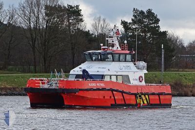
NJORD PETREL
High speed craft
Current Trip
KLINTHOLM
| Time Travelled | 57 days |
|---|---|
| Remaining Time | --- |
| Distance Travelled | 2449.03 nm |
| Remaining Distance | --- |
| AVG Speed | 16.5 Knopen |
| MAX Speed | 16.5 Knopen |
| AVG Wind | 12.2 knots |
| MAX Wind | 25 knots |
| MIN Temp | 0.9°C / 33.62°F |
| MAX Temp | 10.5°C / 50.9°F |
| Diepgang | 1.6 M |
| Positie ontvangen | Nu |
Current Position
| Lengtegraad | 12.46738° |
|---|---|
| Breedtegraat | 54.95280° |
| Status | Under way using engine |
| Snelheid | |
| Koers | 199° |
| Gebied | Baltic Sea |
| Station | T-AIS |
| Positie ontvangen | Nu |
Info
Information
The current position of NJORD PETREL is in Baltic Sea with coordinates 54.95280° / 12.46738° as reported on 2024-04-19 11:32 by AIS to our vessel tracker app. The vessel's current speed is 0 Knopen
The vessel NJORD PETREL (MMSI: 235095777) is a High speed craft It's sailing under the flag of [GB] United Kingdom.
In this page you can find informations about the vessels current position, last detected port calls, and current voyage information. If the vessels is not in coverage by AIS you will find the latest position.
The current position of NJORD PETREL is detected by our AIS receivers and we are not responsible for the reliability of the data. The last position was recorded while the vessel was in Coverage by the Ais receivers of our vessel tracking app.
The current draught of NJORD PETREL as reported by AIS is 1.6 meters
Weather
| Temperature | 4°C / 39.2°F |
|---|---|
| Wind Speed | 10 knots |
| Direction | 175° S |
| Pressure | 1000.4 hPa |
| Humidity | 96.4 % |
| Cloud Coverage | 100 % |
Featured Company
Events
| Tijd | Evenement | Details | Positie / Bestemming | Info |
|---|---|---|---|---|
| 2024-04-19 07:43 | Stop beweging | 14.6 nm, East of BOGOE HAVN |
54.95278 / 12.46640
KLINTHOLM
|
Snelheid: 0.2 kn Koers: 74° |
| 2024-04-19 06:37 | Wijzig zee gebeid | Danish part of the Baltic Sea German part of the Baltic Sea |
54.97255 / 13.10113
Baltic Sea
|
Snelheid: 23.1 kn Koers: 247.5° |
| 2024-04-19 06:34 | Start beweging |
54.97402 / 13.14080
KLINTHOLM
|
Snelheid: 19.7 kn Koers: 288.7° |
|
| 2024-04-19 06:20 | Stop beweging |
54.97325 / 13.14442
KLINTHOLM
|
Snelheid: 0.3 kn Koers: 239° |
|
| 2024-04-19 06:10 | Wijzig zee gebeid | German part of the Baltic Sea Danish part of the Baltic Sea |
54.97067 / 13.10580
Baltic Sea
|
Snelheid: 21.4 kn Koers: 90.1° |
| 2024-04-19 05:05 | Start beweging | 14.52 nm, East of BOGOE HAVN |
54.95191 / 12.46451
KLINTHOLM
|
Snelheid: 4.4 kn Koers: 266.1° |
| 2024-04-18 15:10 | Stop beweging | 14.63 nm, East of BOGOE HAVN |
54.95281 / 12.46731
KLINTHOLM
|
Snelheid: 0.3 kn Koers: 170° |
| 2024-04-18 14:08 | Wijzig zee gebeid | Danish part of the Baltic Sea German part of the Baltic Sea |
54.96034 / 13.07664
Baltic Sea
|
Snelheid: 24 kn Koers: 255.8° |
| 2024-04-18 14:01 | Start beweging |
54.96799 / 13.15499
KLINTHOLM
|
Snelheid: 14.6 kn Koers: 266.7° |
|
| 2024-04-18 13:45 | Stop beweging |
54.96766 / 13.15833
KLINTHOLM
|
Snelheid: 0.3 kn Koers: 242° |