
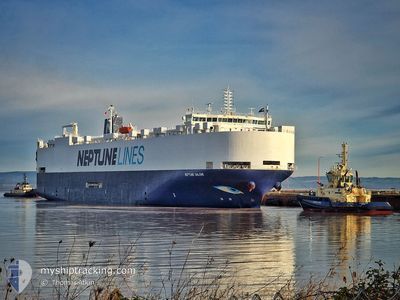
NEPTUNE GALENE
Vehicles Carrier
Current Trip
MAPTM
| Time Travelled | 25 days |
|---|---|
| Remaining Time | --- |
| Distance Travelled | 9624.96 nm |
| Remaining Distance | --- |
| AVG Speed | 15.5 Knopen |
| MAX Speed | 20.3 Knopen |
| AVG Wind | 12.7 knots |
| MAX Wind | 25.9 knots |
| MIN Temp | 8.1°C / 46.58°F |
| MAX Temp | 29.6°C / 85.28°F |
| Diepgang | 8.3 M |
| Positie ontvangen | 3 d geleden |
Current Position
| Lengtegraad | 17.90091° |
|---|---|
| Breedtegraat | -34.36835° |
| Status | Under way using engine |
| Snelheid | 16.3 Knopen |
| Koers | 325.8° |
| Gebied | South Atlantic Ocean |
| Station | T-AIS |
| Positie ontvangen | 3 d geleden |
Info
Information
The current position of NEPTUNE GALENE is in South Atlantic Ocean with coordinates -34.36835° / 17.90091° as reported on 2024-04-16 12:14 by AIS to our vessel tracker app. The vessel's current speed is 16.3 Knopen
The vessel NEPTUNE GALENE (IMO: 9668491, MMSI: 241298000) is a Vehicles Carrier that was built in 2014 ( 10 Jaar oud ). It's sailing under the flag of [GR] Greece.
In this page you can find informations about the vessels current position, last detected port calls, and current voyage information. If the vessels is not in coverage by AIS you will find the latest position.
The current position of NEPTUNE GALENE is detected by our AIS receivers and we are not responsible for the reliability of the data. The last position was recorded while the vessel was in Coverage by the Ais receivers of our vessel tracking app.
The current draught of NEPTUNE GALENE as reported by AIS is 8.3 meters
Weather
| Temperature | 24.2°C / 75.56°F |
|---|---|
| Wind Speed | 13 knots |
| Direction | 141° SE |
| Pressure | 1013.4 hPa |
| Humidity | 85.5 % |
| Cloud Coverage | 20 % |
Featured Company
Last Port Calls
| Port | Arrival | Departure | Time In Port |
|---|---|---|---|
| 2024-03-25 21:51 | 2024-03-26 04:46 | 6 h | |
| 2024-03-23 21:08 | 2024-03-25 07:13 | 1 d | |
| 2024-02-17 00:03 | 2024-02-17 02:45 | 2 h | |
| 2024-02-15 22:52 | 2024-02-16 16:52 | 18 h | |
| 2024-02-14 15:05 | 2024-02-15 16:38 | 1 d | |
| 2024-02-13 07:52 | 2024-02-13 13:22 | 5 h | |
| 2024-02-12 01:12 | 2024-02-12 22:00 | 20 h | |
| 2024-02-11 05:23 | 2024-02-11 14:17 | 8 h | |
| 2024-02-10 10:10 | 2024-02-10 18:08 | 7 h | |
| 2024-02-06 11:43 | 2024-02-06 18:58 | 7 h |
Last Trips
| Origin | Departure | Destination | Arrival | Distance | |
|---|---|---|---|---|---|
| 2024-03-25 16:13 | 2024-03-26 06:51 | 79.00 nm | |||
| 2024-02-17 03:45 | 2024-03-24 06:08 | 13077.54 nm | |||
| 2024-02-16 17:52 | 2024-02-17 01:03 | 84.78 nm | |||
| 2024-02-15 17:38 | 2024-02-15 23:52 | 78.35 nm | |||
| 2024-02-13 14:22 | 2024-02-14 16:05 | 412.18 nm | |||
| 2024-02-12 23:00 | 2024-02-13 08:52 | 162.52 nm | |||
| 2024-02-11 15:17 | 2024-02-12 02:12 | 159.92 nm | |||
| 2024-02-10 19:08 | 2024-02-11 06:23 | 110.80 nm | |||
| 2024-02-06 21:58 | 2024-02-10 11:10 | 1359.97 nm | |||
| 2024-02-06 08:32 | 2024-02-06 14:43 | 68.03 nm |
Events
| Tijd | Evenement | Details | Positie / Bestemming | Info |
|---|---|---|---|---|
| 2024-04-16 12:20 | Status Changed | Default Under way using engine |
-34.34680 / 17.88359
MAPTM
|
Snelheid: 16.3 kn Koers: 325.8° |
| 2024-04-16 12:14 | Buitenbereik |
-34.36835 / 17.90091
South Atlantic Ocean
|
Snelheid: 16.3 kn Koers: 325.8° |
|
| 2024-04-16 12:12 | Status Changed | Under way using engine Default |
-34.37668 / 17.90775
MAPTM
|
Snelheid: 16 kn Koers: 327° |
| 2024-04-16 11:49 | Status Changed | Default Under way using engine |
-34.46823 / 17.98023
MAPTM
|
Snelheid: 17.3 kn Koers: 325° |
| 2024-04-16 11:42 | Status Changed | Under way using engine Default |
-34.49666 / 18.00309
MAPTM
|
Snelheid: 17 kn Koers: 323° |
| 2024-04-16 11:34 | Status Changed | Default Under way using engine |
-34.52833 / 18.03167
MAPTM
|
Snelheid: 17.3 kn Koers: 325.7° |
| 2024-04-16 11:29 | Status Changed | Under way using engine Default |
-34.54802 / 18.04756
MAPTM
|
Snelheid: 17 kn Koers: 304° |
| 2024-04-16 11:07 | Status Changed | Default Under way using engine |
-34.61395 / 18.15140
MAPTM
|
Snelheid: 17.6 kn Koers: 301.6° |
| 2024-04-16 10:57 | Status Changed | Under way using engine Default |
-34.63418 / 18.20187
MAPTM
|
Snelheid: 17.3 kn Koers: 296° |
| 2024-04-16 10:46 | Status Changed | Default Under way using engine |
-34.65833 / 18.26333
MAPTM
|
Snelheid: 17.8 kn Koers: 295.2° |