
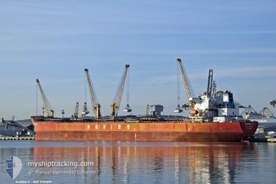
GLORIA G
Bulk Carrier
Current Trip
| Time Travelled | 27 days |
|---|---|
| Remaining Time | 6 h, 44 mins |
| Distance Travelled | 4908.62 nm |
| Remaining Distance | 225.73 nm |
| AVG Speed | 10.5 Knopen |
| MAX Speed | 19.4 Knopen |
| AVG Wind | 8.6 knots |
| MAX Wind | 26.8 knots |
| MIN Temp | 11.3°C / 52.34°F |
| MAX Temp | 30.1°C / 86.18°F |
| Diepgang | 7.7 M |
| Positie ontvangen | 13 h, 30 m geleden |
Current Position
| Lengtegraad | 29.28895° |
|---|---|
| Breedtegraat | 41.49285° |
| Status | Under way using engine |
| Snelheid | 11.4 Knopen |
| Koers | 13.2° |
| Gebied | Black Sea |
| Station | T-AIS |
| Positie ontvangen | 13 h, 30 m geleden |
Info
Information
The current position of GLORIA G is in Black Sea with coordinates 41.49285° / 29.28895° as reported on 2024-04-18 12:51 by AIS to our vessel tracker app. The vessel's current speed is 11.4 Knopen and is heading at the port of SULINA. The estimated time of arrival as calculated by MyShipTracking vessel tracking app is 2024-04-19 09:05 LT
The vessel GLORIA G (IMO: 9305099, MMSI: 636013655) is a Bulk Carrier that was built in 2006 ( 18 Jaar oud ). It's sailing under the flag of [LR] Liberia.
In this page you can find informations about the vessels current position, last detected port calls, and current voyage information. If the vessels is not in coverage by AIS you will find the latest position.
The current position of GLORIA G is detected by our AIS receivers and we are not responsible for the reliability of the data. The last position was recorded while the vessel was in Coverage by the Ais receivers of our vessel tracking app.
The current draught of GLORIA G as reported by AIS is 7.7 meters
Weather
| Temperature | 11.5°C / 52.7°F |
|---|---|
| Wind Speed | 14 knots |
| Direction | 347° NNW |
| Pressure | 1005.6 hPa |
| Humidity | 87.2 % |
| Cloud Coverage | 88 % |
Featured Company
Last Port Calls
| Port | Arrival | Departure | Time In Port |
|---|---|---|---|
| 2024-04-13 03:50 | 2024-04-13 13:09 | 9 h | |
| 2024-03-22 20:15 |
Last Trips
| Origin | Departure | Destination | Arrival | Distance | |
|---|---|---|---|---|---|
| 2024-03-23 01:45 | 2024-04-13 05:50 | 3921.26 nm |
Events
| Tijd | Evenement | Details | Positie / Bestemming | Info |
|---|---|---|---|---|
| 2024-04-18 12:51 | Buitenbereik |
41.49285 / 29.28895
Black Sea
RO SULINA
|
Snelheid: 11.4 kn Koers: 13.2° |
|
| 2024-04-18 11:20 | Wijzig zee gebeid | Turkish part of the Black Sea Turkish part of the Sea of Marmara |
41.23262 / 29.14814
Black Sea
RO SULINA
|
Snelheid: 11.1 kn Koers: 44.7° |
| 2024-04-18 09:39 | Destination Changed | RO SULINA PIVDENYI |
41.00267 / 28.99732
RO SULINA
|
Snelheid: 9.2 kn Koers: 7.1° |
| 2024-04-18 09:39 | ETA Changed | 2024/04/19 04:50 2024/04/21 04:50 |
41.00267 / 28.99732
RO SULINA
|
Snelheid: 9.2 kn Koers: 7.1° |
| 2024-04-18 07:51 | Start beweging | 7.83 nm, South West of MALTEPE |
40.80687 / 29.03271
PIVDENYI
|
Snelheid: 3.5 kn Koers: 146° |
| 2024-04-17 21:37 | Stop beweging | 10.33 nm, South East of YESILKOY |
40.80778 / 28.94260
PIVDENYI
|
Snelheid: 0.3 kn Koers: 7° |
| 2024-04-17 20:37 | Start beweging | 13.15 nm, South of YESILKOY |
40.75162 / 28.93227
PIVDENYI
|
Snelheid: 3.1 kn Koers: 135° |
| 2024-04-17 12:53 | Stop beweging | 9.04 nm, South West of MALTEPE |
40.83053 / 28.96377
PIVDENYI
|
Snelheid: 0.3 kn Koers: 1° |
| 2024-04-17 10:24 | ETA Changed | 2024/04/21 04:50 2024/04/17 04:50 |
40.79084 / 28.96741
PIVDENYI
|
Snelheid: 0.9 kn Koers: 93° |
| 2024-04-16 22:27 | Destination Changed | PIVDENYI CANAKKALE |
40.63458 / 27.36681
PIVDENYI
|
Snelheid: 12 kn Koers: 66.7° |