
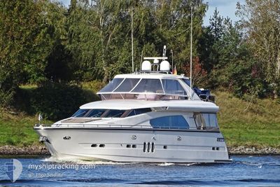
MY ELEGANCE
Pleasure Craft
Current Trip
| Trip Time | 19 days |
|---|---|
| Trip Distance | 704.11 nm |
| AVG Speed | 7.9 Knopen |
| MAX Speed | 9.8 Knopen |
| Diepgang | --- |
| AVG Wind | 8.3 knots |
| MAX Wind | 9.7 knots |
| MIN Temp | 8.7°C / 47.66°F |
| MAX Temp | 13.1°C / 55.58°F |
| Positie ontvangen | 6 h, 55 m geleden |
Current Position
| Lengtegraad | 16.25100° |
|---|---|
| Breedtegraat | 43.51566° |
| Status | Default |
| Snelheid | |
| Koers | --- |
| Gebied | Adriatic Sea |
| Station | T-AIS |
| Positie ontvangen | 6 h, 55 m geleden |
Info
Information
The current position of MY ELEGANCE is in Adriatic Sea with coordinates 43.51566° / 16.25100° as reported on 2024-04-25 10:36 by AIS to our vessel tracker app. The vessel's current speed is 0 Knopen and is currently inside the port of TROGIR.
The vessel MY ELEGANCE (MMSI: 211221520) is a Pleasure Craft It's sailing under the flag of [DE] Germany.
In this page you can find informations about the vessels current position, last detected port calls, and current voyage information. If the vessels is not in coverage by AIS you will find the latest position.
The current position of MY ELEGANCE is detected by our AIS receivers and we are not responsible for the reliability of the data. The last position was recorded while the vessel was in Coverage by the Ais receivers of our vessel tracking app.
Weather
| Temperature | 13.1°C / 55.58°F |
|---|---|
| Wind Speed | 7 knots |
| Direction | 221° SW |
| Pressure | 1008.2 hPa |
| Humidity | 57.2 % |
| Cloud Coverage | 8 % |
Featured Company
Last Port Calls
| Port | Arrival | Departure | Time In Port |
|---|---|---|---|
| 2024-04-25 10:32 | |||
| 2024-03-31 17:02 | 2024-04-06 05:20 | 5 d | |
| 2024-03-30 17:46 | 2024-03-31 05:56 | 12 h | |
| 2024-03-30 11:13 |
Most Visited Ports (Last year)
| Port | Arrivals | |
|---|---|---|
| 2 | ||
| 2 | ||
| 2 | ||
| 2 | ||
| 1 | ||
| 1 |
Last Trips
| Origin | Departure | Destination | Arrival | Distance | |
|---|---|---|---|---|---|
| 2024-04-06 07:20 | 2024-04-25 12:32 | 704.11 nm | |||
| 2024-03-31 07:56 | 2024-03-31 19:02 | 65.08 nm | |||
| 2024-03-30 12:13 | 2024-03-30 18:46 | 60.65 nm |
Events
| Tijd | Evenement | Details | Positie / Bestemming | Info |
|---|---|---|---|---|
| 2024-04-25 10:36 | Buitenbereik |
43.51566 / 16.25100
Adriatic Sea
[HR] TROGIR
|
Snelheid: Koers: 359.9° |
|
| 2024-04-25 10:32 | Stop beweging |
43.51565 / 16.25100
[HR] TROGIR
|
Snelheid: Koers: 511° |
|
| 2024-04-25 10:32 | Aankomsthaven |
|
43.51565 / 16.25100
[HR] TROGIR
|
Snelheid: 1.1 kn Koers: 511° |
| 2024-04-25 09:53 | Gevonden in zee | Croatian part of the Adriatic Sea |
43.47501 / 16.23931
Adriatic Sea
|
Snelheid: 9.8 kn Koers: 267.3° |
| 2024-04-25 09:53 | Binnenbereik |
43.47501 / 16.23931
Adriatic Sea
|
Snelheid: 9.8 kn Koers: 267.3° |