
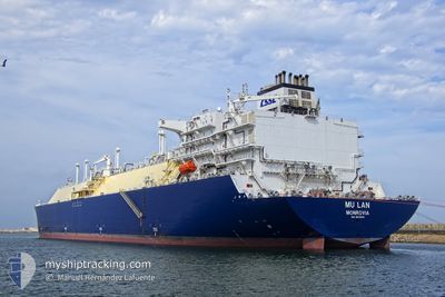
MU LAN
Tanker
Current Trip
FOR ORDERS
| Time Travelled | 44 days |
|---|---|
| Remaining Time | --- |
| Distance Travelled | 9328.42 nm |
| Remaining Distance | --- |
| AVG Speed | 10.7 Knopen |
| MAX Speed | 21.5 Knopen |
| AVG Wind | 16.1 knots |
| MAX Wind | 41 knots |
| MIN Temp | 7.3°C / 45.14°F |
| MAX Temp | 31.1°C / 87.98°F |
| Diepgang | 9.3 M |
| Positie ontvangen | 21 h, 30 m geleden |
Current Position
| Lengtegraad | 76.36709° |
|---|---|
| Breedtegraat | 6.86678° |
| Status | Under way using engine |
| Snelheid | 15.8 Knopen |
| Koers | 302.9° |
| Gebied | Laccadive Sea |
| Station | T-AIS |
| Positie ontvangen | 21 h, 30 m geleden |
Info
Information
The current position of MU LAN is in Laccadive Sea with coordinates 6.86678° / 76.36709° as reported on 2024-04-24 00:52 by AIS to our vessel tracker app. The vessel's current speed is 15.8 Knopen
The vessel MU LAN (IMO: 9878876, MMSI: 636021030) is a Tanker It's sailing under the flag of [LR] Liberia.
In this page you can find informations about the vessels current position, last detected port calls, and current voyage information. If the vessels is not in coverage by AIS you will find the latest position.
The current position of MU LAN is detected by our AIS receivers and we are not responsible for the reliability of the data. The last position was recorded while the vessel was in Coverage by the Ais receivers of our vessel tracking app.
The current draught of MU LAN as reported by AIS is 9.3 meters
Weather
| Temperature | 29.2°C / 84.56°F |
|---|---|
| Wind Speed | 5 knots |
| Direction | 342° NNW |
| Pressure | 1006.1 hPa |
| Humidity | 68.8 % |
| Cloud Coverage | 20 % |
Featured Company
Most Visited Ports (Last year)
| Port | Arrivals | |
|---|---|---|
| 3 | ||
| 2 | ||
| 2 | ||
| 1 | ||
| 1 | ||
| 1 |
Events
| Tijd | Evenement | Details | Positie / Bestemming | Info |
|---|---|---|---|---|
| 2024-04-24 01:04 | Status Changed | Default Under way using engine |
6.89603 / 76.32194
FOR ORDERS
|
Snelheid: 15.8 kn Koers: 302.9° |
| 2024-04-24 00:52 | Status Changed | Under way using engine Default |
6.86678 / 76.36709
FOR ORDERS
|
Snelheid: 15.7 kn Koers: 302° |
| 2024-04-24 00:52 | Buitenbereik |
6.86678 / 76.36709
Laccadive Sea
FOR ORDERS
|
Snelheid: 15.8 kn Koers: 302.9° |
|
| 2024-04-24 00:19 | Status Changed | Default Under way using engine |
6.78833 / 76.48756
FOR ORDERS
|
Snelheid: 15.4 kn Koers: 303.2° |
| 2024-04-23 23:53 | Status Changed | Under way using engine Default |
6.72867 / 76.57965
FOR ORDERS
|
Snelheid: 15.5 kn Koers: 302° |
| 2024-04-23 23:49 | Binnenbereik |
6.72867 / 76.57965
Laccadive Sea
FOR ORDERS
|
Snelheid: 15.5 kn Koers: 303.9° |
|
| 2024-04-23 22:55 | Status Changed | Default Under way using engine |
6.58079 / 76.78242
FOR ORDERS
|
Snelheid: 15.4 kn Koers: 292.8° |
| 2024-04-23 22:48 | Status Changed | Under way using engine Default |
6.57080 / 76.81021
FOR ORDERS
|
Snelheid: 15.5 kn Koers: 296° |
| 2024-04-23 22:48 | Buitenbereik |
6.57080 / 76.81021
Laccadive Sea
FOR ORDERS
|
Snelheid: 15.4 kn Koers: 292.8° |
|
| 2024-04-23 22:21 | Status Changed | Default Under way using engine |
6.51581 / 76.91202
FOR ORDERS
|
Snelheid: 15.6 kn Koers: 291° |