
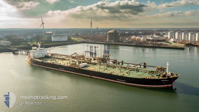
MT SAMURAI
Crude Oil Tanker
Current Trip
ZOUSHAN,CHINA
| Time Travelled | --- |
|---|---|
| Remaining Time | --- |
| Distance Travelled | 2432.20 nm |
| Remaining Distance | --- |
| AVG Speed | 10.5 Knopen |
| MAX Speed | 14.3 Knopen |
| AVG Wind | 10.1 knots |
| MAX Wind | 31.7 knots |
| MIN Temp | 5.2°C / 41.36°F |
| MAX Temp | 29.7°C / 85.46°F |
| Diepgang | 8.6 M |
| Positie ontvangen | 2024-02-21 19:23 |
Current Position
| Lengtegraad | 104.38920° |
|---|---|
| Breedtegraat | 1.32977° |
| Status | Under way using engine |
| Snelheid | 10 Knopen |
| Koers | 46° |
| Gebied | South China Sea |
| Station | T-AIS |
| Positie ontvangen | 2024-02-21 19:23 |
Info
Information
The current position of MT SAMURAI is in South China Sea with coordinates 1.32977° / 104.38920° as reported on 2024-02-21 19:23 by AIS to our vessel tracker app. The vessel's current speed is 10 Knopen
The vessel MT SAMURAI (IMO: 9378876, MMSI: 636013852) is a Crude Oil Tanker that was built in 2009 ( 15 Jaar oud ). It's sailing under the flag of [LR] Liberia.
In this page you can find informations about the vessels current position, last detected port calls, and current voyage information. If the vessels is not in coverage by AIS you will find the latest position.
The current position of MT SAMURAI is detected by our AIS receivers and we are not responsible for the reliability of the data. The last position was recorded while the vessel was in Coverage by the Ais receivers of our vessel tracking app.
The current draught of MT SAMURAI as reported by AIS is 8.6 meters
Weather
| Temperature | 28.9°C / 84.02°F |
|---|---|
| Wind Speed | 5 knots |
| Direction | 51° NE |
| Pressure | 1008.3 hPa |
| Humidity | 71.6 % |
| Cloud Coverage | 44 % |
Featured Company
Last Port Calls
| Port | Arrival | Departure | Time In Port |
|---|---|---|---|
| 2024-02-05 01:48 | 2024-02-06 01:43 | 23 h | |
| 2024-02-02 23:26 |
Most Visited Ports (Last year)
| Port | Arrivals | |
|---|---|---|
| 4 | ||
| 1 | ||
| 1 | ||
| 1 | ||
| 1 | ||
| 1 |
Last Trips
| Origin | Departure | Destination | Arrival | Distance | |
|---|---|---|---|---|---|
| 2024-02-03 03:26 | 2024-02-05 04:48 | 470.77 nm |
Events
| Tijd | Evenement | Details | Positie / Bestemming | Info |
|---|---|---|---|---|
| 2024-04-17 09:00 | Start beweging | 7.59 nm, South of JINHAI HEAVY INDUSTR |
30.12873 / 122.25010
ZOUSHAN,CHINA
|
Snelheid: 3.5 kn Koers: 135° |
| 2024-04-16 07:59 | Stop beweging | 7.16 nm, South of JINHAI HEAVY INDUSTR |
30.13590 / 122.24371
ZOUSHAN,CHINA
|
Snelheid: 0.2 kn Koers: 120° |
| 2024-04-16 06:15 | Start beweging | 9.39 nm, South East of JINHAI HEAVY INDUSTR |
30.13468 / 122.36477
ZOUSHAN,CHINA
|
Snelheid: 3.4 kn Koers: 227° |
| 2024-04-16 05:07 | Stop beweging | 9.21 nm, South East of JINHAI HEAVY INDUSTR |
30.13823 / 122.36428
ZOUSHAN,CHINA
|
Snelheid: 0.1 kn Koers: 94° |
| 2024-04-15 21:26 | Start beweging |
29.94393 / 123.02337
ZOUSHAN,CHINA
|
Snelheid: 3.6 kn Koers: 180° |
|
| 2024-04-15 21:14 | Stop beweging |
29.95083 / 123.02645
ZOUSHAN,CHINA
|
Snelheid: Koers: 195° |
|
| 2024-04-15 07:34 | Start beweging | 11.89 nm, North East of JINTANG |
30.16083 / 122.04480
ZOUSHAN,CHINA
|
Snelheid: 3.7 kn Koers: 85° |