
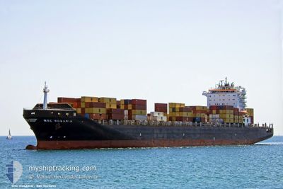
MSC ROSARIA
Container Ship
Current Trip
| Time Travelled | 5 days |
|---|---|
| Remaining Time | --- |
| Distance Travelled | 2232.24 nm |
| Remaining Distance | --- |
| AVG Speed | 16.6 Knopen |
| MAX Speed | 18 Knopen |
| AVG Wind | 16.5 knots |
| MAX Wind | 31.1 knots |
| MIN Temp | 7.2°C / 44.96°F |
| MAX Temp | 17.5°C / 63.5°F |
| Diepgang | 12.4 M |
| Positie ontvangen | 4 d geleden |
Current Position
| Lengtegraad | -24.03347° |
|---|---|
| Breedtegraat | 41.03128° |
| Status | Under way using engine |
| Snelheid | 17 Knopen |
| Koers | 281.1° |
| Gebied | North Atlantic Ocean |
| Station | T-AIS |
| Positie ontvangen | 4 d geleden |
Info
Information
The current position of MSC ROSARIA is in North Atlantic Ocean with coordinates 41.03128° / -24.03347° as reported on 2024-04-15 20:45 by AIS to our vessel tracker app. The vessel's current speed is 17 Knopen and is heading at the port of BOSTON. The estimated time of arrival as calculated by MyShipTracking vessel tracking app is 2024-04-21 10:00 LT
The vessel MSC ROSARIA (IMO: 9320453, MMSI: 372737000) is a Container Ship that was built in 2007 ( 17 Jaar oud ). It's sailing under the flag of [PA] Panama.
In this page you can find informations about the vessels current position, last detected port calls, and current voyage information. If the vessels is not in coverage by AIS you will find the latest position.
The current position of MSC ROSARIA is detected by our AIS receivers and we are not responsible for the reliability of the data. The last position was recorded while the vessel was in Coverage by the Ais receivers of our vessel tracking app.
The current draught of MSC ROSARIA as reported by AIS is 12.4 meters
Weather
| Temperature | 9.5°C / 49.1°F |
|---|---|
| Wind Speed | 19 knots |
| Direction | 351° N |
| Pressure | 1016.6 hPa |
| Humidity | 82.7 % |
| Cloud Coverage | 100 % |
Featured Company
Last Port Calls
| Port | Arrival | Departure | Time In Port |
|---|---|---|---|
| 2024-04-13 01:44 | 2024-04-14 01:47 | 1 d | |
| 2024-04-08 01:27 | 2024-04-08 11:37 | 10 h | |
| 2024-04-02 08:31 | 2024-04-03 01:44 | 17 h | |
| 2024-03-31 05:27 | 2024-03-31 20:06 | 14 h | |
| 2024-03-29 15:51 | 2024-03-30 13:38 | 21 h | |
| 2024-03-28 17:17 | 2024-03-29 07:50 | 14 h | |
| 2024-03-24 18:13 | 2024-03-26 08:41 | 1 d | |
| 2024-03-08 21:20 | 2024-03-10 18:01 | 1 d | |
| 2024-03-04 14:54 | 2024-03-04 15:01 | 7 m | |
| 2024-03-03 18:05 | 2024-03-04 14:40 | 20 h |
Most Visited Ports (Last year)
| Port | Arrivals | |
|---|---|---|
| 6 | ||
| 5 | ||
| 4 | ||
| 4 | ||
| 4 | ||
| 4 |
Last Trips
| Origin | Departure | Destination | Arrival | Distance | |
|---|---|---|---|---|---|
| 2024-04-08 13:37 | 2024-04-13 02:44 | 1317.54 nm | |||
| 2024-04-03 04:44 | 2024-04-08 03:27 | 1439.47 nm | |||
| 2024-03-31 23:06 | 2024-04-02 11:31 | 630.45 nm | |||
| 2024-03-30 16:38 | 2024-03-31 08:27 | 214.39 nm | |||
| 2024-03-29 10:50 | 2024-03-29 18:51 | 110.53 nm | |||
| 2024-03-26 09:41 | 2024-03-28 20:17 | 897.30 nm | |||
| 2024-03-10 14:01 | 2024-03-24 19:13 | 5370.23 nm | |||
| 2024-03-04 10:01 | 2024-03-08 16:20 | 124.72 nm | |||
| 2024-03-04 09:40 | 2024-03-04 09:54 | 0.39 nm | |||
| 2024-03-03 12:53 | 2024-03-03 13:05 | 0.76 nm |
Events
| Tijd | Evenement | Details | Positie / Bestemming | Info |
|---|---|---|---|---|
| 2024-04-15 20:52 | Status Changed | Default Under way using engine |
41.03833 / -24.07500
BOSTON
|
Snelheid: 17 kn Koers: 281.1° |
| 2024-04-15 20:45 | Buitenbereik |
41.03128 / -24.03347
North Atlantic Ocean
BOSTON
|
Snelheid: 17 kn Koers: 281.1° |
|
| 2024-04-15 20:44 | Wijzig zee gebeid | Portuguese (Azores) part of the North Atlantic Ocean High seas of the North Atlantic Ocean |
41.02961 / -24.02219
North Atlantic Ocean
BOSTON
|
Snelheid: 17.1 kn Koers: 282.9° |
| 2024-04-15 20:42 | Status Changed | Under way using engine Default |
41.02774 / -24.00983
BOSTON
|
Snelheid: 17 kn Koers: 280° |
| 2024-04-15 20:28 | Binnenbereik |
41.02961 / -24.02219
North Atlantic Ocean
BOSTON
|
Snelheid: 17.1 kn Koers: 282.9° |
|
| 2024-04-15 02:19 | Status Changed | Default Under way using engine |
39.89500 / -17.32667
BOSTON
|
Snelheid: 17.2 kn Koers: 283.4° |
| 2024-04-15 02:11 | Status Changed | Under way using engine Default |
39.88604 / -17.27775
BOSTON
|
Snelheid: 17 kn Koers: 284° |
| 2024-04-15 02:11 | Buitenbereik |
39.88604 / -17.27775
North Atlantic Ocean
BOSTON
|
Snelheid: 17.2 kn Koers: 283.4° |
|
| 2024-04-15 01:56 | Status Changed | Default Under way using engine |
39.87021 / -17.18881
BOSTON
|
Snelheid: 16.8 kn Koers: 283.3° |
| 2024-04-15 01:29 | Status Changed | Under way using engine Default |
39.83932 / -17.02482
BOSTON
|
Snelheid: 17 kn Koers: 285° |